
The 124 million acres where we focus our on-the-ground efforts in Bolivia and Peru is one of the most biodiverse places on Earth and our living laboratory for finding solutions that are applicable well beyond our boundaries. We expand our impact by engaging and bringing together partners at the national level in these countries. We are also leading national and international collaborations to bring greater knowledge, political support, and investments back to our focus area in the southwest Amazon.
In Bolivia and Peru, where we have had a presence on the ground for the past 20 years, we are elevating our field-based solutions by working with national governments to improve the conditions for conservation in each country. Through our longstanding partnerships with government agencies, NGOs, communities, and academic institutions, our actions and impact on the ground are helping drive national-level policy changes.
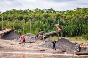
Our current real-time deforestation monitoring work has helped create the governmental framework in Peru that uses cutting-edge technology to systematically take action against illegal deforestation, the National System of Monitoring and Control.

We bring together government officials, civil society, community leaders, and key funders to discuss how to apply use technology and science to advance conservation solutions in the field and transform policy nationally at our yearly AmazonTec event.
We are committed to bolstering conservation across the Amazon by sharing our approach to managing protected areas, building sustainable and resilient livelihoods, and applying science and innovative technology. Rather than doing it alone, we seek out local partners like us and build cross-boundary opportunities to bring this approach to scale, which avoids duplication of work and enables best practices to be implemented across international borders. We are extending our real-time deforestation monitoring using satellite imagery in Bolivia, Brazil, Colombia, and Ecuador. We do this by building the capacity of local partners to pilot this technology, verifying its effectiveness and impact, and bringing it to scale in their own countries.
 Loading...


1025 Connecticut Ave NW · Suite 415 · Washington DC 20036 · USA
202-234-2356 / info@amazonconservation.org

