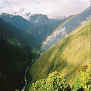
AmazonTEC is a premier forum for discussing science and technology’s connection to policy and governance in the Amazon. Developed by Amazon Conservation’s Peruvian sister organization Conservación Amazónica – ACCA, AmazonTEC brings together forest users, technology experts, NGOs, governments, and other stakeholders in a forum to discuss the use of cutting-edge technology (satellites, mobile apps, drones, and more) in the advancement of public policy for environmental protection in the Amazon.
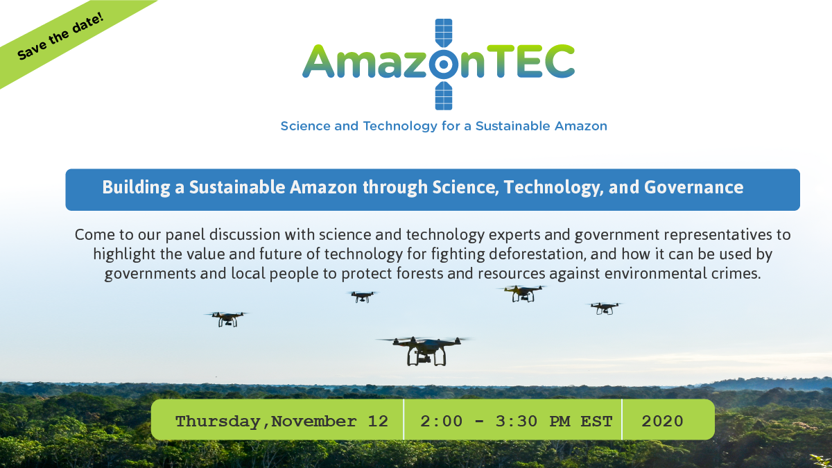
Tomorrow is the English session of AmazonTEC. Register now to join Amazon Conservation and a host of technology, government, and science experts in an English-language live panel on the value and future of technology for fighting deforestation and how it can be used by governments and local people to protect forests and resources. Click here to download the full English session agenda.
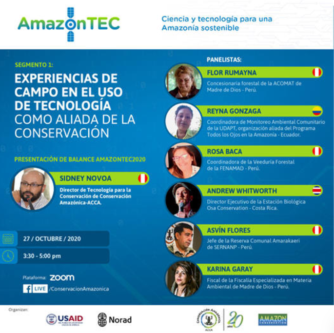
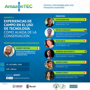 The first of five sessions of the annual AmazonTEC event, titled Experiencias De Campo En El Uso De Tecnología Como Aliada De La Conservación, focused on how technology is being applied on the ground by forest users, such as concessionaires, indigenous groups, NGOs, or authorities working on the ground. Click here to watch the recording of the first session (in Spanish). All Spanish recordings are also available on Conservación Amazónica – ACCA’s Facebook page.
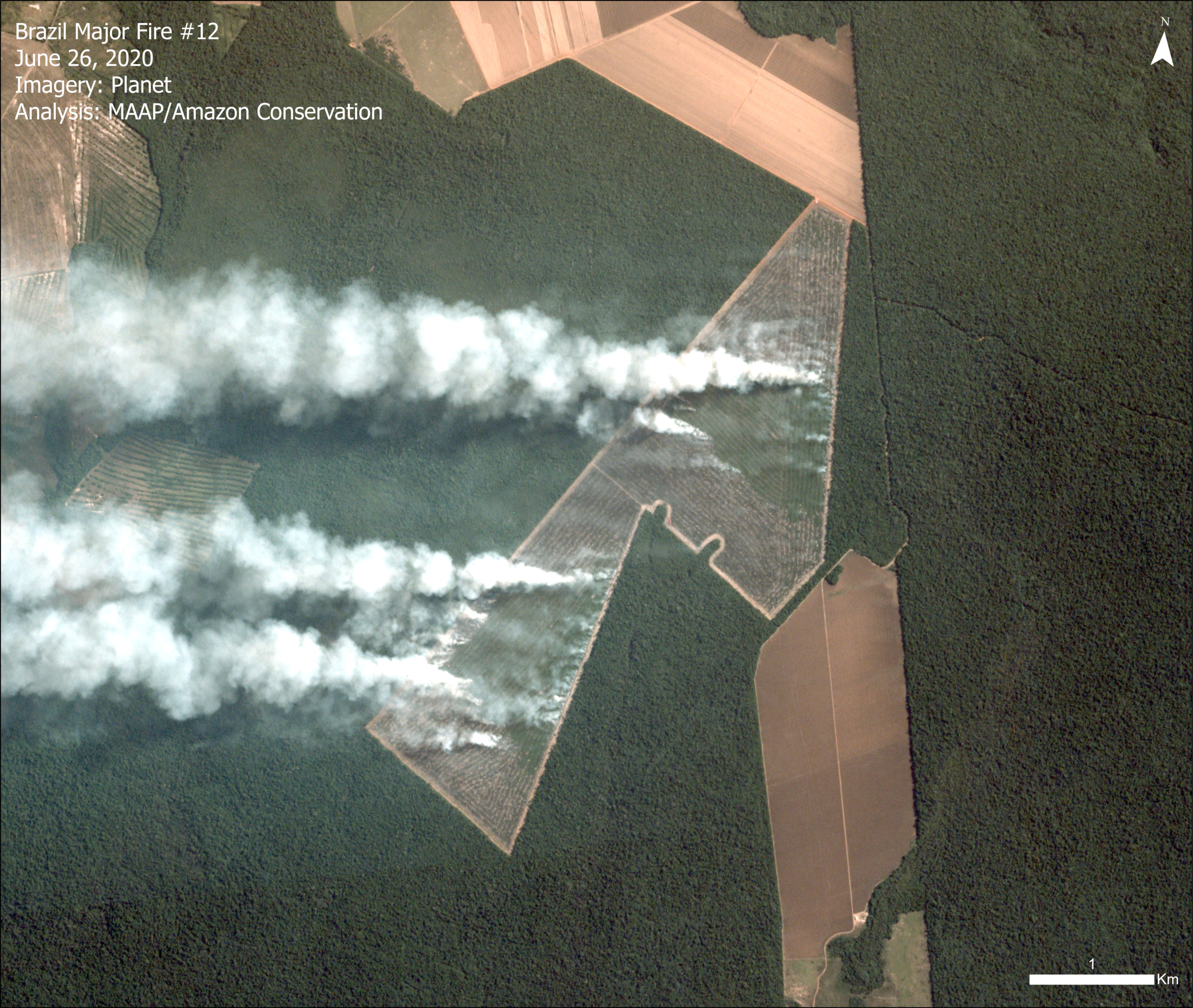
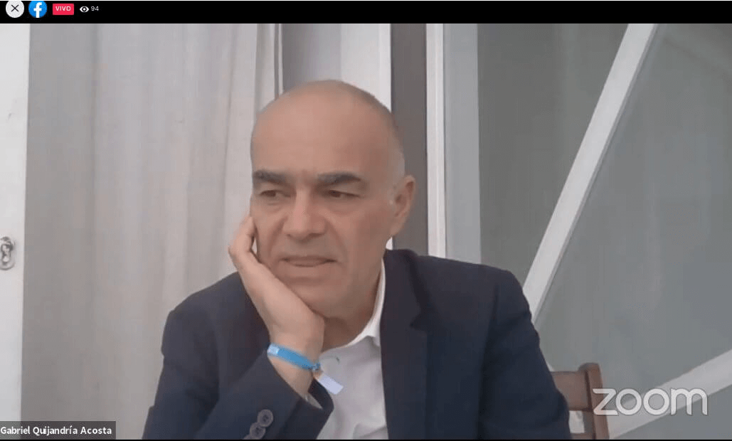
The event started with welcoming remarks from many speakers, including Peru’s current Minister of Environment, Kirla Echegaray, and Einar Telnes, Senior Advisor at the NORAD Department for Climate, Energy and Environment. Another was Jene Thomas, Director of USAID Peru, who highlighted the successes of the MAAP initiative in detecting illegal logging with very high resolution satellites. USAID Peru supports MAAP through their Prevenir project. He said,
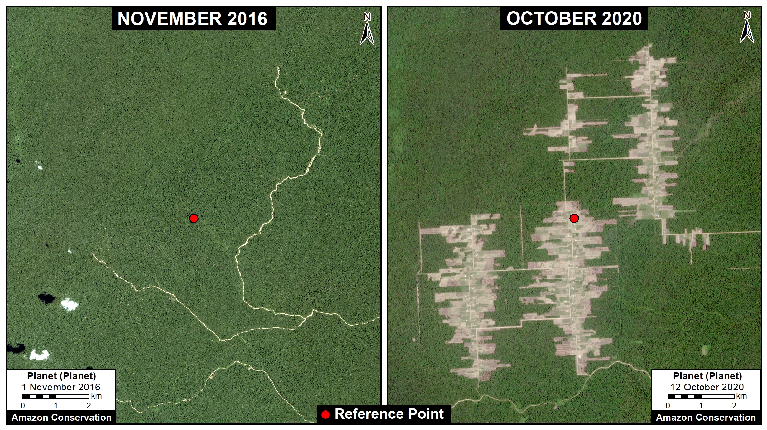
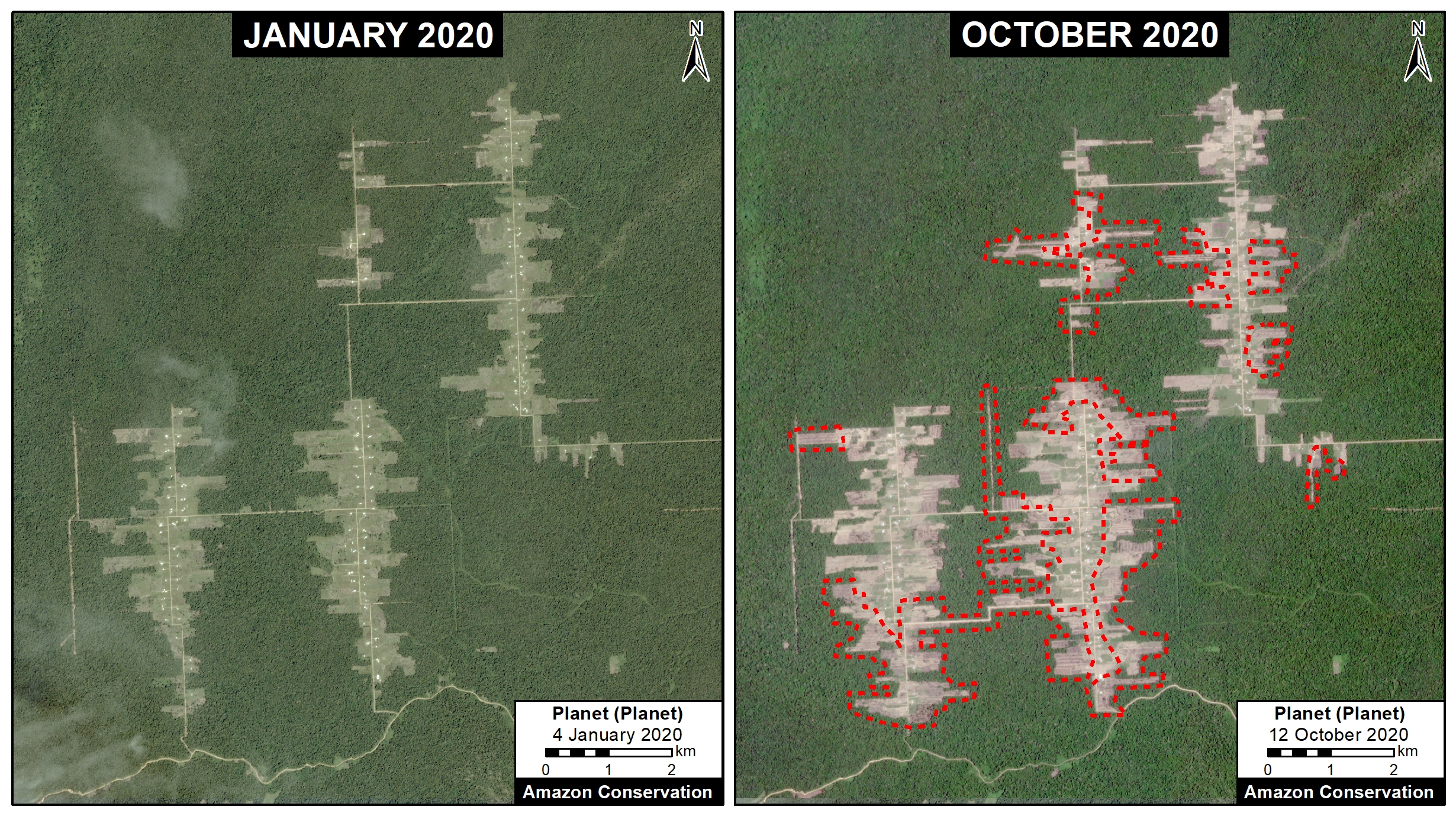
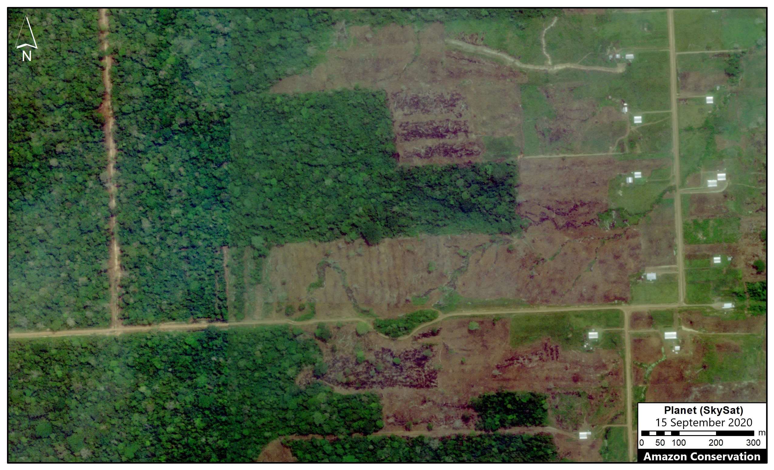
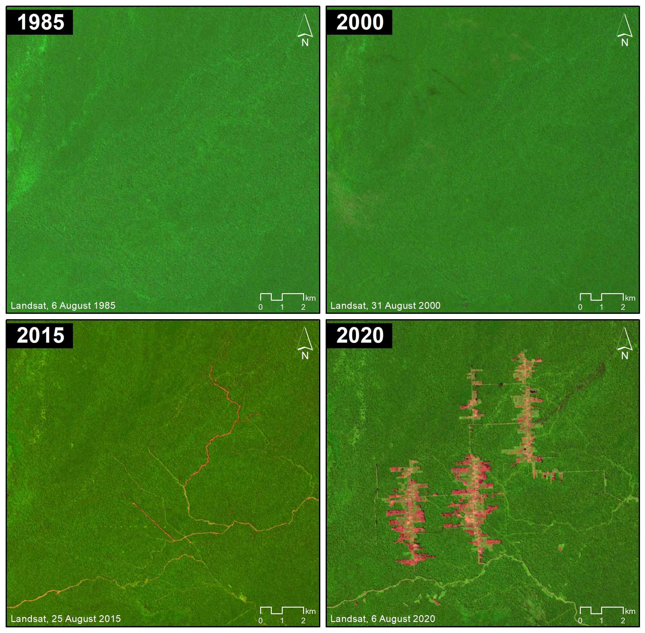
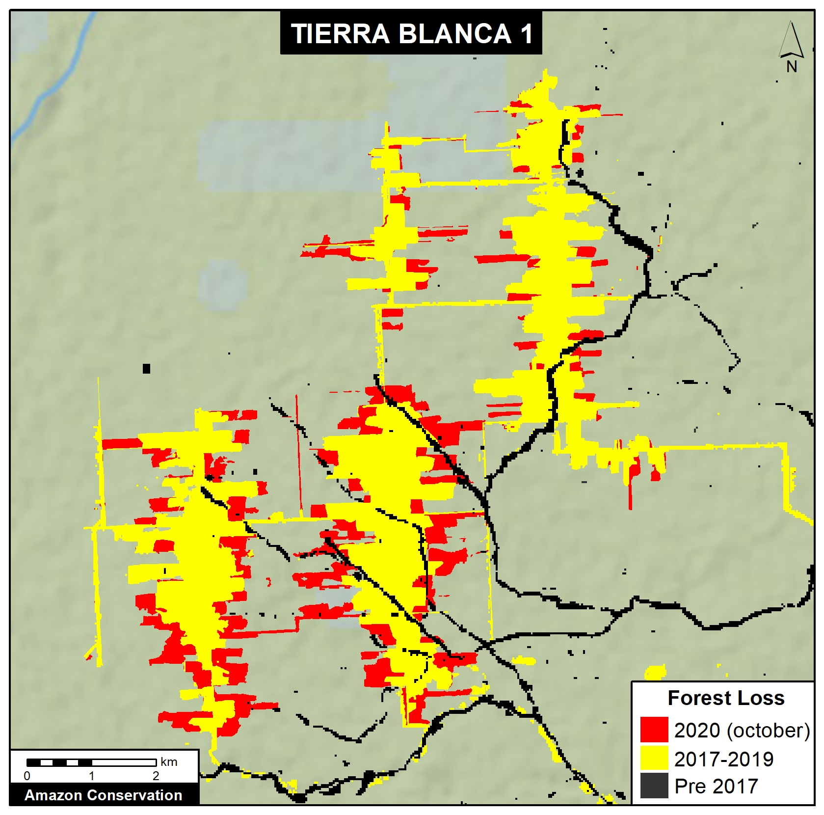
“The recent report from MAAP helps us detect events related to illegal logging by identifying the presence of trails in the Peruvian Amazon, using high-resolution satellite images in real time. It is important to have information in real time because it allows us to do preventive work, and to identify the emergence of new sources of deforestation…these new sources of deforestation affect the life and safety of the local and indigenous communities, and this detection was possible due to analysis of satellite images.”
 He also noted that he was eager to hear the visions from the four women on the AmazonTEC panel, saying that “you don’t as often see women in technology and sciences.” Thus, it was a highlight to hear from a diverse array of voices and experiences.
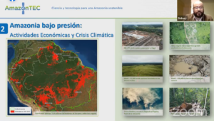
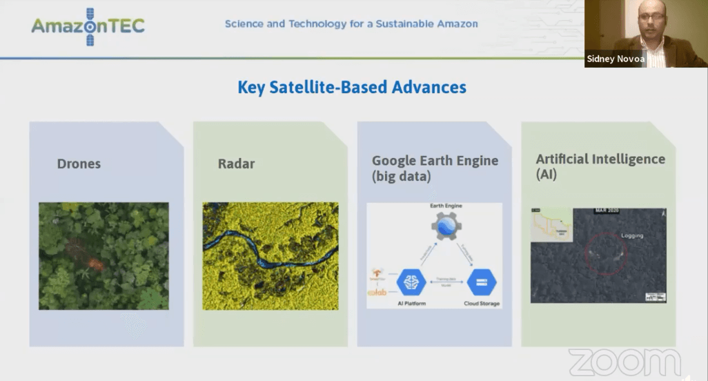
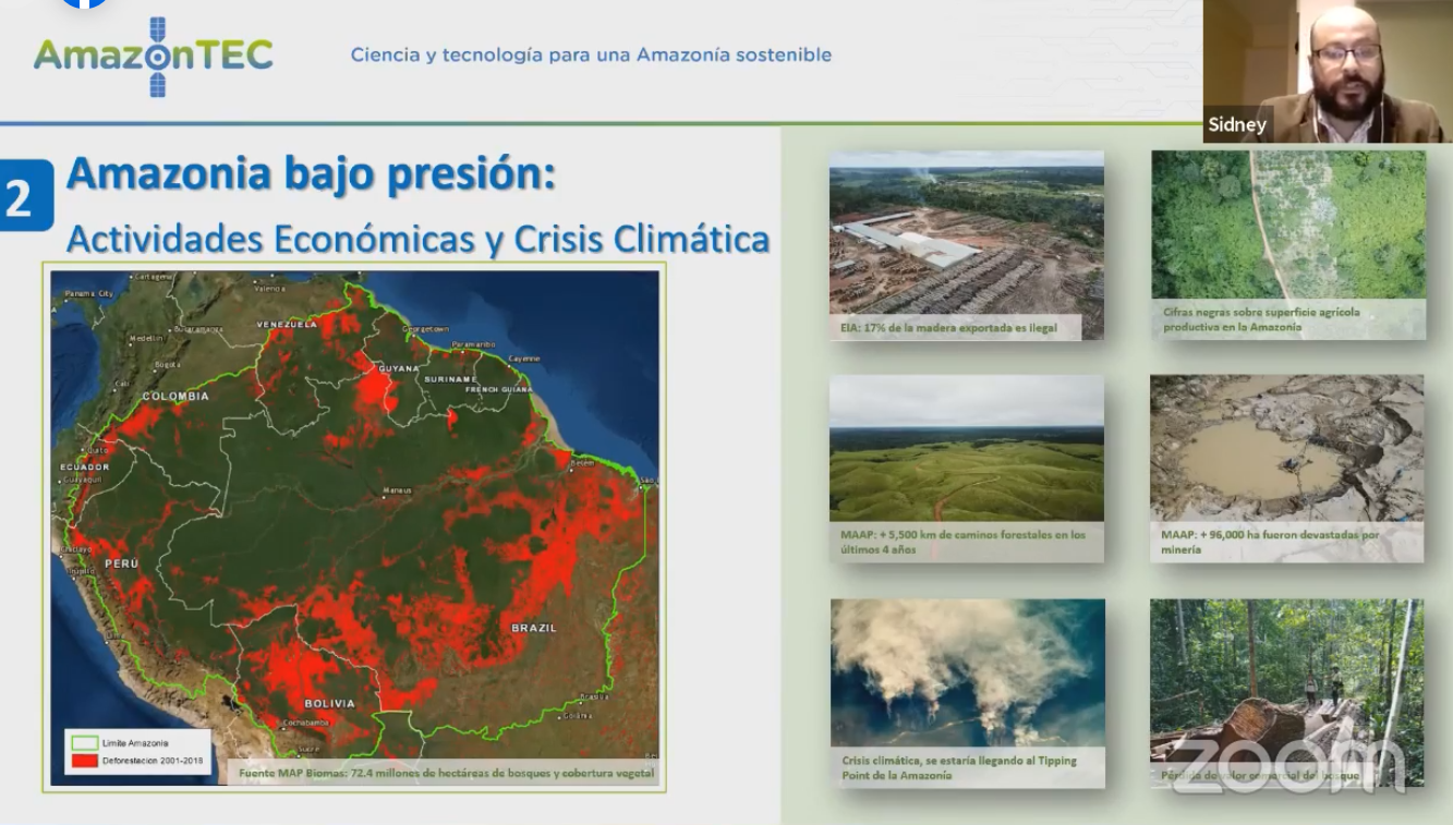
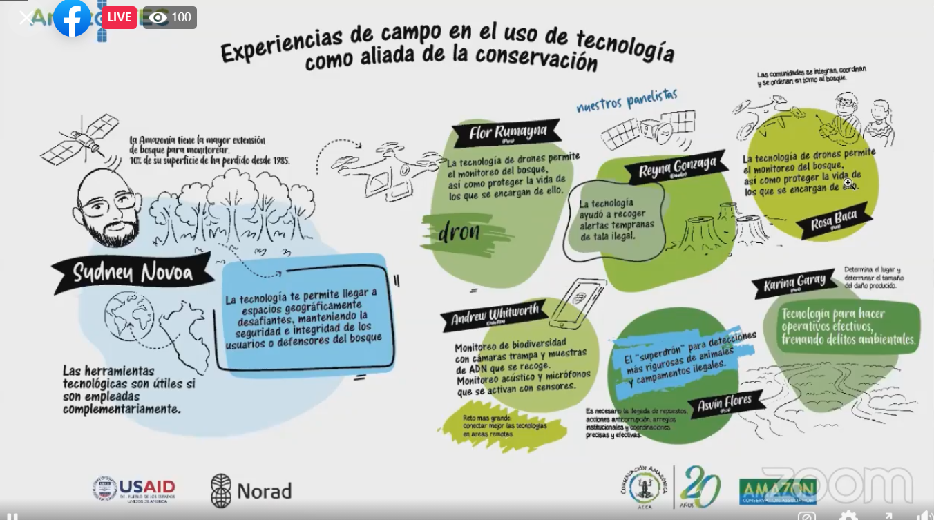
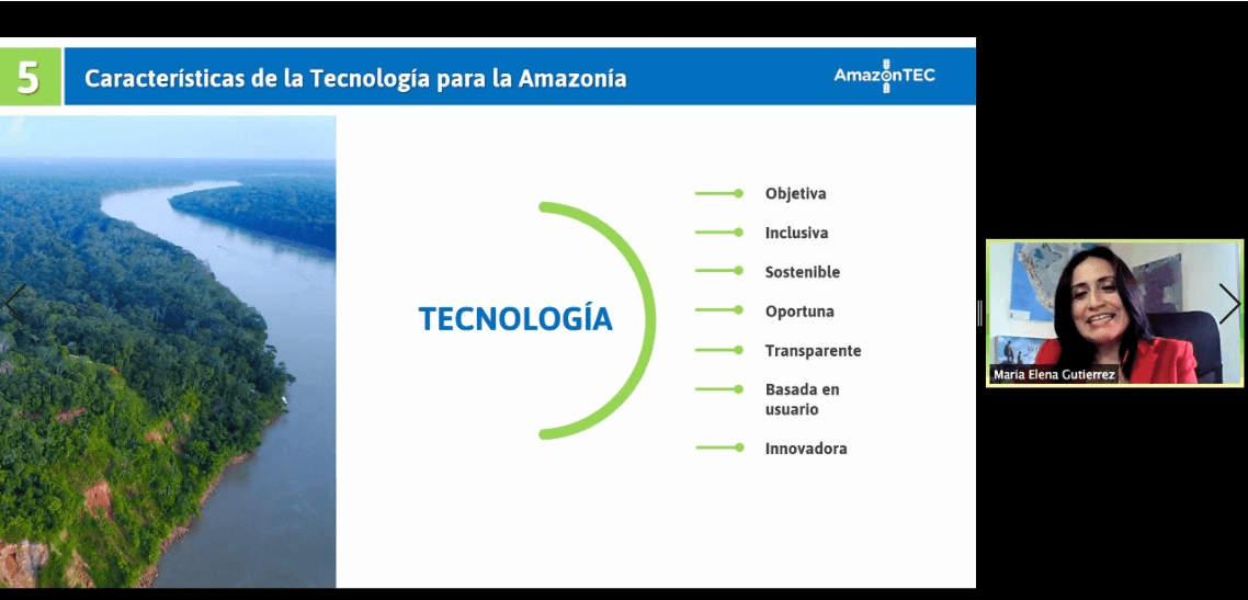
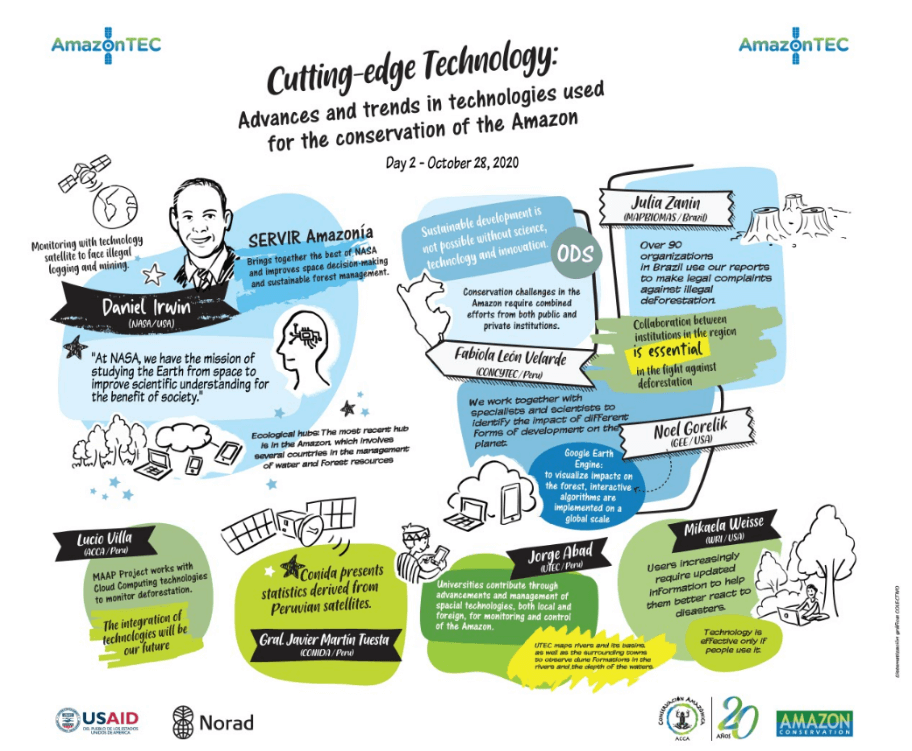
After the opening remarks, Sidney Novoa, Director of GIS and Technology for Conservación Amazónica – ACCA gave a short presentation about using satellite and drone technology to protect the Amazon. He said, “Our existence has become a constant threat to the environment and to combat it we need a strategic, multisectoral approach. But first, like a doctor, we need a diagnosis.”
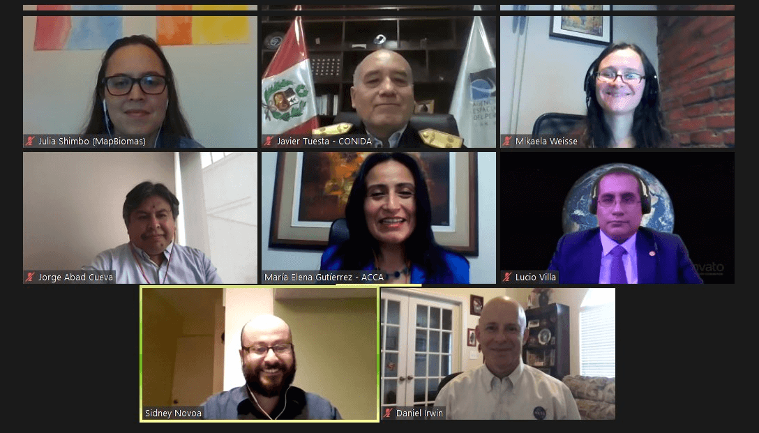
Each of the featured panelists then introduced themselves and gave short presentations about their area of expertise. Panelists included:
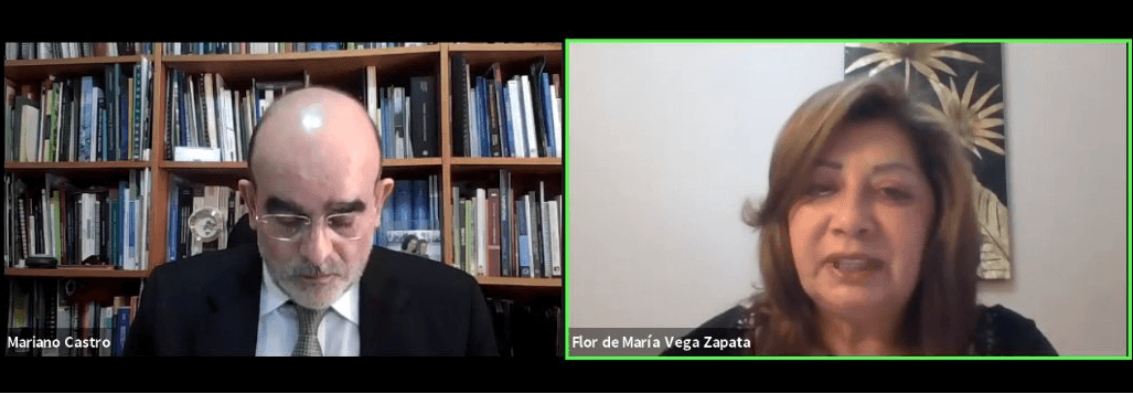
 Flor Rumayna, a forest concessionaire in Madre de Dios, Peru, who is also a part of ACOMAT, an association of forest concessionaires.
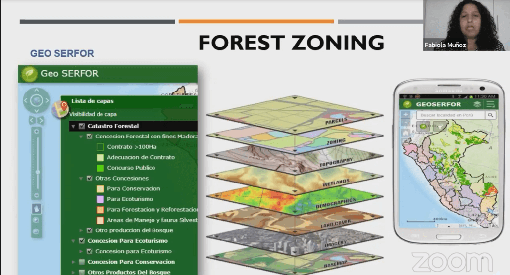
Forest concessionaires like Flor’s family lease land from the Peruvian government that they can use for any purpose, as long as they protect it. Therefore, concessionaires must report illegal activity on their lands. Many concessionaires use the land for conservation, sustainable harvesting of forest fruits and nuts, or ecotourism, which is what Flor and her husband uses their concession for. This is a part of the Peruvian government’s plan for sustainable forest management.
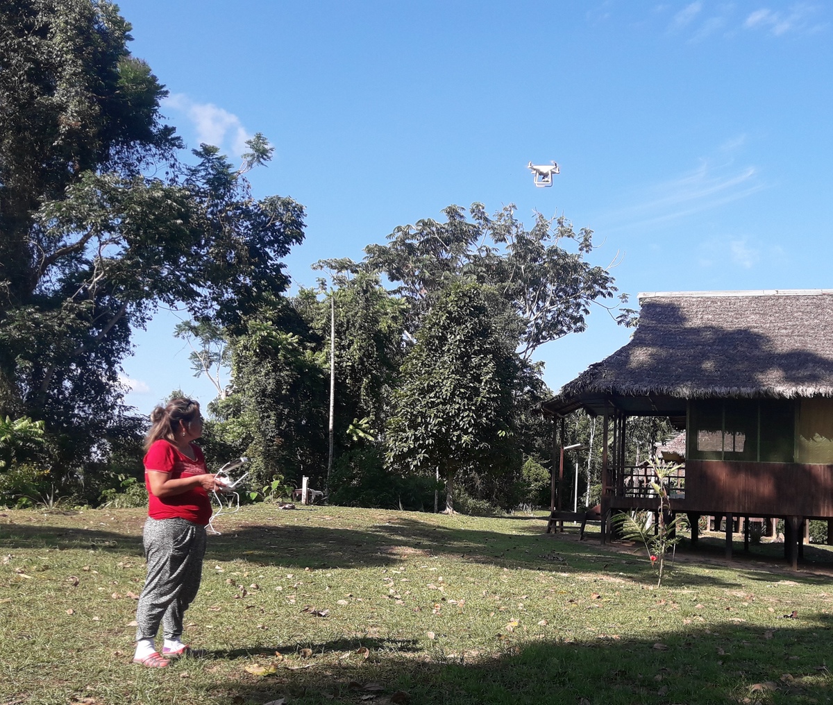
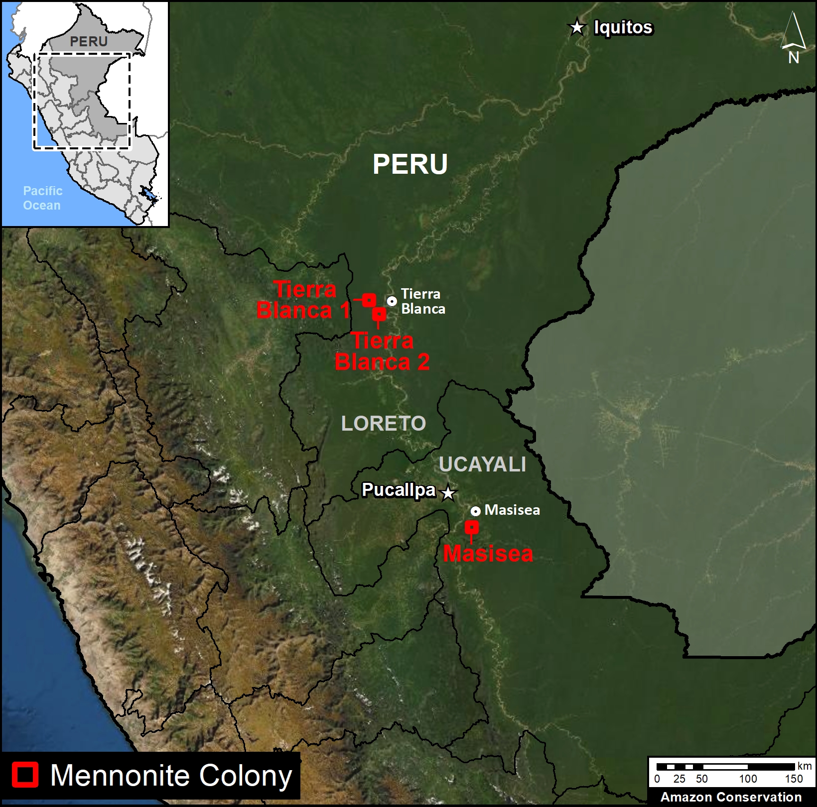
The full title of ACOMAT, which is the association that Flor Rumayna and her husband are a part of, is the “Asociación de Concesionarios Forestales Maderables y no Maderables de las Provincias del Manu, Tambopata y Tahuamanu.” This association connects concessionaires across Madre de Dios and provides resources to its members in the form of training and legal assistance when reporting environmental crimes. Read about ACOMAT’s recent role in using drones to report environmental crimes here, and click here to learn more about the Southwest Amazon Drone Center, where many ACOMAT members train.
 Reyna Gonzaga, Coordinator of Community Environmental Monitoring of the Union of Affected Persons by the Petroleum Operations of Texaco (UDAPT), partner organization of the Todos los Ojos en la Amazonia in Ecuador. Reyna spoke about technology-based decisions regarding the indigenous peoples of Ecuador and nearby Colombia, saying that “technology has been very useful for our organization, helping indigenous communities with early alerts for illegal logging, and has helped compile evidence that we can give to communities that need it so they’re able to file legal complaints.”
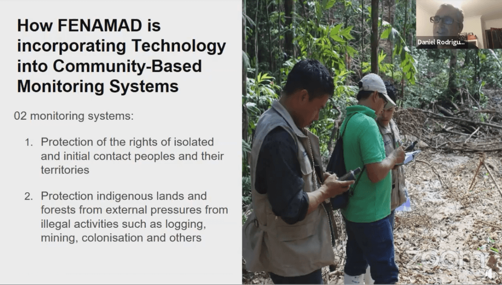
Rosa Baca, Coordinator of the Forestry oversight of the Federation Native to the Madre de Dios River and Tributaries (FENAMAD), Peru. Rosa elaborated on technology and the connection to the Amazon from the indigenous perspective. Moderator Gustavo Solano asked her about connectivity in the Amazon, to which she responded, “It is a system of real-time alerts at the satellite level, which allows users to send alerts with an internet signal or by satellite. Through these systems, we monitor what is happening in the communities through the alerts that the indigenous people receive, and thus with this we have been able to reach the authorities.”
 Andrew Whitworth, Executive Director of Osa Conservation in Costa Rica, who spoke about the use of technology to monitor biodiversity in tropical forests. He noted that for him, the biggest advancement was the availability and ease of technology to anyone who wants to monitor biodiversity. “With cell phone applications–it’s now more accessible to people where they can upload their own data, their own records. For me this is the biggest advance, that this technology is simple so that everyone can monitor biodiversity.” One attendee asked about the strength of cell phone connections in the Amazon to be able to upload photos of biodiversity or illegal activity. He responded that though that is their biggest challenge right now, there are applications that geotag where you are when you take the photo, so you can then upload it when you have service again.
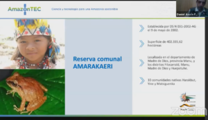
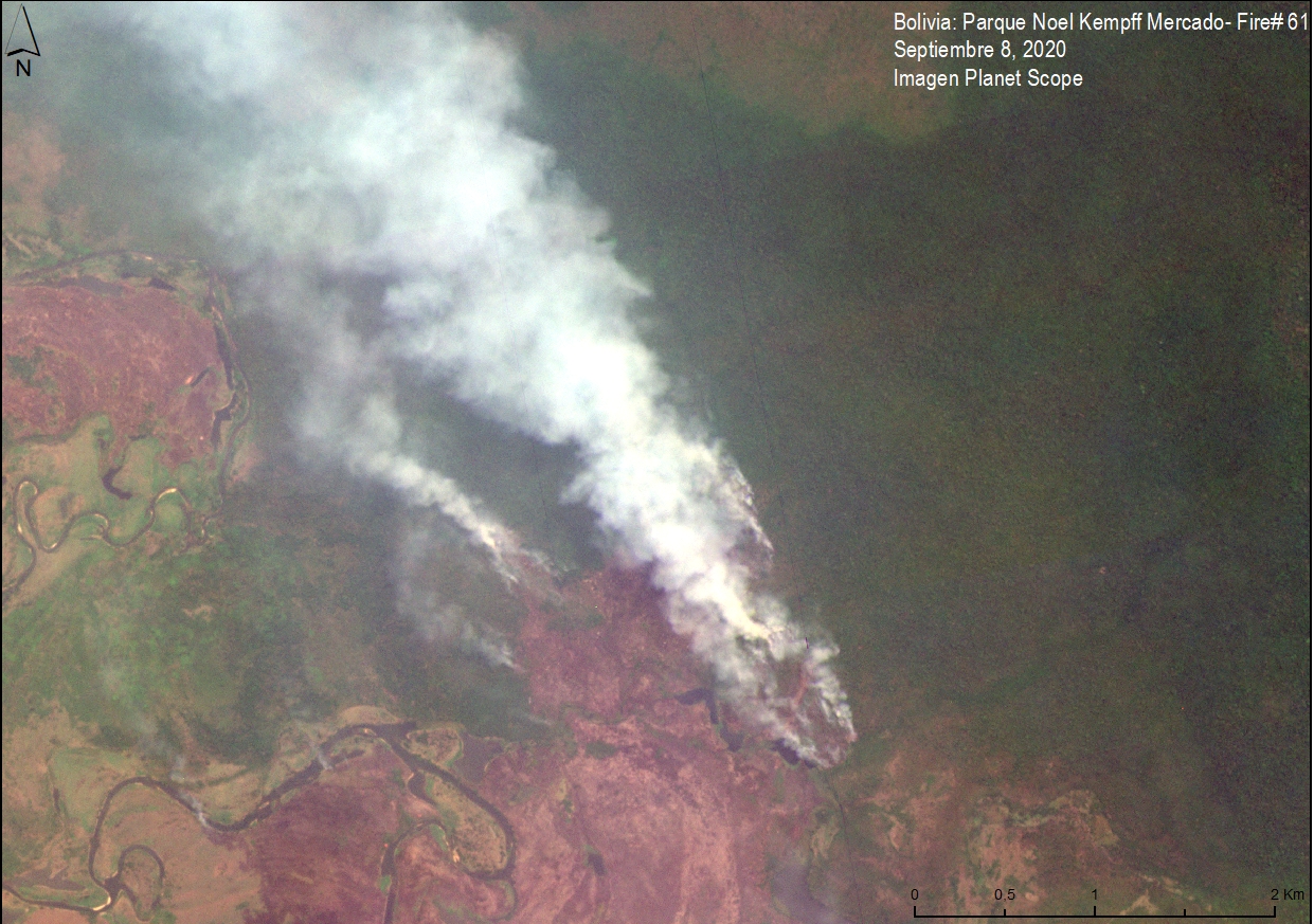
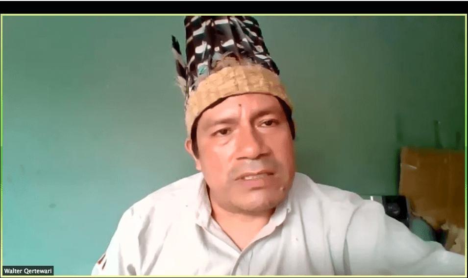
Asvín Flores, Coordinator for the indigenous Amarakaeri Reserve of SERNANP (National Service of Natural Areas Protected by the State of Peru), who spoke about opportunities in the use of technology for the protection of natural areas. He said that, “early monitoring alerts like MAAP & ones like it, help give us a first glance at what’s happening. This helps us reduce risk to our staff and community, but also helps us have better surveillance.”
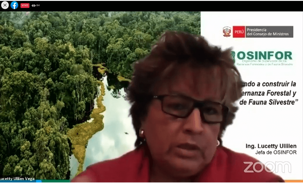
Karina Garay, the Chief Environmental Prosecutor for the  Fiscalía Especializada en Materia Ambiental in Madre de Dios, Perú presented on the role of satellite monitoring in the fight against illegal mining. She was recently dubbed “Peru’s Wonder Woman” in an international news article by Reuters for her work combating illegal gold mining. She noted that, “since we have implemented technological tools, the process for legal action is much quicker and more efficient. We don’t have to wait for the prosecutor to tell us the place because the technological system gives us the route; it helps us plan immediate actions.”
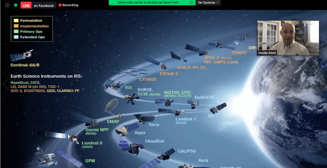
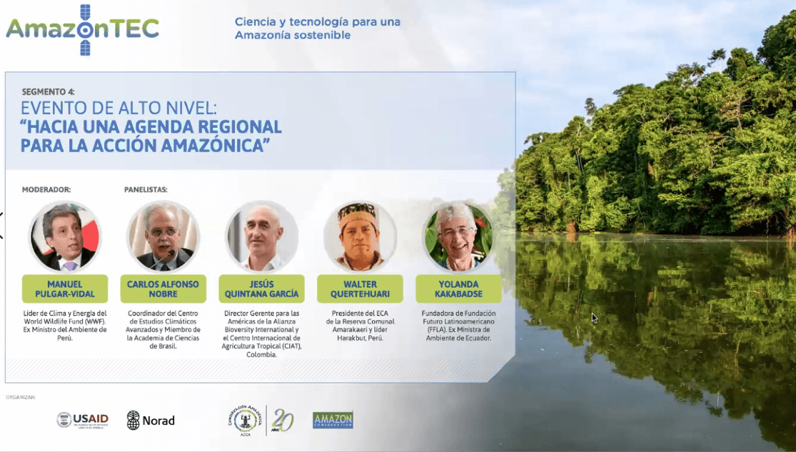
On November 12 from 2-3:30 pm, Amazon Conservation is hosting an English AmazonTEC webinar: Building a Sustainable Amazon Through Science, Technology, and Governance on the value and future of technology for fighting deforestation and how it can be used by governments and local people to protect forests and resources, whill will include speakers and panelists from government agencies in Peru, Colombia, and Norway; and experts from the Gordon and Betty Moore Foundation, WWF, NASA, FENAMAD, IDEAM, Amazon Conservation, and our Peruvian sister organization Conservación Amazónica – ACCA. Click here to register now, or here for more information.
Click here to read more takeaways from #AmazonTEC2020:

 Did you know that you can help save the Amazon while holiday shopping? Support our conservation work and get your holiday shopping finished in one fell swoop by shopping through AmazonSmile or the Good Deeds App.


 Loading...