Helping Create Two Conservation Areas in Bolivia

Porvenir protected area
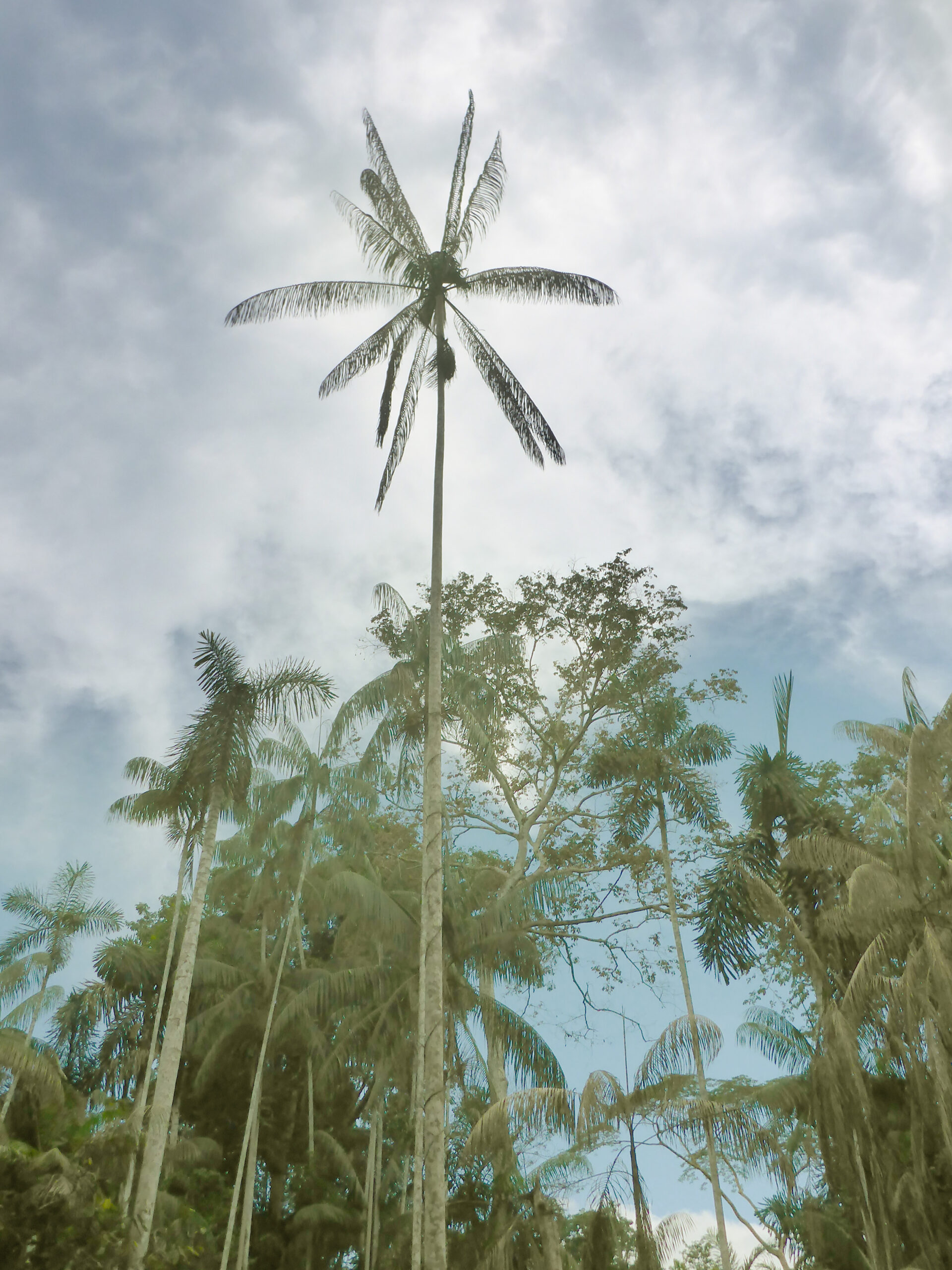
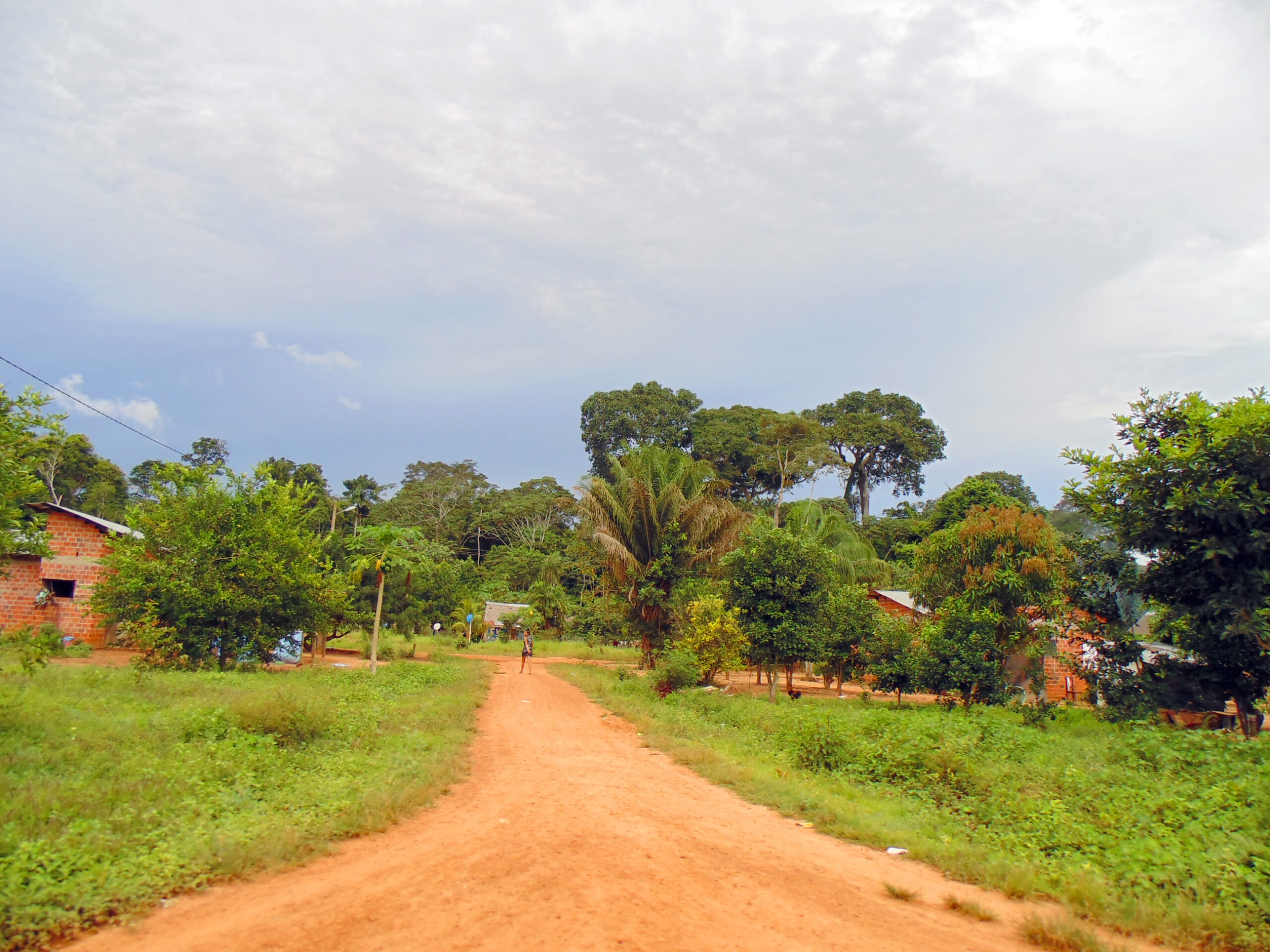
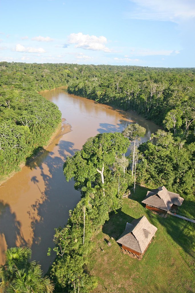
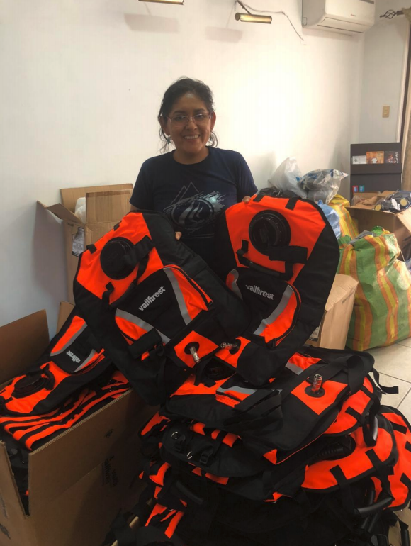
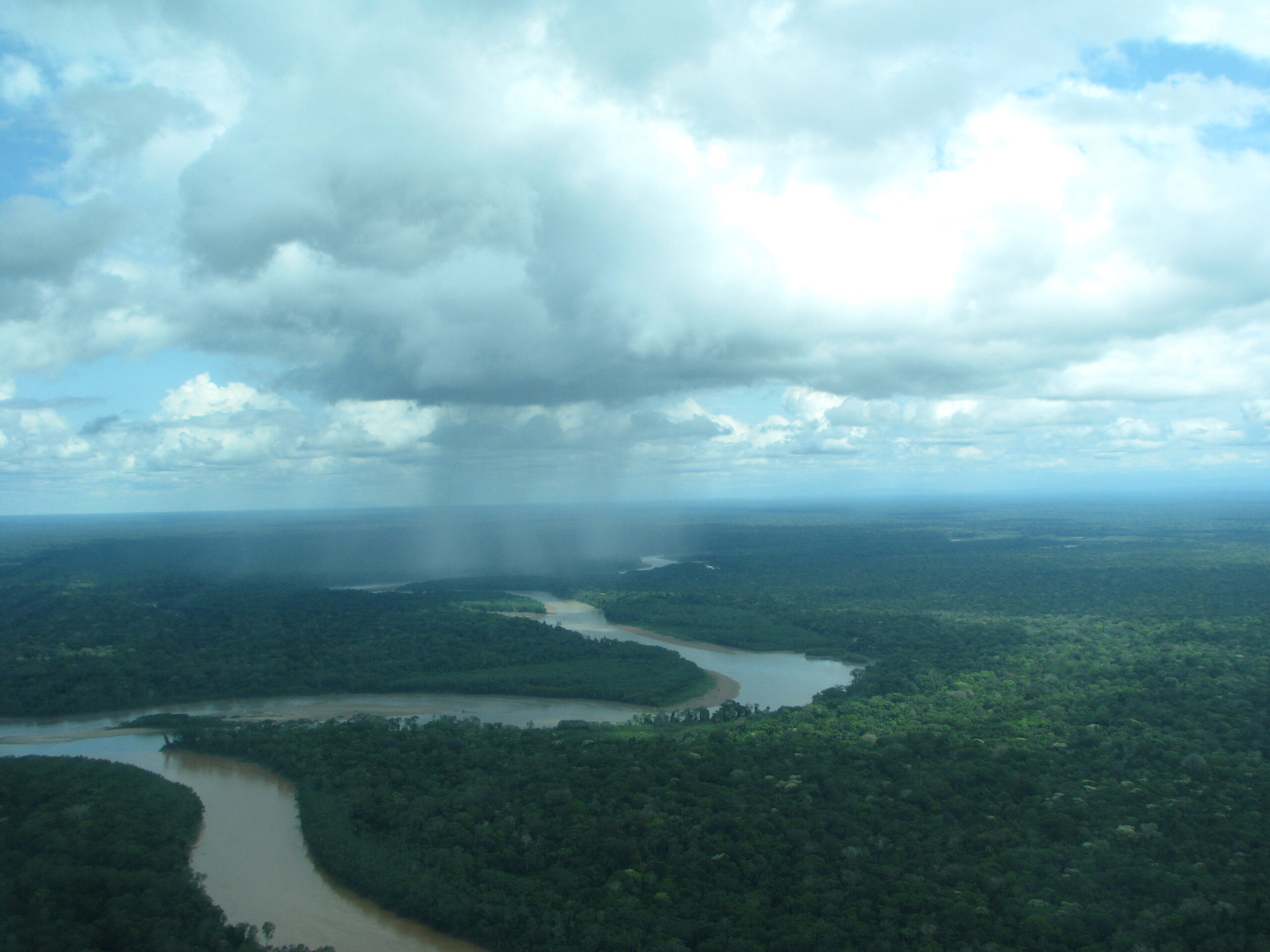
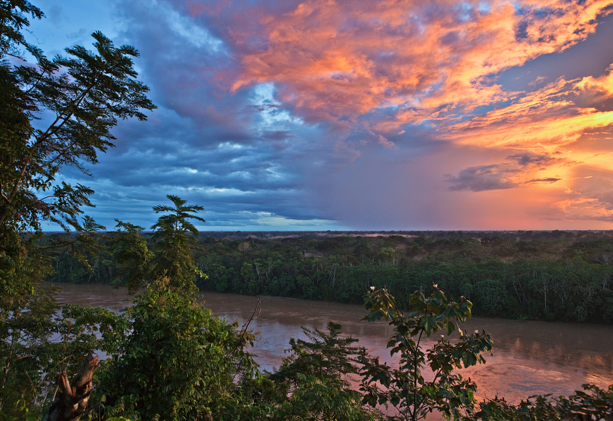
For the past year, we had been working on legal and technical requirements needed to create the 78,000-acre Porvenir Protected Area in the Pando region of Bolivia, and on creating the necessary framework to support its long-term management and protection. This work paid off; even with the challenges of the pandemic, the municipal government has officially declared Porvenir a protected area in early October. Additionally, another protected area nearby, Puerto Rico, is in the final stages of being declared and we expect the process to be completed by the end of the year. Together, these two new conservation areas will protect almost 400,000 acres of forests – a major win for the Bolivian Amazon!

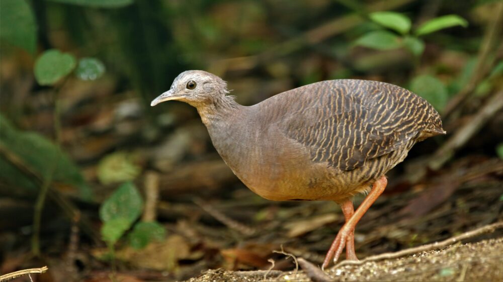
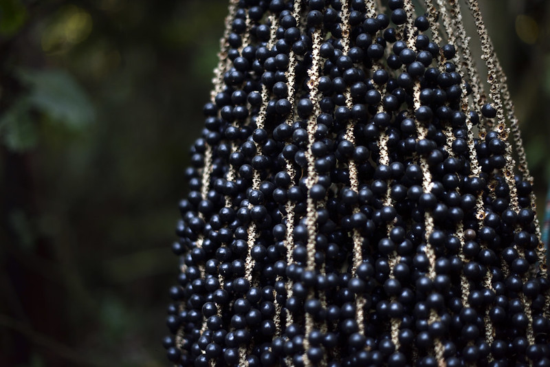
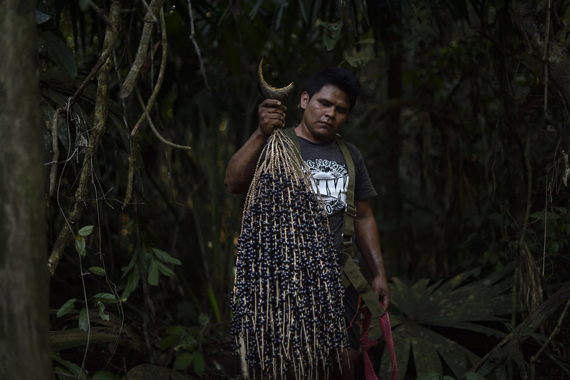
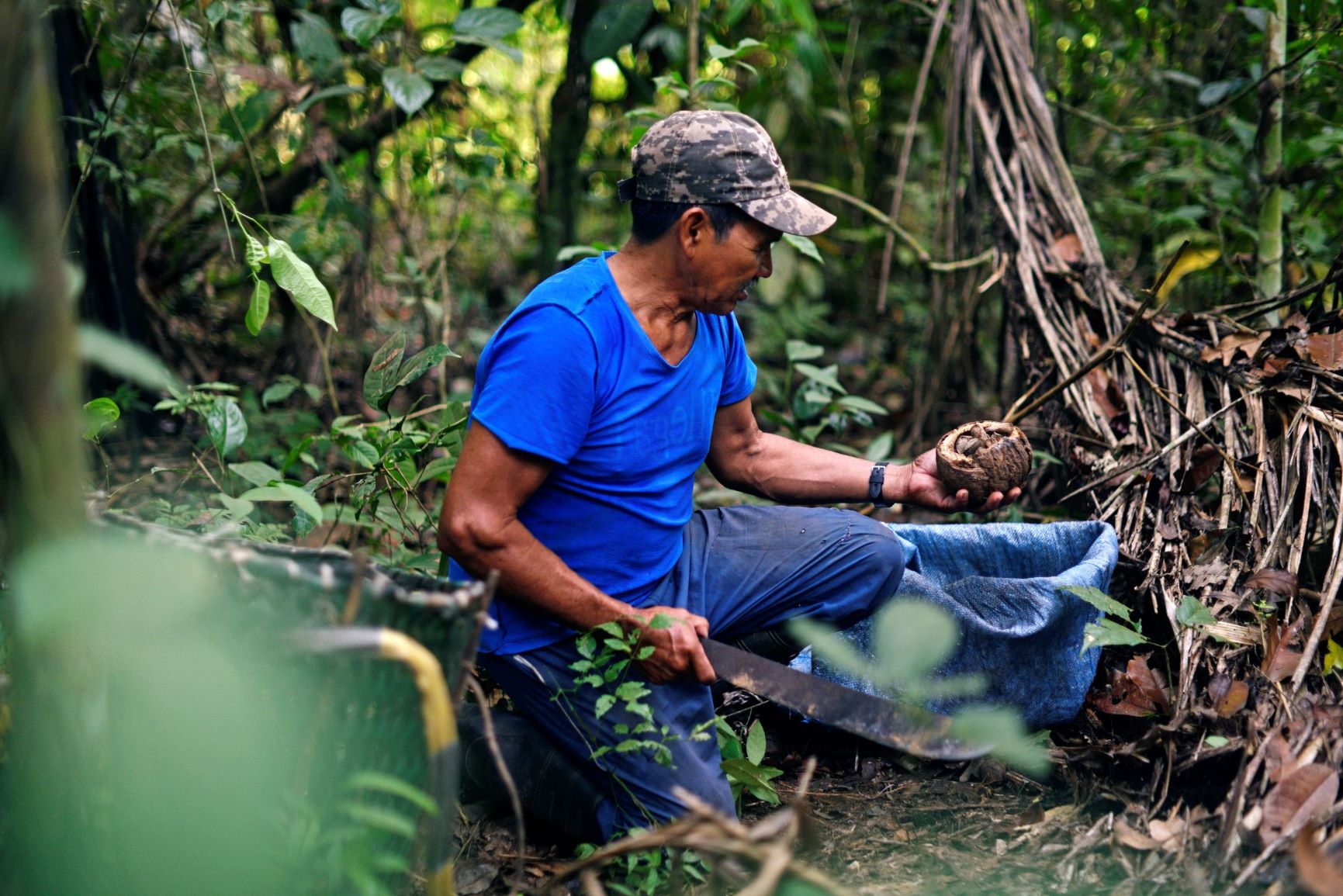
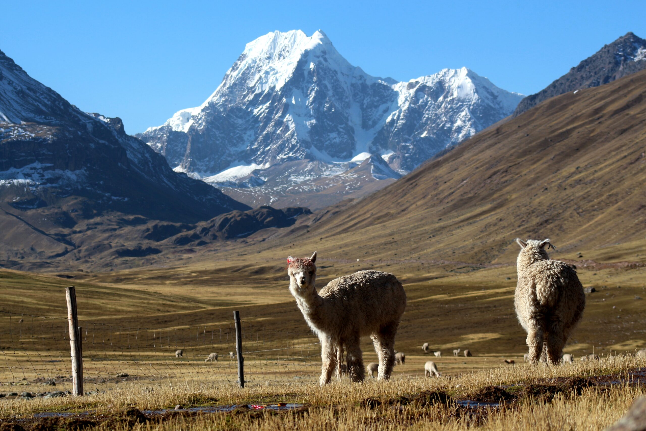
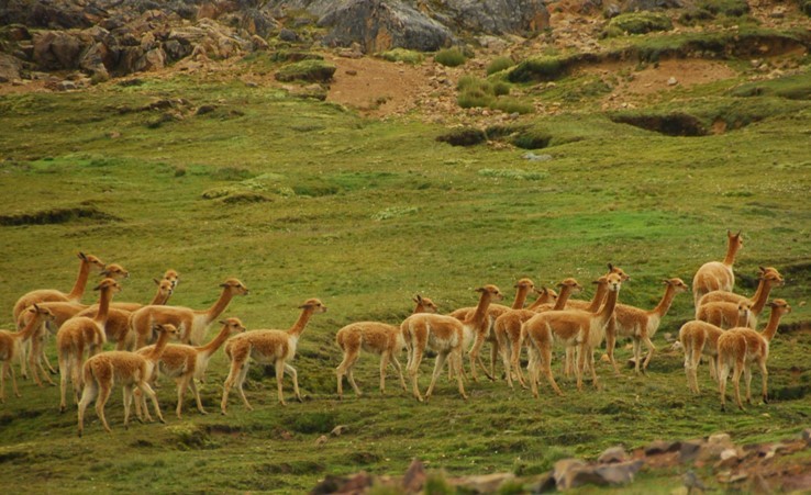
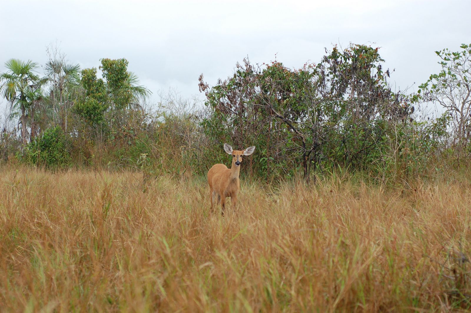
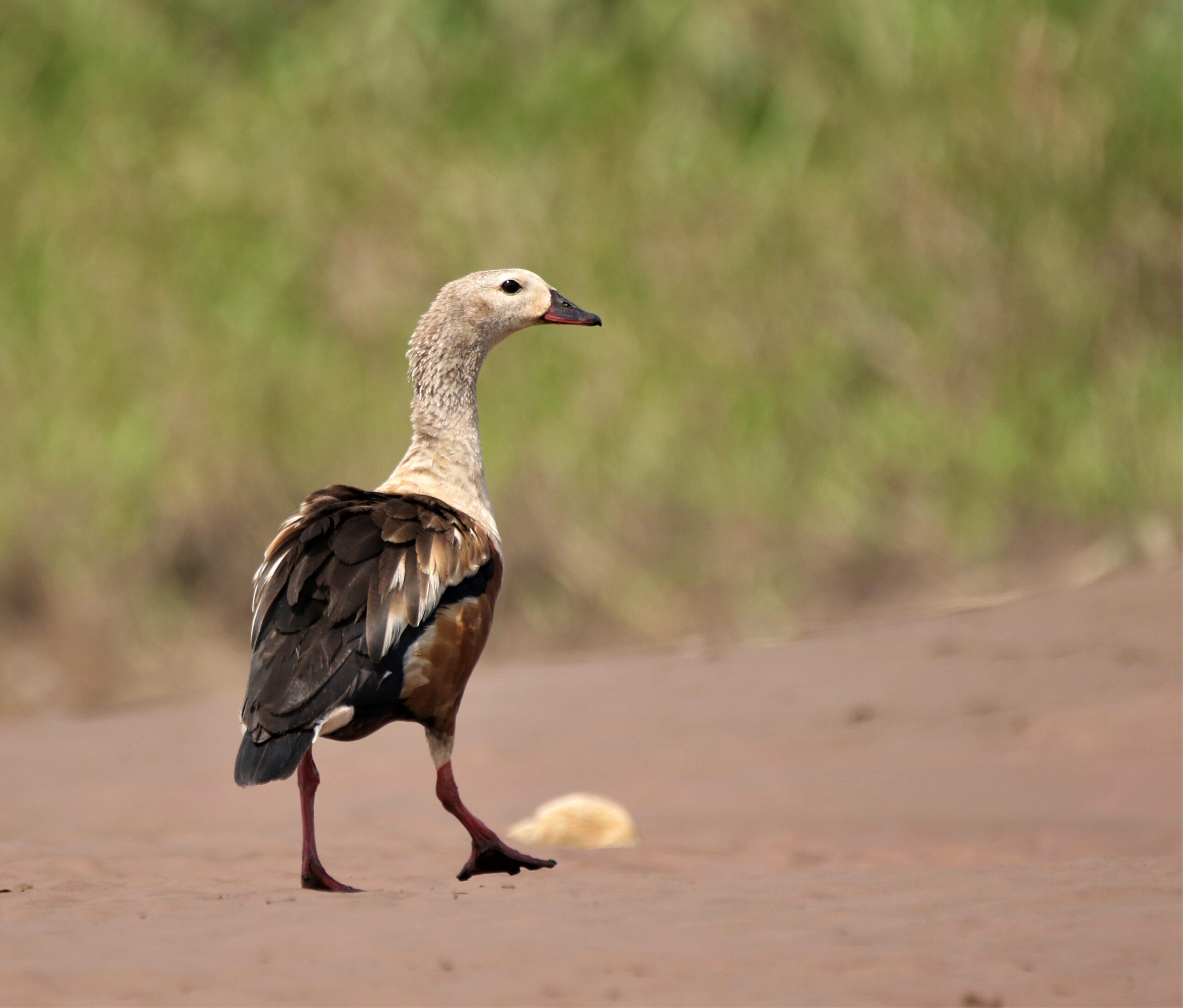
In both of these areas, the process for their creation and management requires an important baseline of information on the biodiversity that lives there and on the ecosystem services that they provide (that is, a quantification of the many benefits to humans get from these forest ecosystems). This way, the management of the natural resources of the area will be sustainable and will keep these centuries-old forests healthy and productive. We provided the communities and the local government with this key ecological information, including physical ecosystem information, inventories of flora and fauna, climate analysis, and the identification of threatened species and of species with the potential for sustainable use that could raise families’ income.

Porvenir protected area
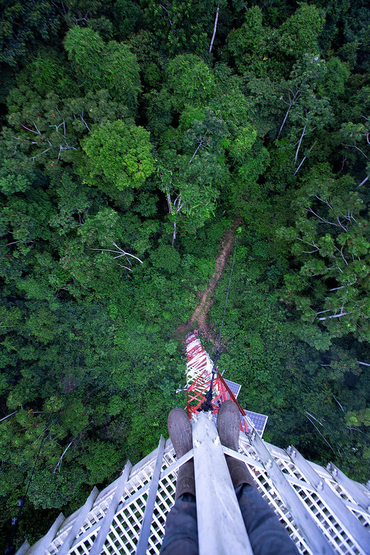
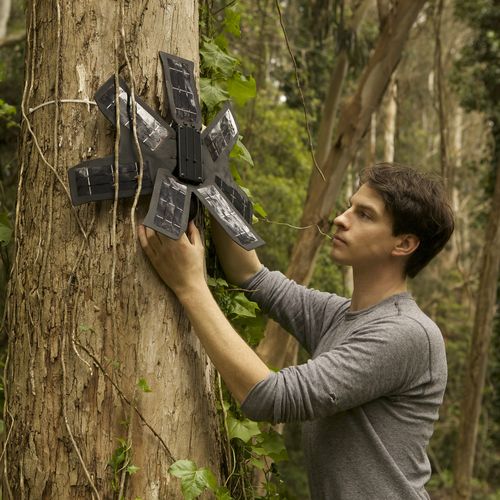
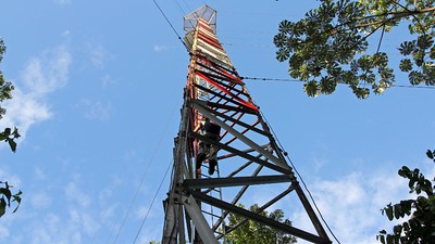
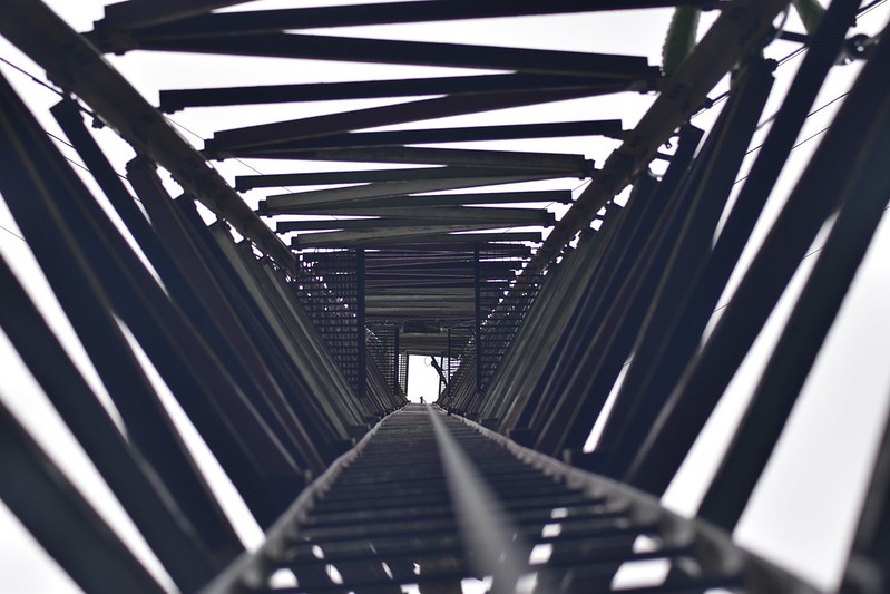
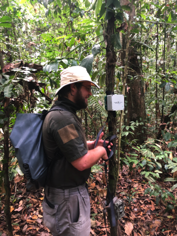
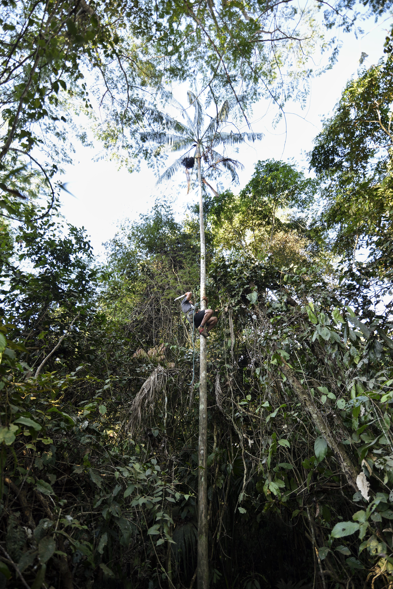
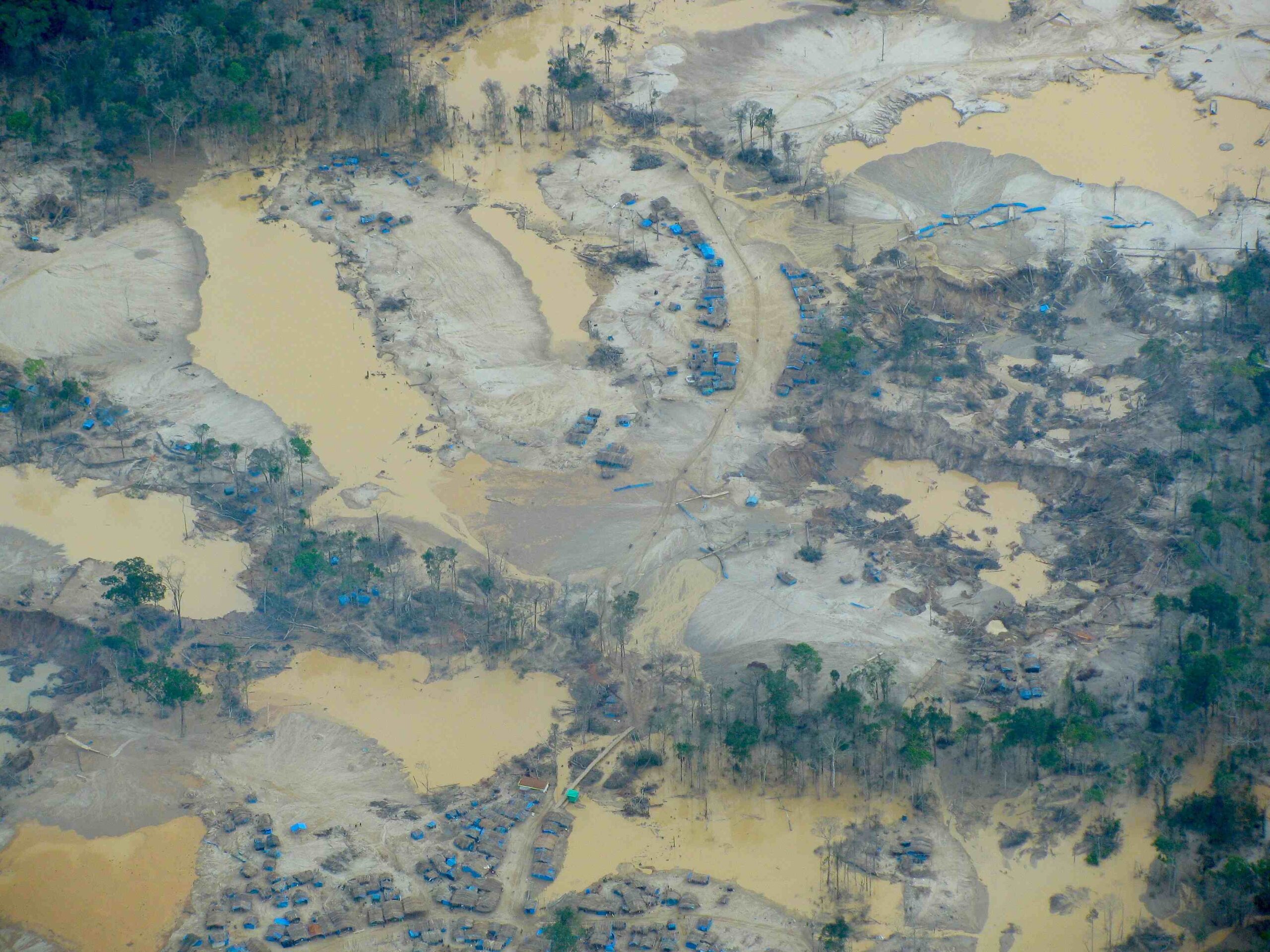
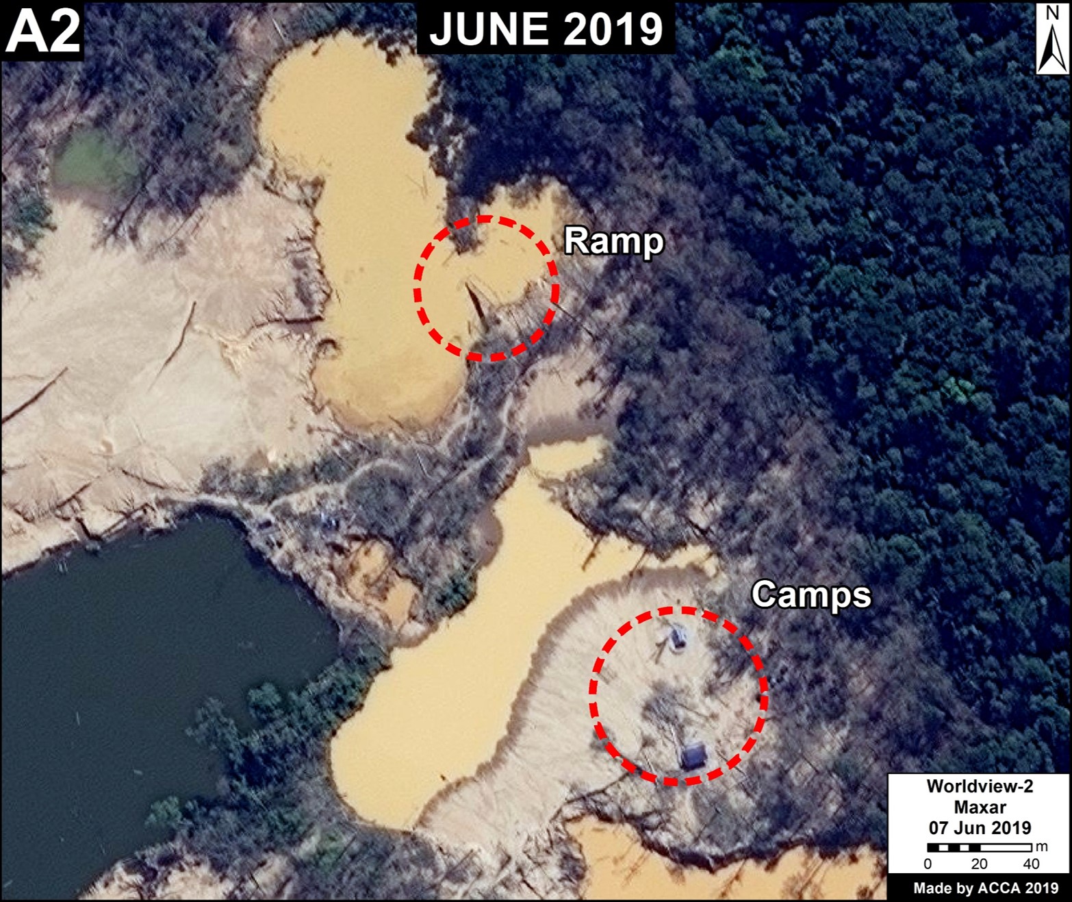
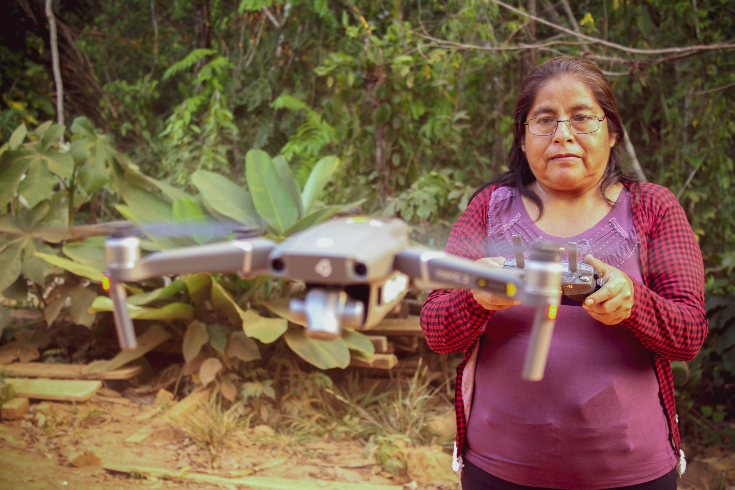
Given the heavy amount of fieldwork needed to create a conservation area, it has been a challenge working within a global pandemic and quarantine restrictions in Bolivia, as it has kept our experts from making the necessary field expeditions to carry out this work. However, we adapted our scientific methodology to continue to move forward given these extraordinary conditions. We developed a survey of all of the studies, literature, and data collections made over the past years and we used geomatic tools (that is, geographic information systems (GIS), remote sensing using satellites, and high-tech drones) to gather data on the groups of flora and fauna in both areas. With this adaptation, we were able to gather sufficient information to support the government in the formal declaration process for Porvenir to become a protected area, and in moving forward to do the same for the Puerto Rico area.


Special thanks to Andes Amazon Fund (AAF), the Sheldon and Audrey Katz Foundation, and all individuals and organizations whose generous support made this project possible.

New Technology Helps Find and Stop Deforestation Using Sound

High in the treetops of our Los Amigos Conservation Concession, two listening devices powered by solar panels transmit real-time sounds of the rainforest to local rangers’ phones, and across the world.

These acoustic monitoring devices transmit a short recording of any unusual sounds through local cell towers to get to a cloud database, where different forest sounds are classified using machine learning techniques. Incoming audio plug into these high-tech detection models where they can be distinguished between normal sounds one expects to hear in a rainforest – like a jaguar growl or different bird songs – and potential illegal activities caused by humans – like a chainsaw or small tractor. The sounds captured are then sent to the cellphones of park rangers, local advocates, and indigenous leaders where they can hear the sound to confirm the findings and know the exact location of where it’s happening so they can take action. All of this happens within seconds. 

Photo of Topher WhiteThe dense forests of Los Amigos are one of the few rainforest locations around the world piloting this innovative listening technology to detect deforestation in real-time. The project, led by Rainforest Connection’s founder Topher White, has partnered with us to test this technology so deforestation can be discovered, reported and stopped before it reaches a point of no return.

For example, when the real-time acoustic monitoring devices record a sound of what could potentially be a chainsaw cutting down trees, our forest rangers on the ground and our staff of experts around Peru receive an alert on their phones notifying them that trees may be being cut in our protected area at that very moment. Rangers then listen to the audio clip and can confirm via the app, based on their extensive experience living and working in the rainforest, that it is indeed a chainsaw that they hear in the recording. If confirmed, we are able to use drones and satellite images in that location to record evidence of illegal activity – without risking the lives of our forest rangers in confrontations with perpetrators – and report the illegal activity to the authorities who can take the appropriate legal and enforcement actions.


Setting Up at Los Amigos

“Los Amigos is the perfect place to test out novel technologies like acoustic monitoring,” says Topher, “it’s really a laboratory to experiment with new conservation ideas.”

For Rainforest Connection’s technology to work, it’s essential to have local cell phone towers and networks to capture and transmit the audio. “The Los Amigos Conservation Hub in Peru has these amazing towers that were built 15 years ago that are ideal to transmit the information,” Topher adds, “This existing infrastructure helped cut our work, and we could focus on just building the cell phone networks powered with solar panels.” 

Some of that technology also needed to be installed in trees near the acoustic recording devices, Topher counted on the help of one of our researcher friends and expert tree-climber, Andy Whitworth from Osa Conservation, to climb Los Amigos’ incredibly tall trees and install two solar panels boxes and cell phone network extenders.

Despite the challenges in keeping the cell phone grid and the monitoring devices powered, secured, and connected to the world via the internet, the potential benefits of keeping forests safer without exposing park guards to dangerous situations kept Topher and Andy going while they were climbing dozens of trees to install the recording devices. “This type of technology still takes a lot of field work,” says Andy, “but it can provide so much for the protection and understanding of these forests in the long run. It’s worth it.”


More to Come: Using Sounds to Advance Science

Aside from recording deforestation-related sounds, the acoustic monitoring devices capture a lot of additional, valuable biodiversity data. As the recordings are hosted in a cloud database, it has the potential of becoming a rich source for baseline data for scientists conducting scientific studies on the Amazon. 

For instance, if a scientist wants to track the presence of a particular bird species in an area over a span of a few months or years, they can refer to the audio library as a baseline resource for hearing the movements and quantity of calls of that species in the lowland forests of Los Amigos. By referencing and sourcing from this vast library of acoustic information, researchers can contribute to our understanding of the biodiversity of the Amazon without having to set foot in it. Topher likens the database as a “Google Earth for acoustic data.” 

On the prospect of expanding this technology to other uses, Topher comments that “sound is the most exciting piece of data available to us that’s not been fully realized for protecting the planet. You look at all the ways satellite imagery has helped us monitor the environment, I believe the next revelation will be in acoustics.”

“With acoustic monitoring, we can even hear things happening that don’t necessarily make a noise, as we can hear the other animals’ response to it. We’re just getting started, and the future involves getting others to be a part of it.”

Brazilian Amazon Fires Intensify in September

Although August was severe, early September saw the Brazilian Amazon fires intensify even more.

September shot up to an average of 53 major fires per day across the Brazilian Amazon, up from 18 in August (and 2 in July).*

In addition, the surrounding Pantanal, the world’s largest tropical wetlands, is experiencing unprecedented fires.

The Base Map shows major fires scattered across the Brazilian Amazon in relation to the huge fire complex to the south in the Pantanal, as seen in our novel real-time fire monitoring app from early September.

Base Map. Amazon fires in relation to Pantanal fires as seen in our Real-time Amazon Fire Monitoring app (September 6). Red indicates most severa fires. Data: MAAP/ACCA.

Red indicates the most intense fires burning the highest levels of biomass.

Overall, we have now detected 963 major fires this year in the Brazilian Amazon with the app.

*Data updated through September 7, 2020.


Increase in Amazon Forest Fires

Also noteworthy is the major spike in Amazon forest fires, defined here as human-caused fires in standing forest. Forest fires now account for a striking 27% of all major fires, up from 13% in August (and 1% in July).

An estimated 896,000 acres (362,000 hectares) have been impacted  by these Amazon forest fires.

The majority of the major fires (66%) continue to burn recently deforested areas, defined here as areas where the forest was previously and recently cleared (between 2018-20) prior to burning.

In fact, over 1.3 million acres (540,000 hectares) of recently deforested areas has burned in 2020.

A major forest fire in the Brazilian Amazon (Mato Grosso) on September 6, 2020. Data: Planet. Analysis: MAAP/ACCA, SERVIR.

Thus, most of the fires are actually a smoking indicator of the current rampant deforestation in the Brazilian Amazon.


Protected Areas and Indigenous Territories

We also must highlight that we have detected 80 major fires in protected areas and indigenous territories of the Brazilian Amazon. The most impacted areas are the Xingu and Kayapó indigenous territories, and Jamanxim National Forest.

Major Fires (orange dots) within and around indigenous territories (bright green) and protected areas (light green) in the eastern Brazilian Amazon. Data: MAAP.


*Notes and Methodology

Our novel Real-time Amazon Fire Monitoring app

Data updated as of September 7, starting from the first major fire detected on May 28.

We detected 569 major fires during August in the Brazilian Amazon.

Prior to August, we detected only one forest fire, and that was on July 31.

The app specializes in filtering out thousands of the traditional heat-based fire alerts to prioritize only those burning large amounts of biomass (defined here as a major fire).

In a novel approach, the app combines data from the atmosphere (aerosol emissions in smoke) and the ground (heat anomaly alerts) to effectively detect and visualize major Amazon fires.

When fires burn, they emit gases and aerosols. A new satellite (Sentinel-5P from the European Space Agency) detects these aerosol emissions. Thus, the major feature of the app is detecting elevated aerosol emissions which in turn indicate the burning of large amounts of biomass. For example, the app distinguishes small fires clearing old fields (and burning little biomass) from larger fires burning recently deforested areas or standing forest (and burning lots of biomass).

We define “major fire” as one showing elevated aerosol emission levels on the app, thus indicating the burning of elevated levels of biomass. This typically translates to an aerosol index of >1 (or cyan-green to red on the app). To identify the exact source of the elevated emissions, we reduce the intensity of aerosol data in order to see the underlying terrestrial heat-based fire alerts. Typically for major fires, there is a large cluster of alerts. The major fires are then confirmed, and burn areas estimated, using high-resolution satellite imagery from Planet Explorer.

See MAAP #118 for additional details on how to use the app.

No fires permitted in the Brazilian state of Mato Grosso after July 1, 2020. No fires permitted in all of Brazilian Amazon after July 15, 2020. Thus, we defined “illegal” as any major fires detected after these respective dates.

A major fire may be classified as burning across multiple land categories (for example, both recently deforested area and surrounding forest fire) so those percentages do not total 100%.

There was no available Sentinel-5 aerosol data on July 4, 15, and 26.


Acknowledgements

The app was developed and updated daily by Conservación Amazónica (ACCA). The data analysis is led by Amazon Conservation in collaboration with SERVIR Amazonia.


Citation

Finer M, Vale H, Villa L, A. Ariñez, Nicolau A, Walker K (2020) Brazilian Amazon Fires Intensify in September. MAAP.

Piloting innovative technology to better understand ecology of terrestrial birds

How young researchers used automated listening devices and machine learning techniques to advance avian science

Los Amigos Biological Station signSince our founding, in partnership with hundreds of scientists and universities, we have supported scientific investigation that leads to better understanding of the Amazon and informs decisions and actions to protect it. The centerpiece of these efforts is our network of three Conservation Hubs in Peru. Each hub is a premier research station, ecolodge, conservation area, and training center. One way we advance science at our hubs is by supporting the next generation of biologists with scholarships and guidance for them to carry out field research. 

Photo of Carla MereReid Rumelt, a student from Cornell University, and Carla Mere, a Peruvian biologist, are two of our 255 scholarship recipients to date. Funded by our Jonathan Franzen Fellowship aimed at supporting young avian researchers, Reid and Carla carried out a research project in 2019 at our Los Amigos Conservation Hub, piloting innovative acoustic monitoring technology and artificial intelligence to understand bird life and their habitats.  

Photo of Reid RumeltUsing a new type of audio recording device, they studied Tinamou birds, which are notoriously hard to detect by sight, even though our Los Amigos Hub is renowned for its presence of a whopping 11 species of tinamou, some of which are endangered. “They are far more often heard than seen,” Reid comments. “The use of emerging technologies [like electronic listening devices] to better detect tinamous will be critical to conservation of these forest habitats.”

The recordings and creation of a novel artificial intelligence model to distinguish the songs of tinamou resulted in finding a total of 13,702 tinamou vocalization events over 1,200 hours of audio. Of all these vocalizations, they were able to identify 9 species of tinamou, and, thanks to our hub’s large variety of ecosystems, identify which type of species live in each type of habitat. This approach and data analysis piloted at Los Amigos will serve as a springboard for future studies, advancing the field of avian research and better informing conservation Photo of tinamousolutions to protect this species.

Also at our hubs, this year, in partnership with the Andes Amazon Fund, we hosted a Technology for Conservation workshop, where experts from private and public sectors met to exchange ideas and develop new ways to use the latest in technology to protect nature. By testing and piloting cutting-edge technology at our hubs, we can gain a deeper understanding of the conservation needs of the Amazon and all species who call it home.

This was a story from our 2019 Impact Report. Click here to read about other conservation successes from 2019.

Amazon Fires: Providing help on-the-ground and from space

Cutting-edge technology and our supporters’ generosity aided firefighting efforts 

Smoke rising from 2019 Amazon fires A cloud of smoke covered hundreds of major cities all over Latin America in August as fires devastated over a million acres in the Amazon basin. The fires were so fierce and smoke so thick – covering major cities like São Paulo, Brazil for days – that they became front-page news and went viral on social media.

Employing the latest in satellite technology that we have been using to detect deforestation in the Amazon in real-time – through our Monitoring of the Andean Amazon Project (MAAP) – we created 12 timely, fact-based analyses of the Satellite photo pinpointing fire from 2019 Amazon fires nature and location of the fires, as they happened. These reports gave local authorities the information needed so they could take action, and provided  the general public and the media up-to-date information on what was actually happening on the ground.

Our analysis was especially helpful in Bolivia, which was hit the hardest as standing forests within protected areas and critical habitats were burned, including the iconic Chiquitano dry forest. In Brazil, we discovered the fires were of a different nature, as they burned through forests that had been previously cleared for agricultural activities, and not standing forests as it was widely thought. These fires were a sign of a much bigger problem: rampant, unchecked deforestation.

Volunteer holding 50 fire protection vests

However, we were able to go far beyond monitoring. Thanks to the overwhelming support of concerned donors, we provided firefighting gear, tools and supplies, as well as water and food, to more than 100 Bolivian firefighters to battle the fires in 6 protected areas covering 17 million acres that were directly affected by the widespread fires. Since many of the fires were in remote locations, adding to the challenge, we also provided crucial support to mobilize firefighting brigades.

The fires have served as a reminder to us of the increasing threat fires bring to the Amazon’s forests. We have since started working more closely with governments and communities to increase fire prevention efforts and scale our approach to support fire-free development of the Amazon. 

This was a story from our 2019 Impact Report. Click here to read about other conservation successes from 2019.

Building a sustainable forest-based economy for the Amazon

By strengthening community-based enterprises and improving safety through innovation, we help grow local economies and advance conservation.

acai berriesThe Amazon’s ecosystems provide an array of vital services to the region and the world as a whole, and they are home to millions of people who rely on the forest for their livelihoods. In Bolivia, we have been working closely with communities in and around the 420,000-acre Santa Rosa del Abuná conservation area who rely on harvesting Brazil nuts and açaí from their forests. Through improving their capacity to sustainably manage these highly productive forests and building the business side of their harvesting activities, we are helping the people of Santa Rosa and nature thrive.

For the last few years we have helped Santa Rosa communities grow their sustainable production to 3 tons of açaí berries. These communities derive income from the açaí berry, the popular “super food” often found in juices and smoothies. Açaí is harvested each year from April to November, complementing the harvest of Brazil nuts that takes place from December to March. Mario Aguada, one of our local experts, heeds the economic importance of harvesting both products: “If one of the two has a poor season, families don’t lose their income for the year. It will be a harder year, but they can still earn some income harvesting the other.”

harvesting acai berriesThis year, we helped improve the processing and storage of açaí, which is increasing incomes and giving these small producers more control in the market. By improving the capacity to efficiently and sanitarily process the berries and then freeze them, they are able to sell directly to buyers instead of middle-men, leaving more money with the community.  

This achievement has required innovation. To make harvesting safer and more efficient, in 2019, we provided 100 new climbing safety harnesses to five Santa Rosa communities. These were based on a prototype that we invented, tested and patented with community members to meet the rigorous needs in the field. To harvest açaí, harvesters need to climb up to 65 feet, scaling 10 to 15 trees daily to gather bundles of fruit weighing 20 to 30 pounds. Carefully balancing the heavy fruit laden branches while safely lowering themselves to the ground, makes this a difficult and dangerous job. 

These harnesses have already proved their value. Omar Espinoza was using the new harness  when he made a misstep coming down a tree with a heavy branch of açaí in hand, falling from a height of over 40 feet, head first. Thanks to our safety harness he was stopped from hitting the ground where he would have faced severe injuries or possibly, death without it.

Our progress this year has reinforced our hope that we can take this system to production across millions of acres across the Bolivian and Peruvian, and that it’s possible to build a true forest-based economy for the Amazon. This forest-friendly enterprise provides families an alternative to clearing and burning forests, instead working to improve their quality of life through sustainable means.

This was a story from our 2019 Impact Report. Click here to read about other conservation successes from 2019.

Operation Mercury: Major success in reducing illegal gold mining in Peru

Building the technology, infrastructure and government capacity needed for authorities and local communities to win the fight against illegal deforestation.

Early in 2019, the Peruvian government declared a state of emergency in the southern region of Madre de Dios. The culprit was a familiar one, as the region has been plagued by the illegal gold mining that has plagued the region for decades. The unmanaged and illegal extraction process turned once thriving habitats into wastelands and left behind only toxic fumes and mercury-contaminated lands and rivers. But not all was lost. The government launched Operation Mercury, a series of highly-coordinated military interventions that apprehended illegal gold miners and destroyed the mining camps that not only destroy thousands of acres of forests but were the breeding ground for human trafficking, child labor, sex slavery, and hired hit men. The result was immediate: a 92% decrease in deforestation caused by illegal gold mining in the region.

This intervention was a culmination of years of work. For the past five years, our deforestation satellite monitoring program has given the Peruvian government real-time reports on illegal deforestation. We applied our satellite monitoring expertise to build the government’s capacity in understanding and using this high-tech information within the judicial system, by training judges, prosecutors, and government officials, as well as creating specialized offices to conduct their own satellite monitoring. Since often the complexity and bureaucracy inherent in governments makes it difficult for agencies to step out of their own silos to effectively work together on fighting complex environmental crimes, we also worked to establish the formal intra-governmental relationships necessary for action to take place. Now the government has a working system – called the National System for Control and Monitoring – that uses high-tech information and is able to coordinate large-scale interventions like Operation Mercury. 

Photo of Marcelina

The National System provides the government with the framework to combat forest crimes, as well as a way for local people to get involved, as they can send evidence of illegal activities taking place in their forest homes so the government knows where action is needed. Recognizing the important role of everyday forest users in stopping illegal deforestation, we trained 27 people this year in the use of drones and smartphone apps to remotely monitor their forests for invasions and illegal activities, adding to the 73 trained in previous years. Using our technology protects them from potentially life-threatening, face-to-face confrontations as they gather needed evidence. Marcelina G. is one of the drone pilots we helped certify. “Now that I can fly drones, I can make sure people don’t illegally enter my forest and that of my neighbors, so others don’t destroy our forest for their gain.” Marcelina is now working together with the government as a front-line guardian of the Amazon.

Much of this progress has been made thanks to the collaborative work of governments, local communities, international supporters like the Norwegian Agency for Development Corporation (Norad), and local conservation organizations nonprofits like us. We will continue to strengthen Peru’s successful monitoring model and help transport it to other areas of the Amazon. 

This was a story from our 2019 Impact Report. Click here to read about other conservation successes from 2019.


Protecting the world’s largest remaining tropical glacier and headwaters essential for climate adaptation

A decade of research, outreach, and negotiations pays off, as Ausangate is officially declared a Regional Conservation Area.

After a decade leading negotiations and building political will in the region, we celebrated a major success: the Peruvian Ministries Council approved the creation of the Ausangate Regional Conservation Area, safeguarding 165,000 acres as an officially designated protected area.

This area’s incredible environmental significance is due in part to the Quelccaya Ice Cap of the Ausangate mountain range. Miguel Ángel Canal, Cusco’s Regional Director of Natural Resources and Environmental Management, stated it best when he said the area, “is considered a global thermometer where the relationship between global warming and glacier melting can be studied.”  

The declaration of Ausangate this year was timely, as there was continued pressure from mining companies petitioning the government to create mining concessions (leasing government land to explore precious minerals) in key parts of  this conservation area. The majority of local communities have strongly opposed mining exploration due to the mercury contamination caused by the extraction process. 

“In the case of Ausangate, I think that the best thing is that the people and the authorities have understood the importance of conserving strategic sites such as this mountain range,” says Marlene Mamani, an Amazon Conservation expert who brings in-depth understanding of the area’s importance from both a climate and cultural perspective. Marlene, a native of the nearby Valle Sagrado community stresses that the city of Cusco gets its water from the mountains and that “people must realize that these snow-capped mountains are vital for our survival.”

With financial support from individuals, foundations, and partners, we were able to help local communities improve their quality of life and incomes by engaging them in sustainable economic activities including managing alpacas and vicuñas for wool production and managing wetlands and pastures that protect their way of life and  natural resources from the impacts from climate change. 

This was a story from our 2019 Impact Report. Click here to read about other conservation successes from 2019.

Establishing Bolivia’s Largest Conservation Area

Supporting  local government and communities to protect 3.7 million acres of pristine forests, savannas, and wetlands.

Photo of Bajo Madidi

In 2019, we helped the local government of Ixiamas, Bolivia establish the Municipal Conservation Area of Bajo Madidi, an area spanning 3.7 million acres (1.5 million hectares). Three times the size of the Grand Canyon, this conservation area is the largest in Bolivia and one of the largest in the world. It hosts a variety of ecological landscapes including wetlands, lowland rainforests, and savannas.


Photo of Bolivia: Marsh deer
Marsh deer

Throughout the long and complex creation process, we provided the technical expertise and assistance to both the government and local communities that was needed to officially declare the area. We also helped them gather and understand key environmental data on the conservation needs of this landscape to develop the plan to protect it for the long-term. This conservation plan now guides the sustainable use and management of natural resources in Bajo Madidi.

Photo of Orinoco Goose
Orinoco goose

This area’s value lies in its major biological significance. While many savannas in Bolivia have been transformed by cattle ranching or road construction, the savannas within Bajo Madidi remain some of the most ecologically-intact savannas in the world. They are home to more than 20 endangered species such as the maned wolf, Orinoco goose, marsh deer, black-faced spider monkey, and the giant anteater, all categorized as “vulnerable” or “threatened” on the IUCN Red List of Threatened Species.


The protected area will also protect the six rivers that flow through Bajo Madidi, safeguarding critical watersheds and aiding migration of birds, fish, and other animals that contribute to the overall rainforest health. Additionally, it will help maintain local The Madre de Dios River at sunset. communities’ sustainable harvesting of herbs, fruits, and nuts. This forest alone contains nearly 10% of the world’s Brazil nut trees under production. It also connects nearby nature reserves, creating an important biodiversity corridor of protected lands in the region.

The establishment of this area was a massive undertaking with contributions by local peoples and support from over 800 stakeholders. Successes like these are the foundation of our conservation efforts that have helped protect over 8.3 million acres of forests to date. 

This was a story from our 2019 Impact Report. Click here to read about other conservation successes from 2019.

Amazon Fire Tracker 2020: End Of August Update (Over 600 Major Fires)

August 2020 just ended its run as a severe Amazon fire month.

Brazilian Amazon Major Fire #584, August 2020. Data: Planet. Analysis: MAAP.Our novel Real-time Amazon Fire Monitoring app has detected 646 major fires in the Brazilian Amazon thus far in 2020.*

Of these, 88% (569 major fires) occurred in August,* and all were illegal, occuring after the burning moratoriums established in July.

Also in August, we saw the sudden appearance of “Forest Fires,” defined here as human-caused fires in standing forest. We detected 82 forest fires in August, which now account for 13% of all the major fires.*

The vast majority of the major fires (79%) continue to burn recently deforested areas, defined here as areas where the forest was previously and recently cleared (between 2018-20) prior to burning.

In fact, over 1.1 million acres (453,000 hectares) of recently deforested areas has burned in 2020. Thus, the fires are actually a smoking indicator of the current rampant deforestation in the Brazilian Amazon.

Base Map

The Base Map is a screen shot of the app’s “Major Amazon Fires 2020” layer (as of September 1). The majority of the major fires in the Brazilian Amazon have been in the states of Pará (37%) and Amazonas (33%), followed by Mato Grosso (16%), Rondônia (13%), and Acre (1%).

The app has detected an additional 58 major fires in the Bolivian Amazon thus far in 2020. The majority of these (71%) have occured in savanna ecosystems in the department of Beni.

Screen shot of the app’s “Major Amazon Fires 2020” layer (as of September 1).

*Notes and Methodology

Data updated as of September 1, starting from the first major fire detected on May 28.

We detected 569 major fires during August in the Brazilian Amazon.

Prior to August, we detected only one forest fire, and that was on July 31.

The app specializes in filtering out thousands of the traditional heat-based fire alerts to prioritize only those burning large amounts of biomass (defined here as a major fire).

In a novel approach, the app combines data from the atmosphere (aerosol emissions in smoke) and the ground (heat anomaly alerts) to effectively detect and visualize major Amazon fires.

When fires burn, they emit gases and aerosols. A new satellite (Sentinel-5P from the European Space Agency) detects these aerosol emissions. Thus, the major feature of the app is detecting elevated aerosol emissions which in turn indicate the burning of large amounts of biomass. For example, the app distinguishes small fires clearing old fields (and burning little biomass) from larger fires burning recently deforested areas or standing forest (and burning lots of biomass).

We define “major fire” as one showing elevated aerosol emission levels on the app, thus indicating the burning of elevated levels of biomass. This typically translates to an aerosol index of >1 (or cyan-green to red on the app). To identify the exact source of the elevated emissions, we reduce the intensity of aerosol data in order to see the underlying terrestrial heat-based fire alerts. Typically for major fires, there is a large cluster of alerts. The major fires are then confirmed, and burn areas estimated, using high-resolution satellite imagery from Planet Explorer.

See MAAP #118 for additional details on how to use the app.

No fires permitted in the Brazilian state of Mato Grosso after July 1, 2020. No fires permitted in all of Brazilian Amazon after July 15, 2020. Thus, we defined “illegal” as any major fires detected after these respective dates.

A major fire may be classified as burning across multiple land categories (for example, both recently deforested area and surrounding forest fire) so those percentages do not total 100%.

There was no available Sentinel-5 aerosol data on July 4, 15, and 26.


Acknowledgements

The app was developed and updated daily by Conservación Amazónica (ACCA). The data analysis is led by Amazon Conservation in collaboration with SERVIR Amazonia.


Citation

Finer M, Vale H, Villa L, A. Ariñez, Nicolau A, Walker K (2020) Amazon Fire Tracker 2020: End of August Update (Over 600 Major Fires). MAAP.