Building a Climate-Smart Forest Economy Alongside Indigenous Peoples

Thanks to the support of Euroclima+ and many others, this year marked two years of working in partnership with local and indigenous communities in Bolivia and Peru to make the management of their forest resources climate-smart across almost 2 million acres of protected areas. This project built their capacity to adapt to changes in climate while taking key steps to build the region’s bioeconomy.

As of 2020, we supported 242 people – a third of whom were women – to improve the sustainable production of Brazil nuts and açaí berries, the two main forest products that grow in this part of the Amazon. To achieve this, we first helped communities assess and understand the state and vulnerability of their resources in the face of extreme weather events – like flooding and drought – to plan the best way to manage their forests and their production under climate change. A major part of our efforts have focused on helping them increase the added value of their forest-based products so that a larger share of the income generated would stay in the community.

One example from this year is the new açaí processing plant that we helped the local community of Santa Rosa del Abuná build in Bolivia. The plant now enables them to extract pulp from this fragile berry that spoils in a matter of days, package it, and store it under refrigeration. Providing the community the capacity to process berries and not just sell the raw product has improved their local market power and profits, while providing them an incentive for keeping their forest healthy. Along with increasing the income from the community’s açaí harvest, we also are helping them diversify and increase their income through developing the production and organic certification of their Brazil nut harvest as well.

Based on the results of this work, we are now prepared to replicate this model and scale it across the Amazonian forests of Bolivia and Peru.

This story was featured in our 2020 Impact Report. Click here to read about other conservation successes from 2020.


Adapting to a New Reality: Advancing Conservation Virtually

Day4 Amazontec infographicIn 2020 our Alliance of sister organizations contributed to over 80 virtual events in the United States, Bolivia, and Peru, helping keep conservation efforts moving forward even amid the impacts of the COVID-19 pandemic. Adapting our in-person work into a virtual format also came with some benefits: we were able to more efficiently and quickly deliver capacity-building workshops to a wide variety of stakeholders – from local community members taking part in our drone training program to international researchers monitoring deforestation from space – as well as expand access for thousands
of people.

For instance, to help educate the press and improve their reporting on environmental, biodiversity, and climate news, we developed a rigorous training curriculum and virtual workshop for Bolivian journalists. Our initiative was met with high interest. Of the 140 journalists who applied from a wide variety of news and media organizations, sixty were ultimately selected for the training and will have a chance to visit the Amazon to help tell the stories of those who live there. We aim to expand the program to include journalists from other Amazonian countries and the United States in a future regional curriculum.

In Peru, we also converted our annual AmazonTEC conference into a virtual forum that brought together policymakers, technology experts, and forest guardians to discuss how technology can advance environmental policies. With no physical location restrictions, our 5-webinar AmazonTEC event reached over 250,000 people in 20 countries digitally, with presentations from renowned speakers from NASA, Matt Finer at AmazonTECUSAID, the Gordon and Betty Moore Foundation, the governments of Peru, Colombia, Norway, and more. The fourth of five sessions (right image) was titled “Towards a Regional Agenda for Action in the Amazon” and considered challenges facing the Amazon. Panelists discussed the role of science and technology in achieving its protection and brainstormed the necessities for an actionable agenda for the region.

Virtual events like these were crucial for us to adapt to the challenges brought on by the pandemic as they enabled us to connect with local communities, indigenous groups, policymakers, the media, and other stakeholders in a new way to continue to advance our conservation efforts together.

This was a story originally featured in our 2020 Impact Report. Click here to read about other conservation successes from 2020.


Patrolling From Space: Empowering the Peruvian Government and Local Communities to Stop Illegal Deforestation

2020 marked an important 5-year milestone in our partnership with the Norwegian Agency for Development Cooperation (Norad) to build government and community capacity for real-time deforestation monitoring and to combat illegal deforestation in Peru.

Building on the trust and expertise we established over our 20-year history, we helped the forest service, prosecutors, and police agencies improve their ability to act on illegal deforestation by helping them create the National System for Monitoring and Control, based on our high-tech, real-time, and cost-effective forest monitoring. The past five years have seen the incredible growth of this system – called Monitoring of the Andean Amazon Project (MAAP), – which now provides a functional real-time satellite monitoring system not only to Peru but to 83% of the Amazon basin.

In Peru, the game-changing technology employed by MAAP supported the government in crafting Operation Mercury in 2019, which launched a highly-successful crackdown on illegal gold mining deforestation in the region of La Pampa. This year, we continued monitoring the long-term success of the operation, showing the good news that, even a year after, there was still a 78% reduction in gold mining deforestation. Moreover, we identified two “leakage points” of gold mining, that is, instances where gold miners moved their illegal operations to other neighboring areas. By alerting the authorities of these new deforestation cases in real-time, they were able to stop the unlawful activities, limiting the destruction they could have caused.

At the same time, we helped forest concessionaires and other local community groups more effectively patrol and monitor their territories by using satellites, drones, and smartphone apps. We then provided them with the legal tools needed to submit the evidence to the government through the newly-implemented National System, thus enabling them to have a more effective channel to report illegal encroachment and deforestation.

This work laid the foundation for a new partnership with USAID – now in its second year – to help us take forest governance to scale by strengthening the government’s ability to take action across the entire Peruvian Amazon, and empowering hundreds of local people to vastly improve the protection of their forests using the latest in cutting-edge technologies.

This story was featured in our 2020 Impact Report. Click here to read about other conservation successes from 2020.


Preserving Agrobiodiversity and Ancestral Farming Practices in Peru

We helped establish two new protected areas to safeguard nearly 50,000 acres from deforestation and unsustainable development in one of the most biodiverse areas in the Peruvian Amazon. Señor de la Cumbre now protects 7,800 acres of forest in Madre de Dios, an area heavily affected by deforestation from illegal gold mining. The second supports indigenous communities in the Cusco region, where we helped establish the Ccollasuyo Agrobiodiversity Zone. This innovative type of protected area focuses on rescuing ancient agricultural practices capable of growing a wide variety of native crops sustainably. One of the first of its kind in the country, this area conserves over 35,000 acres of forest and the unique species that inhabit it.

Señor de la Cumbre

Small but mighty, this conservation area contains highly-biodiverse forests, important water sources, and has a high tourism potential thanks to its abundant wildlife. Due to its particular habitat and climate, Señor de la Cumbre is inhabited by several threatened species as well as species endemic to Peru, such as the saddle-back tamarin. To help protect this vital area and its important species, we provided the local community and government with the continuous legal and technical support needed, throughout the arduous 8-year process, to achieve its declaration.

The establishment of Señor de la Cumbre also helps advance our larger conservation strategy in the Manu-Madidi Conservation Corridor. By creating a mosaic of conservation areas like this one between Manu National Park in Peru and Madidi National Park in Bolivia – the two most biodiverse national parks in the world – we are strengthening habitat connectivity so that wildlife have the needed space to move across uninterrupted swaths of land. Not only that, but bridging large tracts of forest also builds greater climate resilience and adaptation capacity into the region’s forest and aquatic ecosystems.

vegetables in marcapata ccollana agrobiodiversity zoneCcollasuyo Agrobiodiversity Zone

Another conservation success was the establishment of the Ccollasuyo Agrobiodiversity Zone. This area, located in the Peruvian province of Quispicanchi, is home to a hundred indigenous Quechua families who cultivate more than 100 varieties of native potatoes, 12 types of native corn, and unique root vegetables such as oca, mashua, olluco, quinoa, kiwicha and tarwi. For generations, the families of Ccollasuyo have continued to apply their ancient practices to grow these plants that are important markers of the world’s agricultural genetic diversity.

Complementing the conservation of this region, we also began to help a neighboring Quechua community, Marcapata Ccollana, to establish a conservation area that will protect an additional 50,000 acres. Combined, these agrobiodiversity zones and conservation areas help mitigate the effects of climate change in a unique way by promoting and preserving ancestral forest-friendly and climate-resilient farming practices.

This story was featured in our 2020 Impact Report. Click here to read about other conservation successes from 2020.


Protecting Over 650,000 Acres of Forests in Bolivia

By working closely with local communities and governments, we helped establish four new protected areas in 2020. Two areas in Bolivia and two in Peru together safeguard over 650,000 acres of irreplaceable wild places.

In Bolivia, we supported the establishment of the Puerto Rico and Porvenir conservation areas – protecting 513,000 and 78,000 acres respectively – by providing the legal and technical support needed by local communities and municipal governments to officially declare these areas.

Puerto Rico Conservation Area

Declaration of this vast swath of forest helps connect three important conservation areas in Bolivia – Manuripi-Heath National Reserve, Multiethnic Indigenous Territory (TIM II), and the Santa Rosa del Abuná conservation area, which we helped establish in 2017. With the addition of the new Puerto Rico conservation area, this biodiversity corridor now covers nearly 1.5 million acres. This region includes the territories of 20 native communities, many of them members of the Tacana indigenous people who rely on the forests for their livelihoods. Iconic species that benefit from the creation of this massive biological corridor include the giant armadillo, giant anteater, jaguar, crested eagle, the endangered Goeldi’s monkey, and the South American tapir.

Porvenir Conservation Area

This new protected area will ensure the health of these very productive forests with the development of a long-term plan to help communities sustainably manage their natural resources, primarily Brazil nuts and açaí berries. The area is home to hundreds of families, more than 1,000 species of plants, and more than 800 species of vertebrates. Its proximity to the region’s urban center, Cobija, combined with its beauty and biological diversity, provides great ecotourism potential.

To be able to establish these areas during the global pandemic, we had to adapt our approach – relying more heavily on our GIS and remote sensing technology to produce the ecological information the government required to declare these areas. We also stepped up to help communities get access to and participate in online meetings so that their voices could be heard throughout the process.

All in all, these types of large-scale conservation achievements are crucial for keeping the Amazon from reaching its tipping point. By supporting a sustainable forest-based economy and creating the network of interconnected protected areas needed to maintain climate resilience, healthy habitats for species, and functional ecosystems that provide the goods and services vital for our survival, we can achieve a thriving Amazon.

This story was featured in our 2020 Impact Report. Click here to read about other conservation successes from 2020.


Fires in the Amazon: What You Need to Know in 2021 Webinar Recap

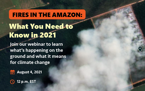
On August 4, attendees at our webinar Fires in the Amazon: What You Need to Know in 2021 learned what to expect during this year’s intense fire season and the implications for climate change, indigenous peoples, and protected areas.

Real-time monitoring experts, scientists, and local organizations witnessing the impact of the Amazonian fires shared their insights through a series of short informational presentations over three distinct sections:

  • The Findings
  • The Tech
  • What It All Means

Click here to see the full agenda, or watch the full recording of the webinar (original audio available only, English translations coming soon). Click here to download the presentations.  Interested in supporting fire prevention and response efforts? Click here.


The Findings

During the first section, The Findings, attendees learned about the fires in the Amazon, the patterns we’ve identified, and the drivers behind them.

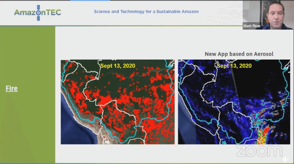
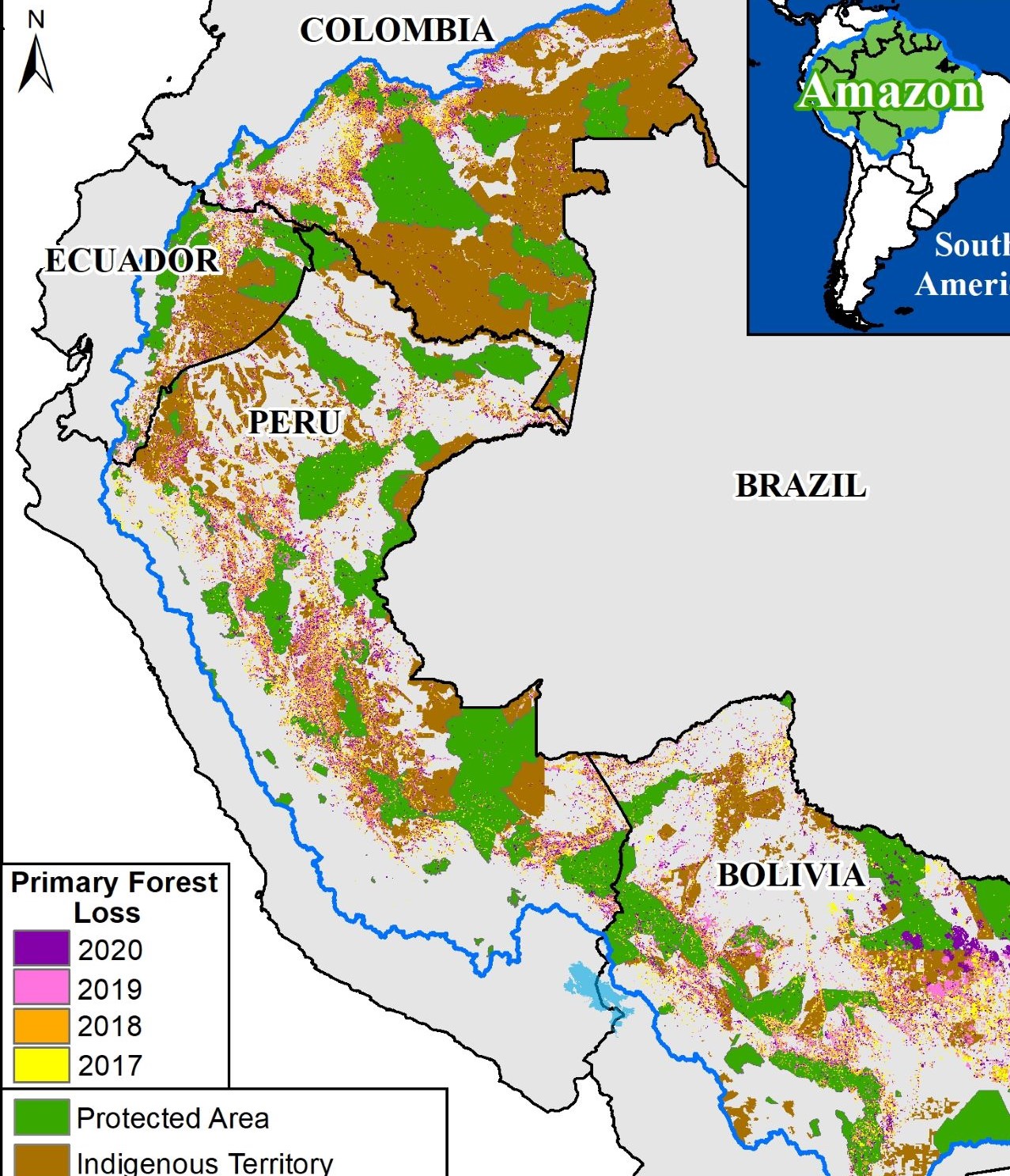
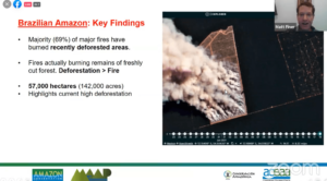
Amazon Conservation’s Director of MAAP Matt Finer started off this section, presenting “What We Know About the First Fires in the Amazon in 2021.” He explained that because most fire detection systems are based on heat and temperature anomalies, it tends to show thousands of red dots indicating fires everywhere. “Our app filters through these hundred and thousands of red dots and fires and really just distinguishes those that are burning lots of biomass.” 

He also warned that, “With the current indications, this season may be intense more than last season, and at the end of 2020 we documented over 2,000 major fires.” One reason behind this is that the fires season this year started one week earlier than last year, along with record high levels of deforestation. Lastly, Matt Finer highlighted the very strong link between deforestation and fires, “Of these fires in the Brazilian Amazon, the vast majority are burning recently deforested areas; 
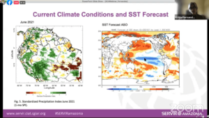
the fires are actually burning the remains of freshly cut forests. There’s a very tight link between deforestation and fires.”

Climate Scientist Kátia Fernandes, who works at the University of Arkansas and SERVIR-Amazonía, followed with “Expectations for the Rest of the Fire Season and Climate Change Implications.” She explained various graphs showing the temperature of the Atlantic ocean, the sea surface temperature forecast for the upcoming months, and how this affects weather patterns and the Amazon. She says that “In Brazil we see the season has started…the conditions at the beginning of the fire season are very dry in Mato Grosso.” 


The Tech 

The next section revealed the technology to use to detect the fires, with demonstrations on how to use them that can be replicated at home by any user interested.

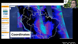
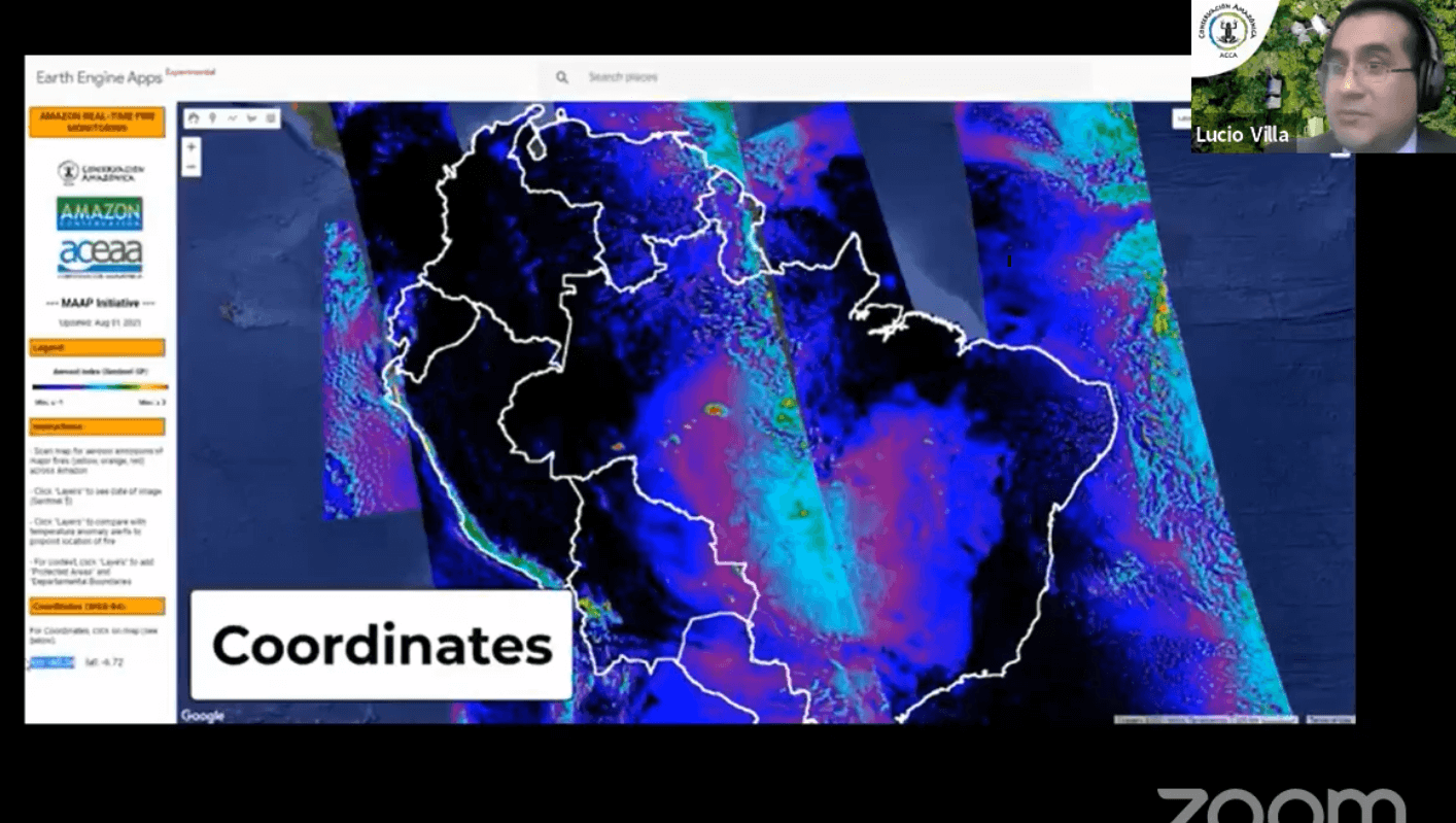
Lucio Villa, GIS and Remote Sensing Specialist at our sister organization Conservación Amazónica – ACCA in Peru, gave an overview of our novel Fire Tracker App. He explained that the app works through satellite information and demonstrated how to use it, switching through each of the layers panels. One aspect of the app that he highlighted was being able to actually see the coordinates of the fires. “By making a small click on the screen we can obtain the coordinates in the lower left part with good precision. Then you can put the coordinates in another source of information to reference it.” This system of checking the coordinates and referencing them with an outside source (for us, it is Planet satellite imagery) is how we are able to tra
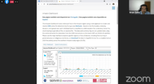
ck fires in the Amazon daily.

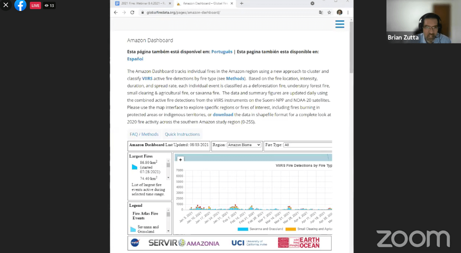
Brian Zutta, from the NASA Applied Science Team then demonstrated how to use the new Amazon Dashboard, which tracks individual fires in the Amazon region using a new approach to cluster and classify active fire detections by type. Based on the fire location, intensity, duration, and spread rate, each individual event is classified as a deforestation fire, understory forest fire, small clearing & agricultural fire, or savanna fire.  Users can use the map to explore specific regions or fires of interest, including fires burning in protected areas or indigenous territories, or download the data in shapefile format for a complete look at 2020 fire activity across the southern Amazon study region. He noted that, “The objective is to be able to look at policy and prevention, and understand what’s occurring in real time.”


What It All Means

The last section synthesized what we learned from the findings and the technology behind them into what it all means.

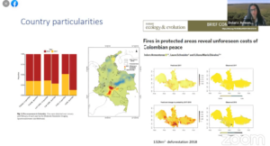
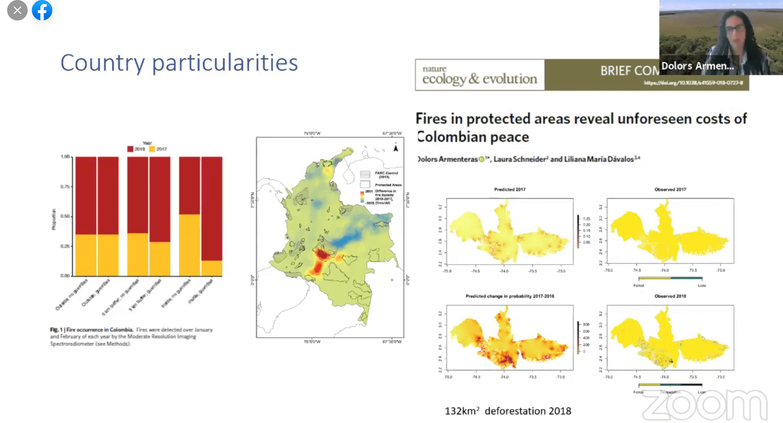
Dolors Armenteras, from the Universidad Nacional de Colombia presented “Fighting Fires in the Amazon: What Can Be Done”. “With the technology available to us, we have a greater ability to show exactly what’s happening and to predict it,” she explained. She also noted that it is important to discuss the drivers of deforestation and fires, referencing in particular the increased demand of agricultural products. Additionally, the importance of maintaining open communication with local communities and stakeholders was not understated. “We have to come to a solution recognize the rights of indigenous communities and also train communities and people in sustainable activities…We need sustainable infrastructure.”

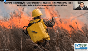
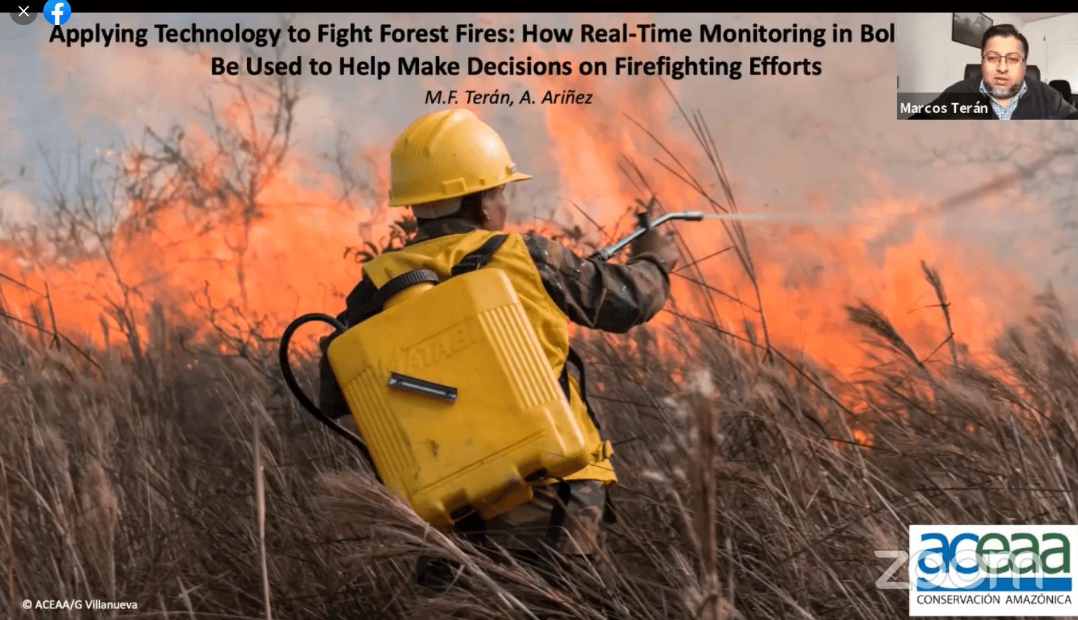
Marcos Terán, Executive Director at our sister organization Conservación Amazónica – ACEAA, concluded with his presentation “Applying Technology to Fight Forest Fires: How Real-Time Monitoring in Bolivia Can Be Used to Help Make Decisions on Firefighting Efforts.”  He noted that in the Bolivian region of Pando, there are a number of fires . “What do we do within this context?” he asks. “We need to integrate several tools to be able to have more strategies in the region.”  He explained that the majority of tools to monitor the fires are using the “hotspots” as an alert system. There are different systems to show the fires, and some have made a lot of progress to isolate the temperature variations to identify the major fires with the hotspots. “As Lucio said, this helps us identify major fires within the region. But we also have the problem that not all hotspots turn into fires and not all fires can be detected with this kind of tool…but we can use the tools and images we have.” When referencing the fire with the use of land they then can identify if it is legal or not, and refer this information to local authorities that can take action. Marcos also took time to thank those for their efforts in detecting and stopping the Amazon fires, saying “I’d also like to thank all those who are involved in fighting fires. Those who work in an office with satellites giving information, but also those who are involved in the fight on the ground. 


In conclusion the webinar was an overall success, with attendees from all around the world learning about the implications of this year’s intense fire season, the technology behind the detection of the fires, what it all means, and how we can help. 

Interested in supporting fire prevention and response efforts? Click here.

Click here to view the full recording of the webinar (no translations, original audio available only), and here to download the presentations.
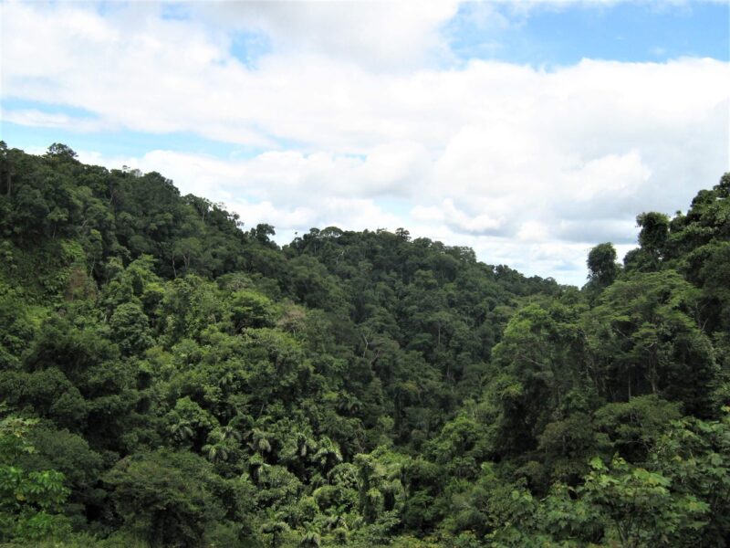
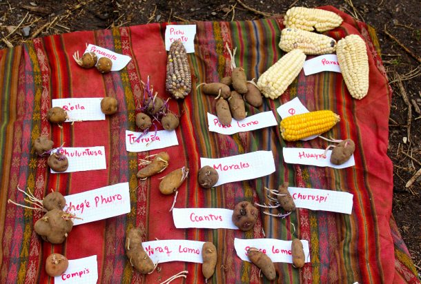
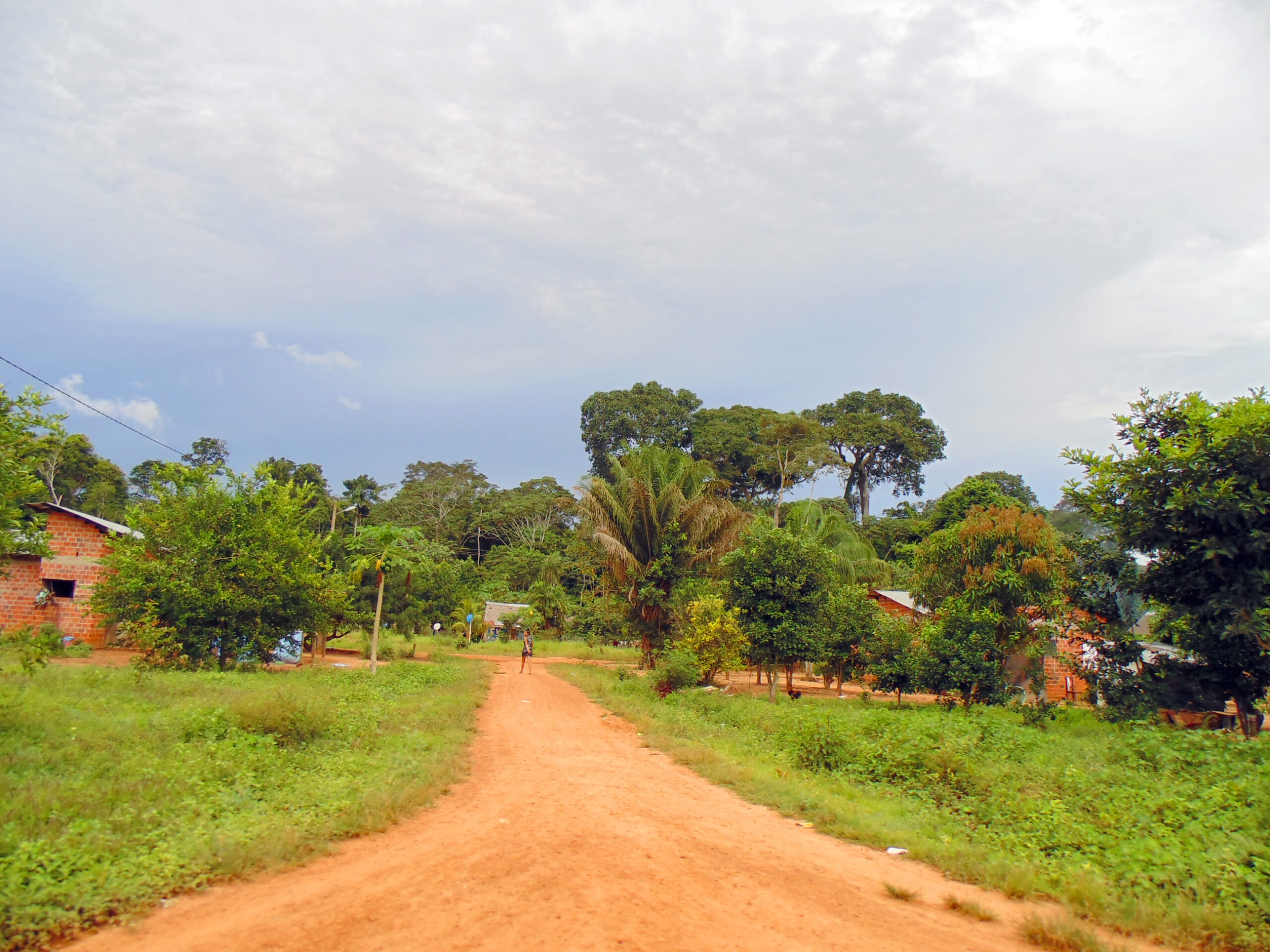


Join Our Fires in the Amazon:
What You Need to Know Webinar

Attend our free, one-hour webinar to learn about what to expect for this year’s fire season in the Amazon and its implications for climate change, indigenous peoples, and protected areas, straight from real-time monitoring experts, scientists, and local organizations witnessing the impact of these growing fires. Simultaneous translation will be available in English, Spanish, and Portuguese. Click here to see the full agenda (in English).

Preserving Agrobiodiversity and Ancestral Farming Practices in Peru

Photo by International Potato Center CIP

The Ccollasuyo Agrobiodiversity Zone supports indigenous communities in the Cusco region, and focuses on rescuing ancient agricultural practices capable of growing a wide variety of native crops sustainably. One of the first of its kind in the country, this area conserves over 35,000 acres of forest and the unique species that inhabit it.

Located in the Peruvian province of Quispicanchi, this area is home to a hundred indigenous Quechua families who cultivate more than 100 varieties of native potatoes, 12 types of native corn, and unique root vegetables such as oca, mashua, olluco, quinoa, kiwicha and tarwi. For generations, the families of Ccollasuyo have continued to apply their ancient practices to grow these plants that are important markers of the world’s agricultural genetic diversity.

Complementing the conservation of this region, we also helped a neighboring Quechua community, Marcapata Ccollana, establish a conservation area protecting an additional 50,000 acres. Combined, these agrobiodiversity zones and conservation areas help mitigate the effects of climate change in a unique way by promoting and preserving ancestral forest-friendly and climate-resilient farming practices.


Protected Areas and Indigenous Territories Prove to be the Best Defense against Deforestation for the Western Amazon

Washington, DC, July 27, 2021. A new analysis by Amazon Conservation’s Monitoring of the Andean Amazon Project (MAAP) shows that protected areas and indigenous territories offer the best defense against deforestation for the Amazon Rainforest.

Through Amazon Conservation’s latest Monitoring of the Andean Amazon Project (MAAP) analysis, the organization studied how land use designations in the four countries of the western Amazon – Bolivia, Colombia, Ecuador, and Peru – impacted primary forest loss in 2020. 

The primary finding solidifies the importance of protected areas and indigenous territories as key mechanisms to fight deforestation.

“The results speak for themselves,” says lead author Dr. Matt Finer, Director of Amazon Conservation’s MAAP. “They strongly show that protected areas had the lowest recent deforestation across the western Amazon, closely followed by indigenous territories. Protected areas in Ecuador and Peru and indigenous territories in Colombia were especially effective.” 

The results showed that, across an area of 229 million hectares (568 million acres), lands designated as protected areas, covering 43 million hectares, had the lowest rates of primary forest loss, followed closely by those designated as indigenous territories, covering 58 million hectares. 2020, a year marked by the COVID-19 global pandemic, presented a peak in forest loss in the Amazon as well as a flip in this overall pattern, with indigenous territories having less primary forest loss than protected areas. This increased forest loss in protected areas last year was primarily due to intense forest fires in Bolivia.

Areas with other land use designations had deforestation rates that were two times higher than in protected areas and indigenous territories.

“This data helps reinforce that protected areas and indigenous territories are doing their intended job in safeguarding these irreplaceable forests and the region’s ecological function and services,” says John Beavers, Executive Director at Amazon Conservation. “However, in addition to creating protected areas and helping indigenous peoples reinforce their territorial rights, greater investment is needed to protect them from increased deforestation threats and to build these areas’ resilience in the face of climate change. Strengthening ongoing management and their ability to adapt will provide the continued conservation needed to help the Amazon survive.”

To see the full study, visit MAAProject.org.

——-

About the Amazon Conservation Association 

Amazon Conservation is a pioneering Alliance of local conservation organizations — Conservación Amazónica-ACEAA in Bolivia, Conservación Amazónica-ACCA in Peru, and Amazon Conservation in the United States  — working towards a thriving Amazon. The organization’s holistic approach focuses on protecting wild places, empowering people, and putting science and technology to work for conservation. Visit amazonconservation.org for more information.


Los Amigos’ 20th Anniversary: Scientists Tell Us Why Los Amigos Matters

Photo of Los Amigos Wildlife Conservation LabThis year marks the 20th anniversary of our Los Amigos Conservation Concession. When Los Amigos was established in 2001, it was the first private conservation concession in the world. Located in the Los Amigos watershed in the department of Madre de Dios in southwestern Peru, the 360,000-acre concession borders the world-famous Manu National Park, and is a mosaic of terrestrial and aquatic habitats, including old-growth Amazonian forest, palm swamps, and bamboo thickets. Wildlife is abundant, including 12 globally threatened species, 11 primate species, and over 550 bird species.

Since its establishment, scientists and researchers have conducted studies at the station addressing botany, conservation biology, geology, hydrology, and zoology, among others. Additionally, many field courses have been held at the station with students from Peru and around the world.

See what they have to say about Los Amigos: