MAAP #132: Amazon Deforestation Hotspots 2020

We present a first look at the major hotspots of primary forest loss across the Amazon in 2020 (see Base Map).*
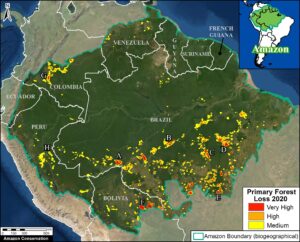
Base Map. Forest loss hotspots across the Amazon in 2020. Data: UMD/GLAD, RAISG, MAAP. The letters A-G correspond to the zoom examples below.

There are several major headlines:

  • We estimate over 2 million hectares (5 million acres) of primary forest loss across the nine countries of the Amazon in 2020.*
  • The countries with the highest 2020 primary forest loss are 1) Brazil, 2) Bolivia, 3) Peru, 4) Colombia, 5) Venezuela, and 6) Ecuador.
  • The majority of the hotspots occurred in the Brazilian Amazon, where massive deforestation stretched across nearly the entire southern region. Many of these areas were cleared in the first half of the year and then burned in July and August. In September, there was a shift to actual forest fires (see MAAP #129).
  • Several of the most intense hotspots were in the Bolivian Amazon, where fires raged through the dry forests (known as the Chiquitano) in the southeast region.
  • There continues to be an arc of deforestation in the northwestern Colombian Amazon, impacting numerous protected areas.
  • In the Peruvian Amazon, deforestation continues to impact the central region. On the positive, the illegal gold mining that plagued the southern region has decreased thanks to effective government action (see MAAP #130).

Below, we show a striking series of high-resolution satellite images that illustrate some of the major deforestation events across the Amazon in 2020 (indicated A-G on the Base Map).


Widespread Deforestation in the Brazilian Amazon

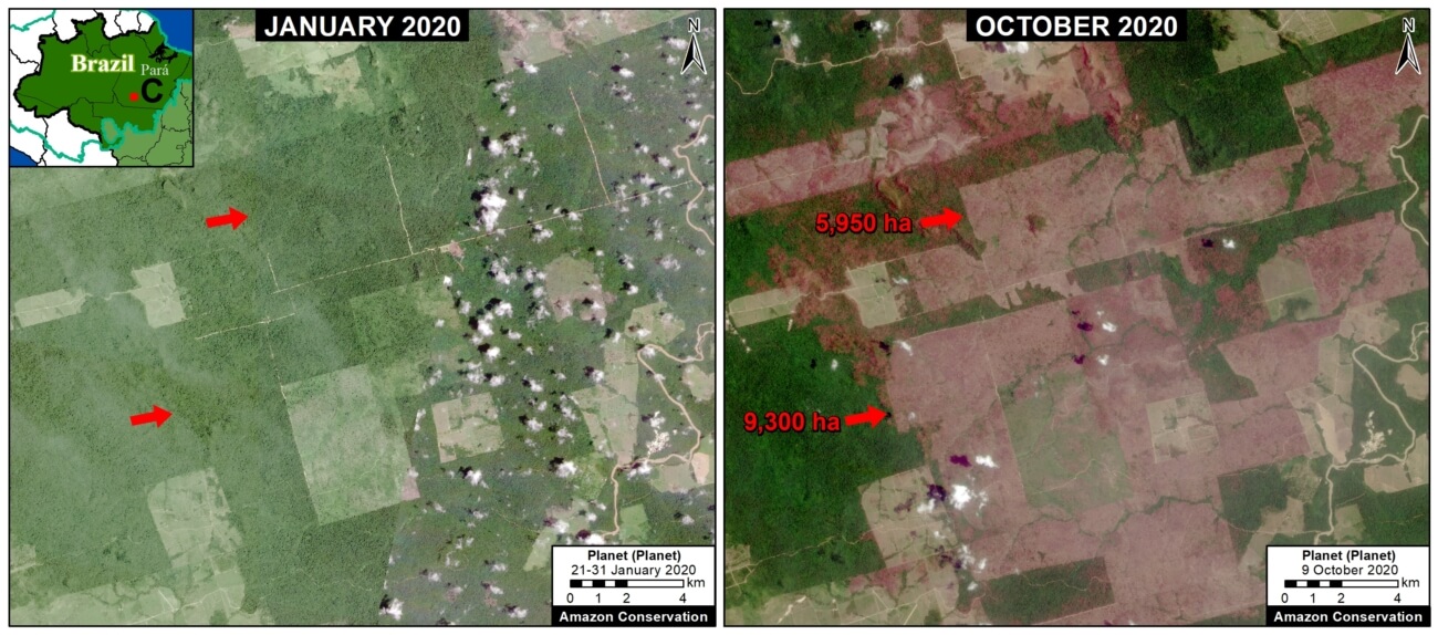
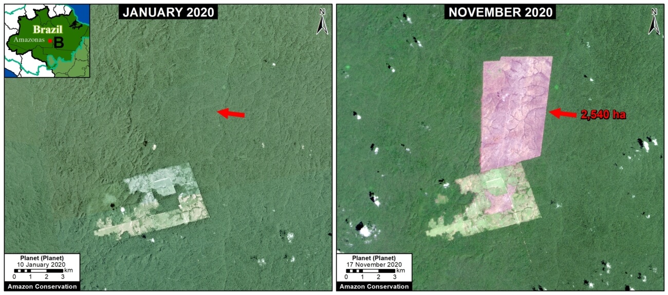
Zooms A-C show examples of a troublingly common phenomenon in the Brazilian Amazon: large-scale deforestation events in the first half of the year that are later burned in July and August, causing major fires due to the abundant recently-cut biomass. Much of the deforestation in these areas appears to associated with clearing rainforests for cattle pastures. The three examples below show the striking loss of over 21,000 hectares of primary forest in 2020.
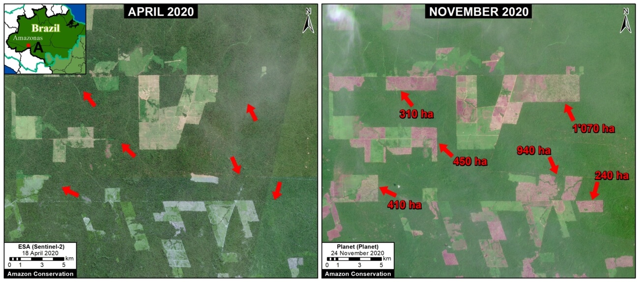
Zoom A. Deforestation in the Brazilian Amazon (Amazonas state) of 3,400 hectares between April (left panel) and November (right panel) 2020. Data: ESA, Planet.


Zoom B. Deforestation in Brazilian Amazon (Amazonas state) of 2,540 hectares between January (left panel) and November (right panel) 2020. Data: Planet.


Zoom C. Deforestation in Brazilian Amazon (Para state) of 15,250 hectares between January (left panel) and October (right panel) 2020. Data: Planet.


Forest Fires in the Brazilian Amazon

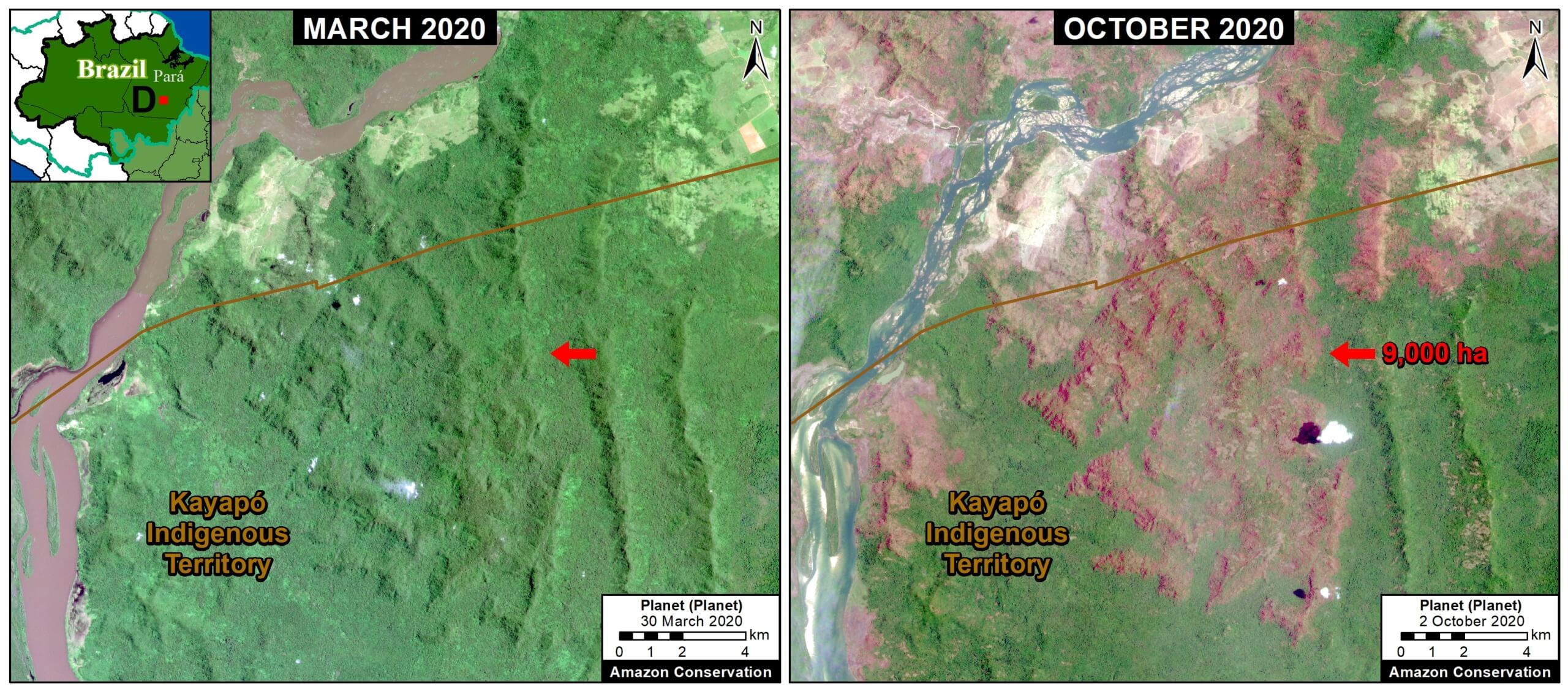
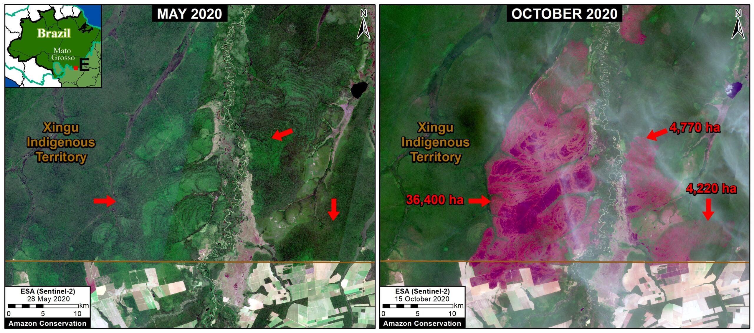
In September, there was a shift to actual forest fires in the Brazilian Amazon (see MAAP #129). Zoom D and E show examples of these major forest fires, which burned over 50,000 hectares in the states of Pará and Mato Grosso. Note both fires impacted indigenous territories (Kayapo and Xingu, respectively).
Zoom D. Forest fire in Brazilian Amazon (Para state) that burned 9,000 hectares between March (left panel) and October (right panel) 2020. Data: Planet.
Zoom E. Forest fire in Brazilian Amazon (Mato Grosso state) that burned over 44,000 hectares between May (left panel) and October (right panel) 2020. Data: Planet.

Forest Fires in the Bolivian Amazon

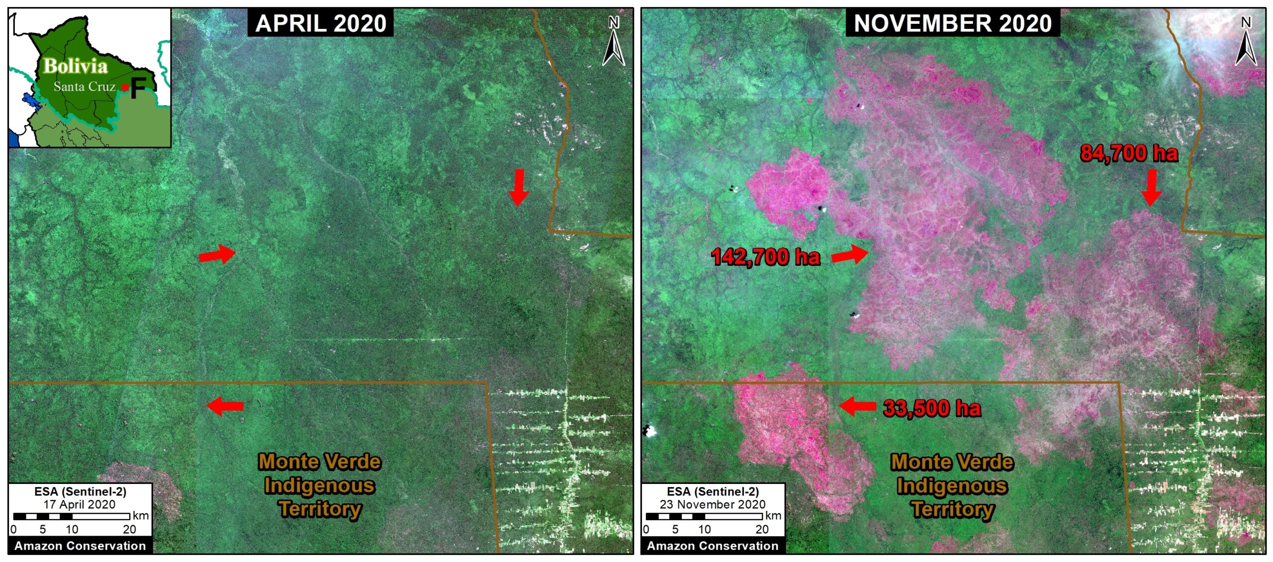
The Bolivian Amazon also experienced another intense fire season in 2020. Zoom F shows the burning of a massive area (over 260,000 hectares) in the Chiquitano dry forests (Santa Cruz department).

Zoom F. Forest fire in Bolivian Amazon (Santa Cruz) that burned over 260,000 hectares between April (left panel) and November (right panel) 2020. Data: ESA.

Arc of Deforestation in the Colombian Amazon

As described in previous reports (see MAAP #120), there is an “arc of deforestation” concentrated in the northwest Colombian Amazon. This arc impacts numerous protected areas (including national parks) and Indigenous Reserves. For example, Zoom G shows the recent deforestation of over 500 hectares in Chiribiquete National Park. Similar deforestation in that sector of the park appears to be conversion to cattle pasture.
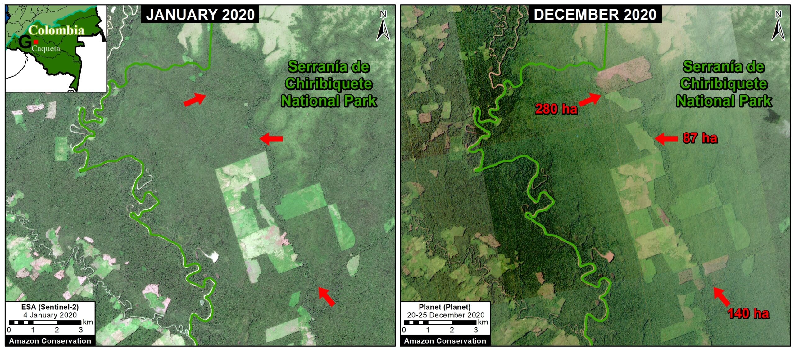
Zoom G. Deforestation in Colombian Amazon of over 500 hectares in Chiribiqete National Park between January (left panel) and December (right panel) 2020. Data: ESA, Planet.

Deforestation in the central Peruvian Amazon

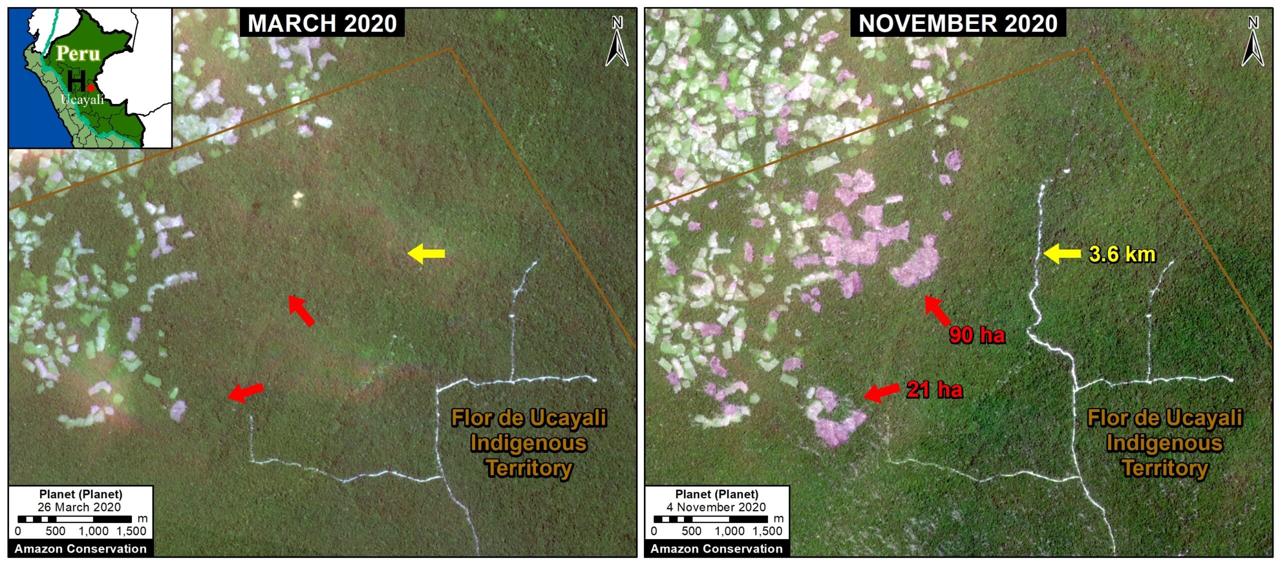
Finally, Zoom H shows expanding deforestation (over 110 hectares), and logging road construction (3.6 km), in an indigenous territory south of Sierra del Divisor National Park in the central Peruvian Amazon (Ucayali region). The deforestation appears to be associated with an expanding small-scale agriculture or cattle pasture frontier.

Zoom H. Deforestation and logging road construction in Peruvian Amazon (Ucayali region) between March (left panel) and November (right panel) 2020. Data: Planet.

*Notes and Methodology

The analysis was based on early warning forest loss alerts known as GLAD alerts (30-meter resolution) produced by the University of Maryland and also presented by Global Forest Watch. It is critical to highlight that this data represents a preliminary estimate and more definitive data will come later in the year. For example, our estimate does include some forest loss caused by natural forces. Note that this data detects and classifies burned areas as forest loss. Our estimate includes both confirmed (1,355,671 million hectares) and unconfirmed (751,533 ha) alerts.

Our geographic range is the biogeographic boundary of the Amazon as defined by RAISG (see Base Map above). This range includes nine countries.

We applied a filter to calculate only primary forest loss. For our estimate of primary forest loss, we intersected the forest cover loss data with the additional dataset “primary humid tropical forests” as of 2001 (Turubanova et al 2018). For more details on this part of the methodology, see the Technical Blog from Global Forest Watch (Goldman and Weisse 2019).

To identify the deforestation hotspots, we conducted a kernel density estimate. This type of analysis calculates the magnitude per unit area of a particular phenomenon, in this case forest cover loss. We conducted this analysis using the Kernel Density tool from Spatial Analyst Tool Box of ArcGIS. We used the following parameters:

Search Radius: 15000 layer units (meters)
Kernel Density Function: Quartic kernel function
Cell Size in the map: 200 x 200 meters (4 hectares)
Everything else was left to the default setting.

For the Base Map, we used the following concentration percentages: Medium: 7-10%; High: 11-20%; Very High: >20%.

Acknowledgements

We thank E. Ortiz (AAF), M.E. Gutierrez (ACCA), and S. Novoa for their helpful comments on this report.

Citation

Finer M, Mamani N (2020) Amazon Deforestation Hotspots 2020. MAAP: 132.


MAAP #131: Power Of Free High-resolution Satellite Imagery From Norway Agreement

This report demonstrates the powerful application of freely available, high-resolution satellite imagery recently made possible thanks to an agreement between the Government of Norway and several satellite companies.*

This unprecedented agreement will bring commercial satellite technology, previously out of reach to many, to all working in tropical forest conservation around the world.

Here we show how MAAP (an initiative of Amazon Conservation) will use this information to enhance our real-time monitoring program and quickly share timely findings to partners in the field.

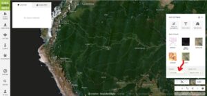
Specifically, we highlight the importance of the monthly basemaps (4.7-meter Planet imagery) available under the Norway agreement.* For example, Image 1 shows the stunning, nearly cloud-free October 2020 basemap across the Amazon.

Image 1. Monthly Planet basemap for October 2020 across the Amazon, as seen on Global Forest Watch.
Moreover, we show the power of this imagery visualized on Global Forest Watch, where it can be combined with early warning forest loss alerts.
Below, we highlight three examples where we combined this data to quickly detect and confirm deforestation in the Colombian, Ecuadorian, and Peruvian Amazon, respectively.

Colombian Amazon

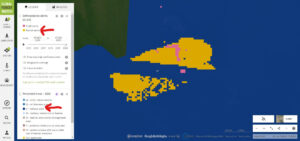
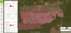
First, we detected recent forest loss alerts (known as GLAD alerts), in the northwestern sector of Chiribiquete National Park. Image 2 is a screen shot of our monitoring search in Global Forest Watch (link here).

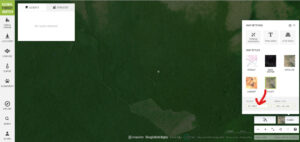
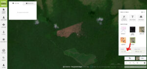
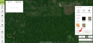
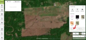
Second, we investigated the alerts with the freely available monthly Planet basemaps. Images 3-5 show the basemaps from October to December 2020. These images confirm that the area was covered in intact (likely primary) Amazon rainforest in October, and then experienced a major deforestation event (225 hectares) in November and December. Similar deforestation in the area appears to be conversion to cattle pasture. Note the crosshairs (+) represent the same point in all four images.

Image 2. Forest loss alerts in Chiribiquete National Park


Image 3. Monthly Planet basemap for October 2020 in Chiribiquete National Park.


Image 4. Monthly Planet basemap for November 2020 in Chiribiquete National Park.


Image 5. Monthly Planet basemap for December 2020 in Chiribiquete National Park.


Peruvian Amazon

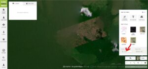
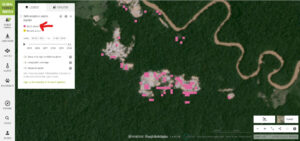
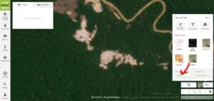
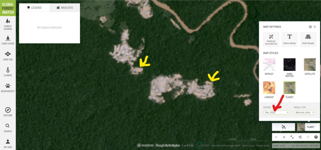
Similarly, we detected recent forest loss alerts in an illegal gold mining area in the southern Peruvian Amazon known as Pariamanu (Image 6). Images 7 & 8 show the monthly basemaps confirming the expansion of illegal mining deforestation between October and December (see yellow arrows). Global Forest Watch link here

Image 6. Forest loss alerts in illegal gold mining zone (Pariamanu).


Image 7. Monthly Planet basemap for October 2020 in Pariamanu.


Image 8. Monthly Planet basemap for October 2020 in Pariamanu.


Ecuadorian Amazon

Finally, we detected recent forest loss alerts of 100 hectares in an indigenous territory (Kichwa) surrounding an oil palm plantation in the Ecuadorian Amazon (Image 9). Images 10 & 11 show the monthly basemaps confirming large-scale deforestation between September and December, likely for the expansion of the plantation. Note the crosshairs (+) represents the same point in all three images. Global Forest Watch link here.
Image 9. Forest loss alerts in the Ecuadorian Amazon.
Image 10. Monthly Planet basemap for September 2020 in Ecuadorian Amazon.


Image 11. Monthly Planet basemap for December 2020 in Ecuadorian Amazon.


Summary

In summary, we show a major advance for free and real-time deforestation monitoring thanks to an agreement between the Government of Norway and satellite companies.* A key aspect of this agreement is making publically available (such as on Global Forest Watch) monthly basemaps created by the innovative satellite company Planet. Thus, users can now freely visualize recent forest loss alerts and then investigate them with high-resolution monthly basemaps on On Global Forest Watch. MAAP illustrated this process with three examples in the Colombian, Peruvian, Ecuadorian Amazon, respectively.

*Notes 

In September 2020, Norway’s Ministry of Climate and Environment entered into a contract with Kongsberg Satellite Services (KSAT) and its partners Planet and Airbus, to provide universal access to high-resolution satellite monitoring of the tropics in order to support efforts to stop the destruction of the world’s rainforests. This effort is led by Norway’s International Climate and Forest Initiative (NICFI). The basemaps are mosaics of the best cloud-free pixels each month. In addition to viewing the monthly basemaps on Global Forest Watch, users can sign up with Planet directly at this link: https://www.planet.com/nicfi/

Acknowledgements

We thank M. Cohen (ACA), M. Weisse (WRI/GFW), E. Ortiz (AAF) and G. Palacios for their helpful comments on this report.

Citation

Finer M, Mamani N (2020) Power of Freely Available, High-resolution Satellite Imagery from Norway Agreement. MAAP: 131.

20 for 20: Launch of the Southwest Amazon Drone Center

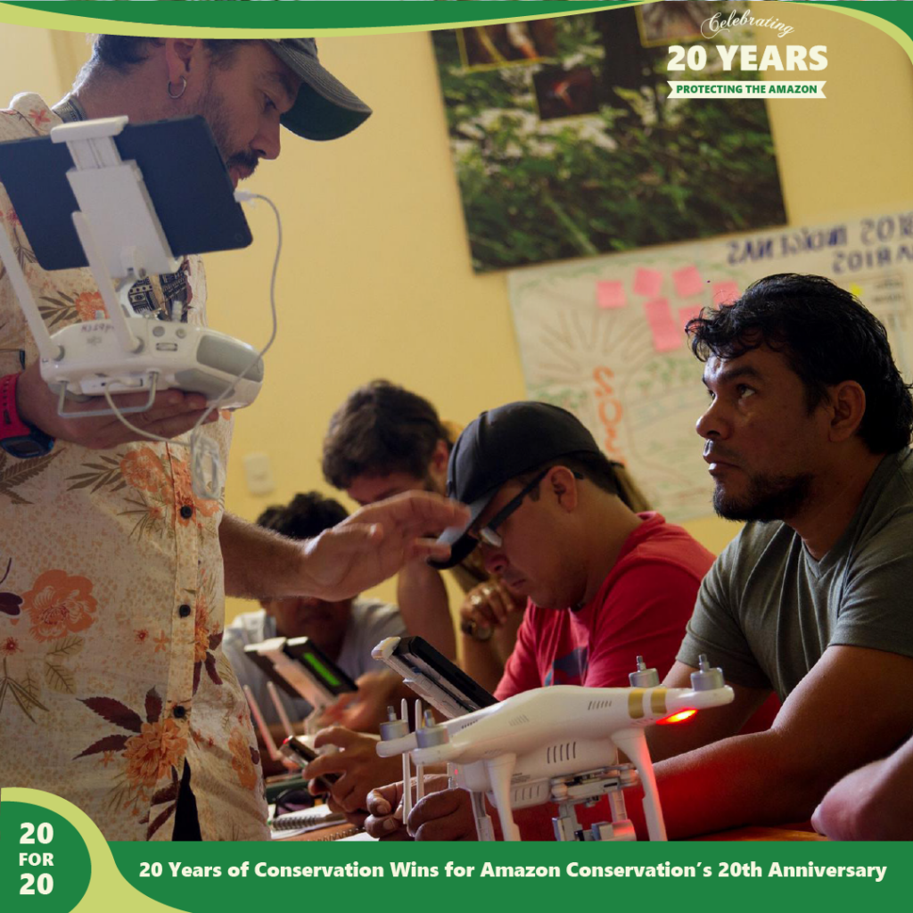
The Southwest Amazon Drone Center located in the Peruvian Amazon, launched in 2017, focuses on training local landowners, indigenous communities, students, and officials in Peru to actively monitor and report illegal deforestation in the western Amazon as well as providing drone overflights for the local government upon request. 

Southwest Amazon Drone Center as a part of the sustainable forest products program by Amazon Conservation,part of 20 for 20 Years of Conservation Wins by Amazon ConservationThis center allows for local community members to obtain training, certifications, and access to high-tech drones that can be used as remote sensing tools to monitor deforestation in tropical forests in a safe, fast, and scientific way. Last year, we trained and certified 89 individuals in using drones and smartphone apps to detect illegal activities in remote areas of their forests, and report them using drone imagery as legally-admissible evidence for law enforcement to be able to take action and prosecute offenders. Sixteen of the new users were women, and their numbers continue to increase as we focus on their inclusion in this type of training. 

By providing these services, we empower people to protect their forests by giving them the tools needed increase legal responses to illegal activities. Presenting evidence, such as drone photos and videos of unlawful deforestation or mining, can be used to prosecute offenders which then deters future illegal activities. Moreover, the use of drone technology is important due to the vastness and remoteness of the Amazon Rainforest — it is a challenge to patrol by foot and stop incidents of illegal deforestation. Face-to-face encounters with those conducting illegal deforestation for financial gain can also be extremely dangerous, and potentially deadly. With technology, Amazon Conservation is changing that.

This story is part of a series commemorating our 20th anniversary protecting the Amazon. We’re celebrating this milestone with a look back at our 20 biggest conservation wins over the past 20 years. Click here to support trainings that help local community members in the Amazon protect their forests.

20 for 20: Discovery of New Beetle Species at our Biological Stations

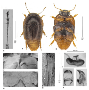
Phytotelmatrichis osopaddington beetle species discovered by Caroline Chaboo
“Paddington Beetle” Phytotelmatrichis osopaddington

At Amazon Conservation’s biological stations around Peru, biodiversity extends beyond just mammals and birds. More than 1,000 new species of beetles were believed to be discovered around these areas in a major study conducted a few years ago by lifelong beetle researcher and expert Dr. Caroline Chaboo, along with around with 40 beetle experts from around the world.

The first to be described in that study was discovered at our Villa Carmen Biological Station, located in the Andean foothills. Named Paddington (Phytotelmatrichis osopaddington), in reference to the Spectacled bear from the movie and children’s books, Dr. Chaboo had hoped the new beetle will raise awareness about biodiversity and conservation in Peru. Additionally, she has published a series of scientific papers titled “Beetles of Peru”– an extensive project spanning ten years–which identified more than 10,000 different types of beetles. Read Part 1 of her studies here: https://www.researchgate.net/publication/285619523_Beetles_Col.

Discovery of 1,000 new beetles as a part of the sustainable forest products program by Amazon Conservation,part of 20 for 20 Years of Conservation Wins by Amazon Conservation
Peru is home to many beetle species

Recently, researchers Michael Caterino and Alexey Tishechkin published a detailed beetle study with 49 new species, including 26 new species from Peru, many coming from Dr. Chaboo’s specimens, titled “Recognition and revision of the Phelister blairi group”. One specimen, Phelister chabooae, is even named after her!

This story is part of a series commemorating our 20th anniversary protecting the Amazon. We’re celebrating this milestone with a look back at 20 significant conservation wins over the past 20 years. Click here to support the protection of these areas that provide spaces for important research like this that helps us learn more about the Amazon.


20 for 20: Açaí Safety Harnesses, a Practical Conservation Tool

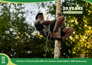
Acai harness as a part of the sustainable forest products program by Amazon Conservation,part of 20 for 20 Years of Conservation Wins by Amazon ConservationDue to a misstep coming down the tree with a heavy branch of açaí in hand, Omar Espinoza, an açaí harvester, fell from a height of about 40 feet head first. He was gathering fruits to support his family and like many açaí harvesters, was climbing 10-15 açaí trees a day with heights reaching up to 65 feet to bring down bundles of açaí weighing dozens of pounds.

Thanks to one of the features in our newly developed safety harnesses distributed earlier in the year, Omar’s misstep was not fatal and due to the harness’s aptly named “life line”, he was stopped from hitting the ground. Instead Omar just dangled from the harness, his head a few feet above the forest floor. Using the harness he had before this project would have meant a certain fall. Had it not been for this new equipment, he would have faced severe and debilitating injuries or possibly, death.

These harnesses are a practical conservation tool because they promote (and improve the safety of) forest-friendly livelihoods such as the sustainable gathering of brazil nuts and acai berries. These activities are safer, more profitable, and encourage conservation of standing forests compared to activities such as gold mining, logging, or agriculture, which results in forest habitats being cleared.

For many years now, we have been working with açaí and Brazil nut harvesters who depend on the Santa Rosa de Abuná conservation area and have helped improve how harvesters locate, gather, and process the forest goods they sustainably harvest. This is a key conservation and community development strategy for providing local people with the incentive to keep forests standing, as many of the globally in-demand fruits and nuts they harvest can only grow in healthy forests – not in large-scale plantations. With this strategy in mind, we help families improve their income by growing their local economies through instituting ecologically sustainable activities that protect the forests they call home.

This story is part of a series commemorating our 20th anniversary protecting the Amazon. We’re celebrating this milestone with a look back at our 20 biggest conservation wins over the past 20 years. Click here to help create more life saving tools that help local harvesters in the Amazon.

20 for 20: Establishing Bajo Madidi, Bolivia’s Largest Conservation Area

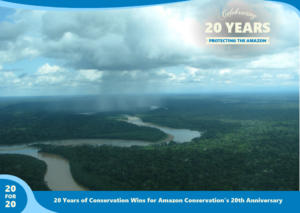
Photo of Bajo Madidi Conservation Area by Amazon Conservation,part of 20 for 20 Years of Conservation Wins by Amazon ConservationLast year we helped the local government of Ixiamas, Bolivia establish the Municipal Conservation Area of Bajo Madidi, an area spanning 3.7 million acres (1.5 million hectares). Three times the size of the Grand Canyon, this conservation area is the largest in Bolivia and one of the largest in the world. It hosts a variety of ecological landscapes including wetlands, lowland rainforests, and savannas. 

Throughout the long and complex creation process, we provided the technical expertise and assistance to both the government and local communities that was needed to officially declare the area. We also helped them gather and understand key environmental data on the conservation needs of this landscape to develop the plan to protect it for the long-term. This conservation plan now guides the sustainable use and management of natural resources in Bajo Madidi. 

The establishment of this area was a massive undertaking with contributions by local peoples and support from over 800 stakeholders. Successes like these are the foundation of our conservation efforts that have helped protect over 8.3 million acres of forests to date. 

This story is part of a series commemorating our 20th anniversary protecting the Amazon. We’re celebrating this milestone with a look back at our 20 biggest conservation wins over the past 20 years. You can help create more protected areas like Bajo Madidi around the Amazon.


20 for 20: Species Discoveries at our Research Stations

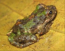
Photo of Glass Frog Discovered At Wayqecha by Amazon Conservation,part of 20 for 20 Years of Conservation Wins by Amazon ConservationThanks to the incredible biodiversity in the Andean Amazon, scientists conducting research at our biological stations have discovered multiple new species. In this 20 for 20 story, we’re highlighting some of our favorite frog discoveries over the years.

An Amazon Conservation-funded research team discovered the 7,000th amphibian species in the world at our Wayqecha Cloud Forest Research Station . The new glass frog, described as Centrolene sabini, was particularly intriguing for researchers due to its high sensitivity to the chytrid fungus. The team was led by Wayqecha’s then-research coordinator Alessandro Catenazzi, who has extensive background studying frog populations around the area, documenting the decline in frog diversity and populations. 

Pygmy Andean Frog Additionally, the Andean region’s smallest known frog was discovered at our Wayqecha Cloud Forest Research Station. Smaller than a dime, the Noble’s pygmy frog (Noblella pygmae) surprised herpetologists studying at Wayqecha because it contradicts the informal rule that high altitude vertebrates tend to be larger than low altitude vertebrates.  Noble’s pygmy frog is among the smallest vertebrates ever found at this altitude, and one of the smallest amphibian species in the world.

New Frog Species Discovered at Los AmigosThe last highlight of today includes a new frog discovered at Los Amigos Biological Station. This species, Pristimantis divnae, belongs to the family Strabomantidae and lives in the leaf-litter and understory in terra firme forest at the base of Peru’s southern Andes. The species is characterized by a contrasting pattern of yellow and black with brown patches.

This story is part of a series commemorating our 20th anniversary protecting the Amazon. We’re celebrating this milestone with a look back at our 20 biggest conservation wins over the past 20 years. Click here to fund important research at our biological stations in and around the Amazon.

High School Student Hosts Virtual Art Classes for Kids to Support the Amazon

High school student Madeleine Herberger has always had a passion for animals and the environment, and last year she was able to visit the Amazon Basin in Peru, nearby where our conservation hubs of Los Amigos, Villa Carmen, and Wayqecha operate. Reflecting on that trip she says, “I was able to spend four incredible days soaking up the awesome beauty and nature there, learning facts about leaf ant highways, tarantulas, clay licks, and more.” 

One aspect of the trip that stood out to her was the amazing range of biodiversity found in this particular region of the Amazon, the headwaters to the Amazon basin. The Amazon’s diverse forests are home to 10% of the world’s known wildlife species, and Madeleine remembers how, “One of the group members photographed a suspected undiscovered insect. This experience made me realize how much the Amazon holds and how important it really is not just to the region, but to our entire world ecosystem.” Not only does a healthy Amazon provide an important mosaic of habitats for over 350 endangered and endemic species, it also serves as a climate regulator, storing over 150 billion metric tons of carbon—more than a third of all the carbon stored in tropical forests worldwide. Amazon forests also absorb 2 billion tons of carbon dioxide each year, representing 5% of global annual emissions.

But Madeleine’s trip also revealed to her how the Amazon is being threatened, as it nears closer to its “tipping point”. This is when the Amazon will no longer be able to generate its own rainfall and support its rainforest ecosystems. Estimates place the current deforestation level of the Amazon at 17%, and its tipping point at 20-25%. If the tipping point is surpassed, the largest rainforest on Earth could become—at best—a dry grassland. So after returning to the United States, Madeleine planned to share this experience with others and raise awareness on the importance of the Amazon rainforest. 

Citing her experience and enjoyment working with children as a babysitter, she came up with a series of virtual art lessons for kids for her school senior project, each focusing on an “amazing animal”, such as macaws, sloths, and leaf-cutter ants. Not only do children learn how to draw the animal, but the lesson also includes fun facts about the species and their English and Spanish names. “These virtual lessons would also help parents who might need a break trying to come up with ways to entertain their children during the pandemic, as well as bring the cause to their attention,” she adds.

It is always inspiring when the next generation of conservationists find new and creative ways to promote conservation in the Amazon. Madeleine says, “I hope to create a series of art lessons that have educational elements focused on Amazonian wildlife, with an overarching theme of raising awareness about the importance of the Amazon basin.” 


Details: 

Classes are free of charge, with optional donations to support Amazon Conservation’s programs that protect the Amazon and all of the important species and communities that call it home. Click here to support Madeleine and the protection of the Amazon rainforest.


The next class is at 11:00 a.m. on Saturday, Dec. 12th. Click here to register.


Schedule 

Classes will run every week on Saturday from 11:00-11:45  a.m. Click here to register.


Contact information 

Contact Madeleine Herberger at the above link for more information.

20 for 20: Celebrating Wayqecha, the Only Cloud Forest Research Station in Peru

Wayqecha Cloud Forest Research Station part of 20 for 20 Years of Conservation Wins by Amazon ConservationAmazon Conservation’s Wayqecha Research Station and Conservation Hub, the only cloud forest research station in Peru, officially opened its doors in 2006. Located at 2,900 m of elevation in the cloud forest region of Cusco and just 175 km from our Los Amigos Conservation Hub in the Amazonian lowlands, these research sites together provide a full panorama of the biodiversity and climate changes in the Andes-Amazon region.

Wayqecha Research Station protects the cloud forest’s biodiversity and facilitates research that leads to a better understanding of this ecosystem. Cloud forests receive hundreds of inches of rain every year and their trees, mosses and soil work as giant sponges capturing the abundant rainfall and then releasing it slowly into a network of small streams and creeks that represent the smallest tributaries of the vast Amazon drainage.

Cloud forests are of critical conservation value for many reasons, including containing a vast storehouse of species, many of them narrowly endemic, and also serve as natural corridors for plant and animal species pushed uphill by global warming.

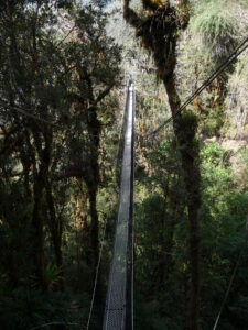
Canopy Walkway at Wayqecha Cloud Forest Research Station and Conservation HubAdditionally, three years after opening, we added the first-ever canopy walkway in an Amazonian highland cloud forest. The canopy walkway provides access to the upper parts of the forest, which is where a lot of natural activity is, including an amazing diversity of bromeliad, orchids, birds and butterflies. It consists of four aluminum towers connected by a 146-meter-long network of suspension bridges that pass under, through, and above the forest canopy. Another important feature of the canopy walkway is a rigid truss bridge through a small rock canyon that leads to the base of a waterfall passing through an area with a completely distinct climate and Cloud Forest Canopy. Other bridges lead visitors across forested slopes that cover eight distinct eco-zones, providing a view from more than 10,000 feet in elevation down to the Amazon basin.

This is part of a series commemorating our 20th anniversary protecting the Amazon. We’re celebrating this milestone with a look back at our 20 biggest conservation wins over the past 20 years. Click here to support protected areas and research stations around the Amazon.

20 for 20: Monitoring of the Andean Amazon Project (MAAP) Established

Monitoring of the Andean Amazon Project (MAAP) by Amazon Conservation,part of 20 for 20 Years of Conservation Wins by Amazon ConservationAndean forests faced escalating threats from illegal gold mining, illegal logging, illegal drug plantations, unsustainable agriculture, cattle pasture, and road construction, and new tactics were needed to address the problems. In response, Amazon Conservation and Conservación Amazónica – ACCA developed MAAP – Monitoring of the Andean Amazon Project to provide real-time satellite monitoring deforestation reports. 

Since the establishment of MAAP in 2015, the program has provided geographic information and evidence of illegal gold mining, deforestation, logging, and more to the public and government officials. MAAP currently monitors 83% of the Amazon rainforest across five countries: Peru, Bolivia, Ecuador, Brazil, and Colombia.

This past summer, in anticipation of the fire season, we’d improved upon our novel MAAP Amazon Fire Tracker App, which recorded over 2,500 major fires across the Amazon. We also provide MAAP deforestation reports directly to government officials who can take action on the ground against the illegal activity, and this information has helped prosecutors stop deforestation in Pariamanu and Chispa, Peru. Additionally, a major success was last year year, when we helped Peruvian government officials in the dismantling of an illegal mining stronghold in La Pampa, Peru causing deforestation in the area to plummet by 90%.