MAAP #68: 2017 Deforestation Hotspots in The Peruvian Amazon (Part 2)

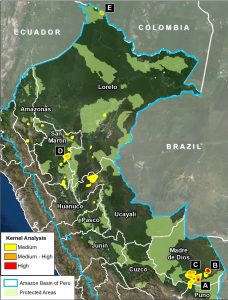
Image 68. Base map. Data: PNCB/MINAM, UMD/GLAD, SERNANP.

In a previous report, MAAP #65, we presented information about deforestation hotspots in 2017 in the Peruvian Amazon, based on early warning alert data from January until mid-July.

Between July and August, the amount of alerts greatly increased, likely due to arrival of the dry season. Thus, this report includes new updated data until mid-August.*

We find new deforestation hotspots in the regions of Madre de Dios and Ucayali (see base map).** At the national level, we now estimate the forest loss of 111,200 acres (45,000 hectares) thus far in 2017 (thru August 17).***

Below, we present satellite imagery of the following hotspots:

– La Pampa, Madre de Dios (Inset A)
– Guacamayo, Madre de Dios (Inset F)
– Iberia, Madre de Dios (Inset G)
– South of Sierra del Divisor, Ucayali (Inset H)
– Nueva Requena, Ucayali (Inset I)

**The data were generated by the National Program of Forest Conservation for Climate Change Mitigation, Peruvian Ministry of Environment (PNCB/MINAM).

**See Hotspots A-E in MAAP #65

***We emphasize that our calculations are just estimates. Official forest loss data are produced annually by the Peruvian Ministry of Environment.

MAAP #65: Deforestation Hotspots Of 2017 in The Peruvian Amazon

In an earlier report, MAAP #40, we highlighted the power of combining early warning GLAD* alerts with analysis of high-resolution satellite images (for example, from the company Planet), as part of a comprehensive near real-time deforestation monitoring system.


In the current report, we analyze the GLAD alerts for the first half of 2017 (through July 17) to identify current deforestation hotspots in the Peruvian Amazon.** These alerts indicate an estimated total forest loss of 37,000 acres (15,000 hectares) thus far during the year.

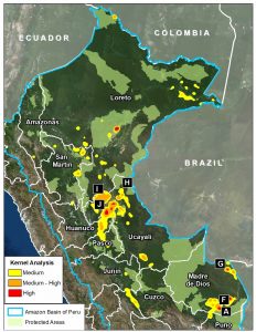
Image 65 (see right) highlights the 2017 deforestation hotspots, defined here as areas with medium to high density of forest loss.

Below, we describe and show images of the most intense hotspots, indicated in red and orange.

Image 65. Data: MINAM/PNCB, UMD/GLAD, SERNANP, MAAP

These areas include:

  • Buffer zones of Tambopata National Reserve and Cordillera Azul National Park
  • Natural loss due to blowdowns from “hurricane winds,” in the Madre de Dios region
  • Northwest border with Colombia

MAAP #64: Good News Deforestation Stories (Peruvian Amazon)


We admit that most MAAP stories are about the bad news of Amazon deforestation. But fortunately
 

 there is good news as well.

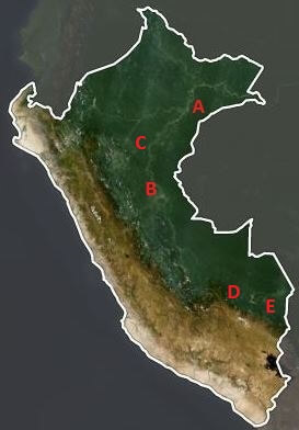
Here we highlight 5 good news stories from the Peruvian Amazon that show how near real-time monitoring may lead to halting deforestation from emerging threats, such as gold mining and large-scale agriculture (oil palm and cacao plantations).

The detailed cases are:

A) United Cacao (cacao),

B) Plantations of Pucallpa (oil palm),

C) Grupo Romero (oil palm),

D) Amarakaeri Comunal Reserve (gold mining), and

E) Tambopata National Reserve (gold mining).


United Cacao

Image 64a. Data: NASA/USGS

Image 64a. Data: NASA/USGS

The rapid deforestation of primary forest for a large-scale cacao plantation in the northern Peruvian Amazon took everyone by surprise in 2013. Civil society led the way in exposing and tracking the deforestation with satellite imagery and the government eventually confirmed the forest loss data. For its part, MAAP published 6 articles (for example MAAP #35 and MAAP #2).

Although total deforestation eventually reached 5,880 acres (2,380 hectares), the company, due to a complicated combination of factors, was suspended from the London Stock Exchange and no new deforestation has been detected in over a year.

Image 64a shows that the cacao project area was covered by intact forest in late 2012, followed by large-scale deforestation of primary forest in 2013. The deforestation slowed, and then stopped, between 2014 and 2017. The yellow circle indicates the cacao plantation area over time.


Plantations of Pucallpa (oil palm)

In a remarkable case, satellite imagery was used to demonstrate that an oil palm company (Plantations of Pucallpa) had breached the Code and Conduct of the RSPO (Roundtable on Sustainable Palm Oil), a non-profit entity founded to develop and implement global standards for sustainable palm oil.

In 2015, the Native Community of Santa Clara de Uchunya (with the support of the NGO Forest Peoples Programme) presented an official complaint to the RSPO against Plantations of Pucallpa, a member of the roundtable. An important component of the complaint alleged massive deforestation, but the company adamantly denied it. MAAP articles showing the deforestation of 15,970 acres (6,460 hectares) were used as evidence (MAAP #4, MAAP #41), as was independent government analysis.

In April 2017, the RSPO concluded that Plantations of Pucallpa cleared 14,145 acres (5,725 hectares) despite declaring no land-clearing, thus breaching the Code and Conduct. Several months prior this decision, the company divested its oil palm estates and withdrew from the RSPO. We have not detected any new deforestation in the project area in over a year.

Image 64b shows the massive deforestation for two large-scale oil palm plantations in the central Peruvian Amazon (Plantations of Pucallpa is the plantation to the north). The yellow circles indicate the oil palm plantation project areas over time. Note that the project area was a mix of primary and secondary forest in 2011, immediately prior to the deforestation, which began in 2012. The deforestation intensified in 2013 before nearly reaching its maximum extent in 2015. We have not detected any new deforestation since 2016.
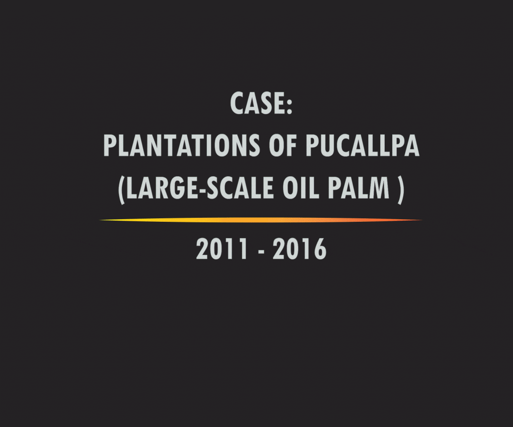
Image 64b. Data: NASA/USGS, MAAP

Grupo Romero (oil palm)

Perhaps the best news of the bunch is about four large-scale oil palm plantations that were stopped before any deforestation occurred. As detailed in a recent report by Environmental Investigation Agency, the Peruvian business conglomerate Grupo Romero conducted environmental impact studies for four new oil palm plantations in the northern Peruvian Amazon. Analysis of these studies revealed that these plantations would cause the massive deforestation of 56,830 acres (23,000 hectares) of primary forest. After strong pushback from civil society, including legal action, a recent report from Chain Reaction Research revealed that Grupo Romero is now working towards a zero-deforestation supply chain and thus found that the four planned plantations are no longer feasible and abandoned the projects.

Image 64c shows how the project area for two of the proposed oil palm plantations (in yellow), Santa Catalina and Tierra Blanca, is largely covered by intact, primary forest.
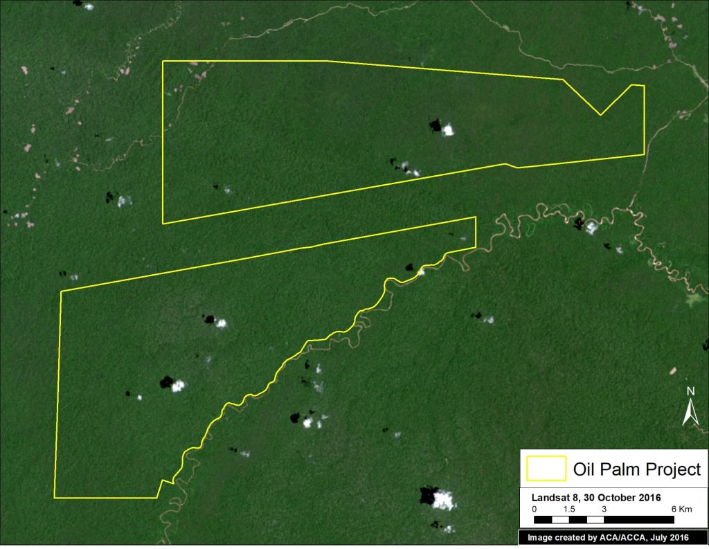
Image 64c. Data: NASA/USGS, Grupo Palmas (Grupo Romero)

Amarakaeri Communal Reserve (gold mining)

In June 2015, we revealed the deforestation of 11 hectares in Amarakaeri Communal Reserve due to an illegal gold mining invasion. The Reserve, located in the southern Peruvian Amazon, is an important protected area that is co-managed by indigenous communities (ECA Amarakaeri) and SERNANP, Peru’s protected areas agency (see MAAP #6). In the following weeks, the Peruvian government, led by SERNANP, cracked down on the illegal mining activities. A year later, we showed that the deforestation had been stopped, with no further expansion into the Reserve (MAAP #44). In fact, we showed that there were signs of recovering vegetation on the recently mined areas.

Image 64d shows the gold mining deforestation approaching (2011-12) and entering (2013-15) Amarakaeri Communal Reserve (yellow circles indicate areas of invasion). However, it also shows how, following action by the government and ECA Amarakaeri, the deforestation was halted and did not expand in 2016-17.
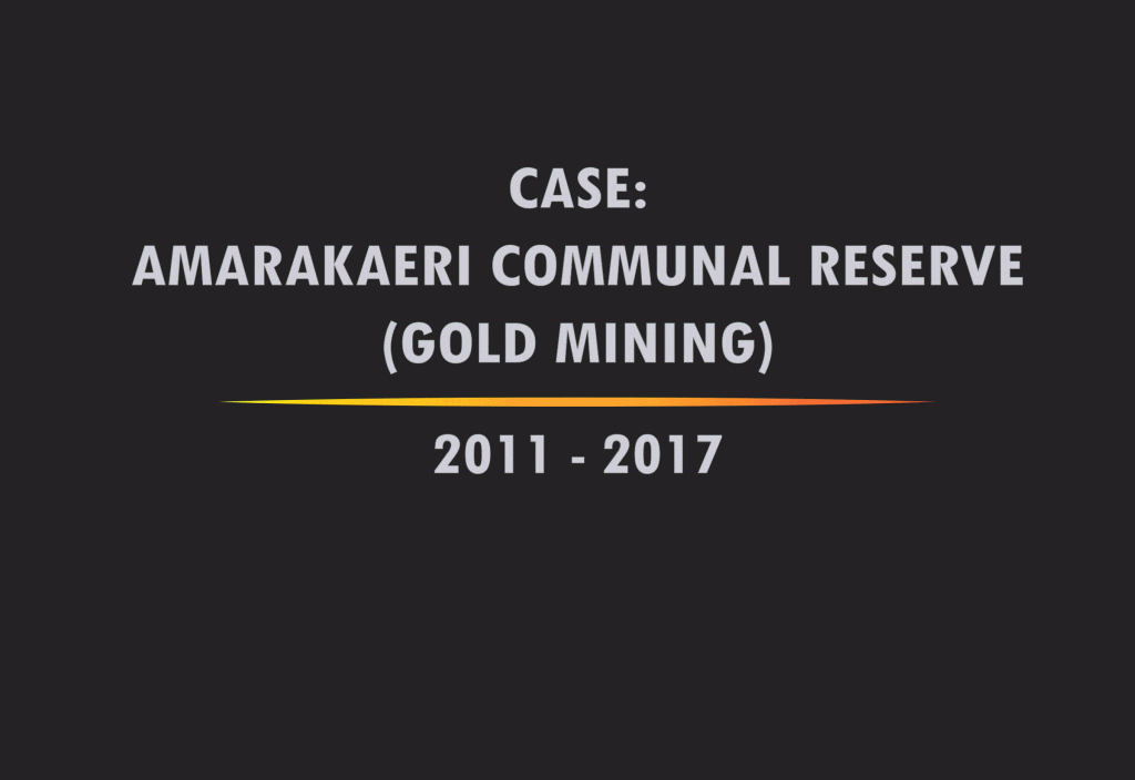
Image 64d. Data: NASA/USGS, Sentinel/ESA, RapidEye/Planet

Tambopata National Reserve (gold mining)

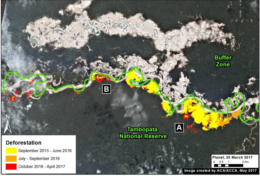
In September 2015, illegal gold miners started to invade Tambopata National Reserve, an important protected area in the southern Peruvian Amazon with world renowned biodiversity. In a series of MAAP articles, we tracked the invasion as it intensified in 2016, and eventually reached 1,360 acres (550 hectares) by early 2017. However, by late 2016, the Peruvian Government intensified its interventions against the illegal mining activity, and the rate of deforestation quickly and sharply decreased. In the most recent satellite imagery, we have not detected any major new expansion of illegal gold mining within the Reserve.

Image 64e shows the initial invasion of Tambopata National Reserve between September 2015 and January 2016. The deforestation within the Reserve intensifies during 2016, but slows significantly in 2017. The yellow circles indicate areas of invasion.
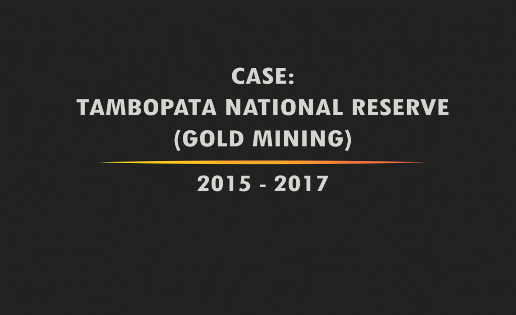
Image 64e. Data: Planet, SERNANP

References

Planet Team (2017). Planet Application Program Interface: In Space for Life on Earth. San Francisco, CA. https://api.planet.com.


Citation

Finer M, Novoa S, Olexy T, Scott A (2017) Good News Deforestation Stories (Peruvian Amazon). MAAP: 64.

MAAP #61: Illegal Gold Mining Decreases in Tambopata National Reserve

In the previous MAAP #60, we showed the rapidly increasing illegal gold mining deforestation in the buffer zone of Tambopata National Reserve. In contrast, here we show that the rate of illegal gold mining deforestation is decreasing within Tambopata National Reserve, due to the active interventions by the Peruvian Government. Tambopata is an important protected area in the southern Peruvian Amazon due to its high biodiversity.


Image 61. Data: Planet, MAAP, SERNANP

MAAP #60: Gold Mining Increases in Buffer Zone Of Tambopata National Reserve

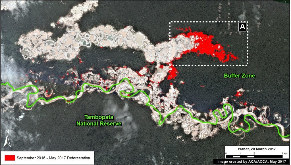
In the previous MAAP #50, we presented an analysis of the extent of gold mining deforestation in the southern Peruvian Amazon as of September 2016. Here, we partially update the data for the area within the buffer zone of Tambopata National Reserve.* We document the increase of 1,135 acres (460 hectares) of illegal mining deforestation during the last 8 months, from September 2016 to May 2017 (see red in Image 60). That brings the total deforested area in the buffer zone to 10,970 acres (4,440 hectares) since 2012.


Image 60. Data: Planet, MAAP, SERNANP

*The buffer zone does not form part of the respective protected area, thus it is not under the jurisdiction of the Peruvian national protected areas agency, SERNANP. However, the illegal activities that are being carried out in the buffer zone are putting the conservation values of the protected area at risk, and are under the jurisdiction of other entities in the Peruvian government.

Exploring the Amazon with photographer Jessica Suarez

Exploring the Amazon with photographer Jessica Suarez, photo of Jessica SuarezThe morning is cool and a rainstorm seems inevitable today as clouds hang low over Villa Carmen Biological Station. Today is one of my last days as an artist-in-residence with Amazon Conservation and I’m anxious to retrieve my camera trap that I left a month ago in a dip in the trail on one of my favorite hikes. Trail nine is steep, gaining several hundred meters of elevation in under a kilometer. As I hike, macaws and parrots keep me company from tree tops, dropping fruit as they eat and chatter. As soon as I reach 800 meters I suddenly realize that I am hiking through clouds. This section of forest with its tall trees cloaked in mist is just magical. 

I make my way up to the small mirador and watch as waves of clouds move through the space obscuring and then revealing the bluish-green mountains and the confluence of rivers below. I spend time filming for my 360 video project, attaching the camera to trees hoping to relay the experience of this special scene. My primary project for my artist-in-residency is to pair 360 video with photos, camera trap images, audio and writing to re-create an immersive experience of what it’s like to be in the Amazon rainforest. As David Attenborough says, “No one will protect what they don’t care about; and no will care about what they have not experienced.” My hope is that this project will help others experience a bit of this amazing rainforest that has completely besotted me.

Exploring the Amazon with Jessica Suarez, Margay cat
Margay captured on a camera trap April 4, 2017, trail 9, Villa Carmen Biological Station.

As I sit and spend a few more moments absorbing the beauty of this place, a mixed flock of birds flit between branches above me. I start photographing them and identify stunning Paradise tanagers, and even a Masked tanager, a new bird for me! Finally, I wind my way down from the mirador to the dip to discover what wildlife my camera trap has seen over the past month. I can hardly wait to hike back to the station to see what images will emerge.

As I return to my cabin, the wind has picked up and thunder rumbles nearby. I quickly cover my backpack and pull out my rain jacket and as I descend the trail, the rain arrives refreshing and clean. Halfway down the trail I hear the familiar whimper of capuchin monkeys. One large fellow eyes me warily before disappearing all the while calling out to his troupe.

Later when I put the camera trap card into the computer, I am swept away with pictures of jaguars, margays, pumas, jagarundis, pacas, agoutis, opossums and giant armadillos. While I hope one day to see some of the animals in person, it is enough to know they are out there, walking these same trails I did, protected and safe. 


Letter from our ED: Why the Amazon Still Matters

In the 1990s, deforestation in the Amazon was a big news story. While now less prominent in the mainstream media in the Letter from our ED- Why the Amazon Still MattersU.S., protection of the planet’s richest forest is more critical than ever, especially as we seek to halt global climate change.

This week, El Comercio, Peru’s leading newspaper, published an alarming story based on Amazon Conservation’s forest monitoring program showing the rapid devastation caused by illegal gold mining across wide swaths of southern Amazon forests. Unsustainable agricultural expansion, illegal logging, and large infrastructure projects also threaten this great wilderness. If current rates of deforestation continue, it is estimated that more than half of the Amazon may be destroyed or severely damaged by 2030. This would be an incredible loss for the planet and affect us all, as the rainforest stores 80 to 120 billion tons of carbon, stabilizing the world’s climate, and produces 20% of the oxygen we breathe.

Letter from our ED_HannahPortraitOur deforestation analysis also highlights what’s working in the Amazon. As reported by El Comercio, Peru’s Park Service in cooperation with other government entities, including the Army and Environmental Prosecutor’s office, successfully halted recent invasions by illegal gold mining inside the spectacular forests and rivers of the Tambopata National Reserve! Local communities also play a key role in protection, like the indigenous community of Matoriato which recently declared a 4,000 acre conservation area on their ancestral communal territory with our assistance. invite you to support these forest guardians whose work on the ground help save this global treasure.

Letter from our ED_HannahSignature

Hannah Stutzman, Executive Director

New conservation area established: Over 11,000 acres of forest protected

An area equivalent to over 8,000 football fields in the heart of the Amazon rainforest is now protected. After years of work supporting the Association of Young Conservationists of Alto Pilcomayo (AJCAP), ACA has helped declare the area of Alto Pilcomayo in the Peruvian Amazon as a protected conservation area.

What makes this new conservation area unique is that it is not owned by a single individual, but rather by the AJPAC association, an organization devoted to conserving the area. Alto Pilcomayo is now a territory where anyone in the AJPAC association can carry out conservation, research, and educational projects in the area as long as the purpose of those projects is to protect the biological diversity in the rainforest.

Alto Pilcomayo is located to the east of the city of Cusco, where the Andes mountains meet the Amazon rainforest. Many endemic species, such as woolly monkeys, Spectacled bears, and many species of amphibians, live in the forest. In addition, a wide variety of orchids bloom here. This area is also a crucial water source to 5,000 people living in the nearby valley of Kosñipata.

Patterns, trends and drivers of deforestation in the Peruvian Amazon: What you need to know 

As the world’s largest rainforest covering nine countries, the Amazon rainforest has been known as Earth’s lungs for generations. However, as a resource-rich forest, it continues to be deforested at staggering rate. To combat that, our MAAP project was launched over 2 years ago to help not only monitor the deforestation in the Peruvian Amazon in near real-time, but also to empower local authorities with key information so they can act before it gets to a point of no return. So far 50 MAAP threat alerts have been issued. Here is what we have learned about the patterns, trends and drivers of deforestation in this key area of the Amazon rainforest.

Trends – What has been the progression of deforestation?
During the 15 years between 2001 and 2015, around 4,448,000 acres of Peruvian Amazon forest have been deforested, with a steadily increasing trend. 2014 had the highest annual forest loss on record (438,775 acres), followed by a slight decrease  in 2015. The preliminary estimate for 2016 indicates that forest loss remains relatively high. The vast majority (80%) of forest loss events in the Peruvian Amazon are small-scale (<13 acres), while large-scale events (>125 acres) pose a latent threat due to new agro-industrial projects.

Hotspots –  Where is the deforestation taking place?
We have identified at least 8 major deforestation hotspots. The most intense hotspots are located in the central Amazon (Huánuco and Ucayali) of Peru. Other important hotspots are located in Madre de Dios and San Martin, two areas that have long been plagued by illegal gold mining. Two legally protected conservation areas (Tambopata National Reserve and El Sira Communal Reserve) are currently threatened by these hotspots, since invasions to these protected areas are not uncommon.

Drivers – What are the key factors that are driving deforestation? 
By analyzing high-resolution satellite imagery, we have documented six major drivers of deforestation and degradation: small/medium-scale agriculture, large-scale agriculture, cattle pasture, gold mining, illegal coca cultivation, and road creation. Small-scale agriculture and cattle pastures are likely the most dominant drivers of deforestation overall. Gold mining is a major driver in southern Peru. Large-scale agriculture and major new roads are latent threats. Logging roads are likely a major source of forest degradation in central Peru.

Check out a full analysis with graphics over at http://maaproject.org/2017/maap-synthesis2/